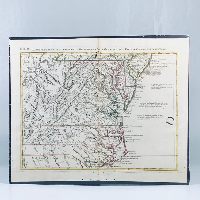
1779 Revolutionary War Map of Maryland, Virginia & Delaware
Venice, Italy: Atante Novissimo, 1779. Very Good. Item #12124
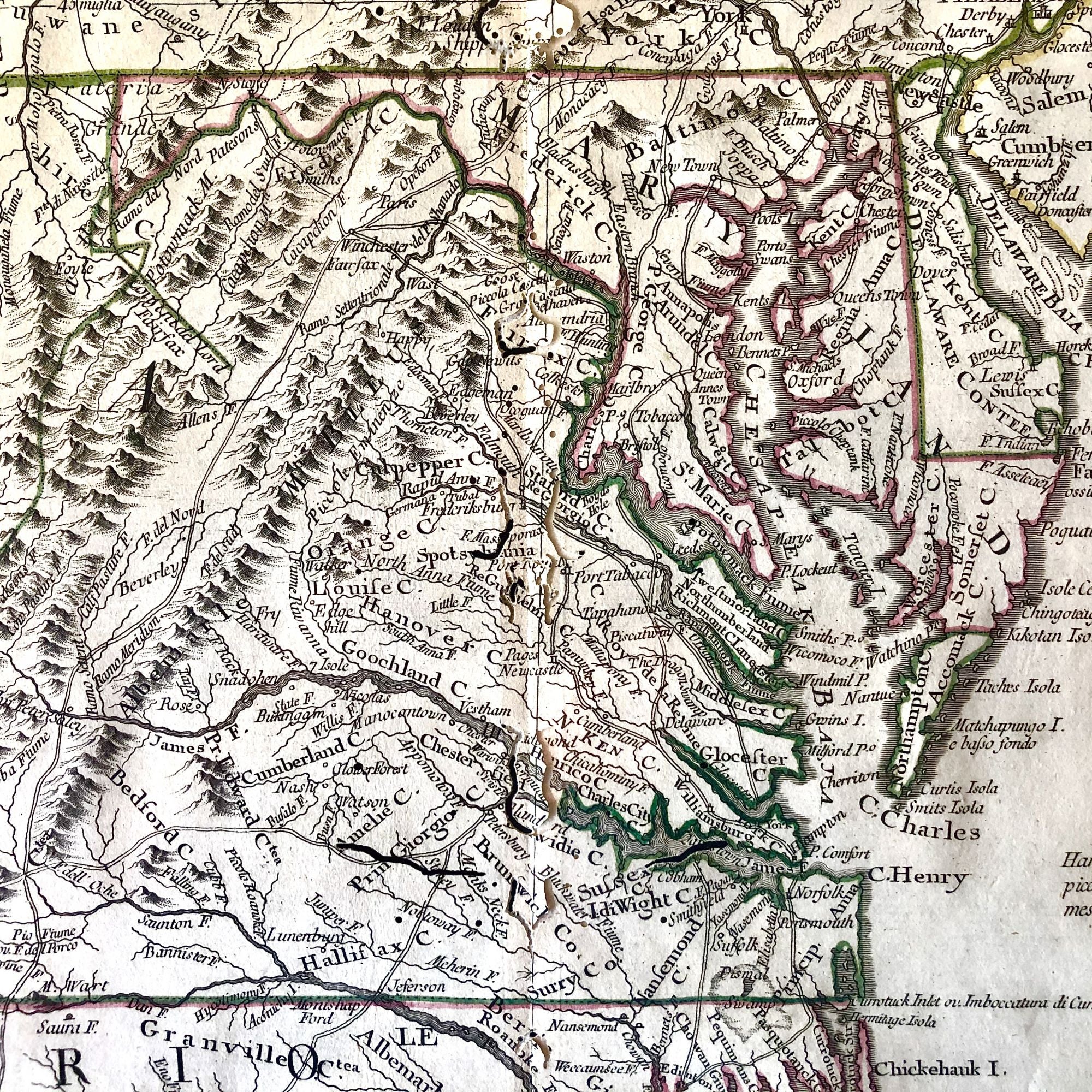
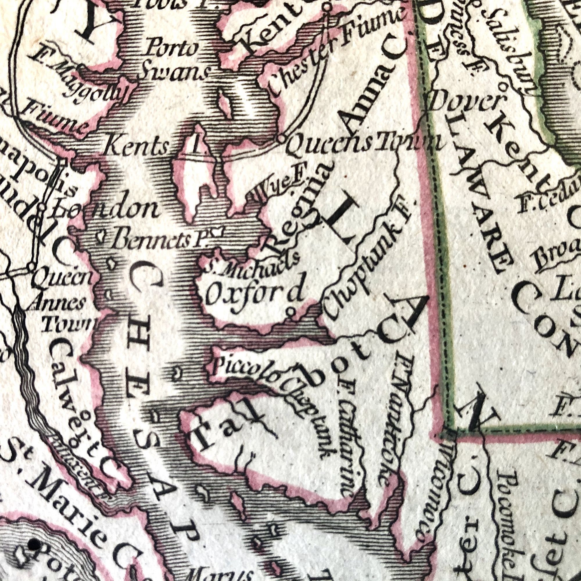
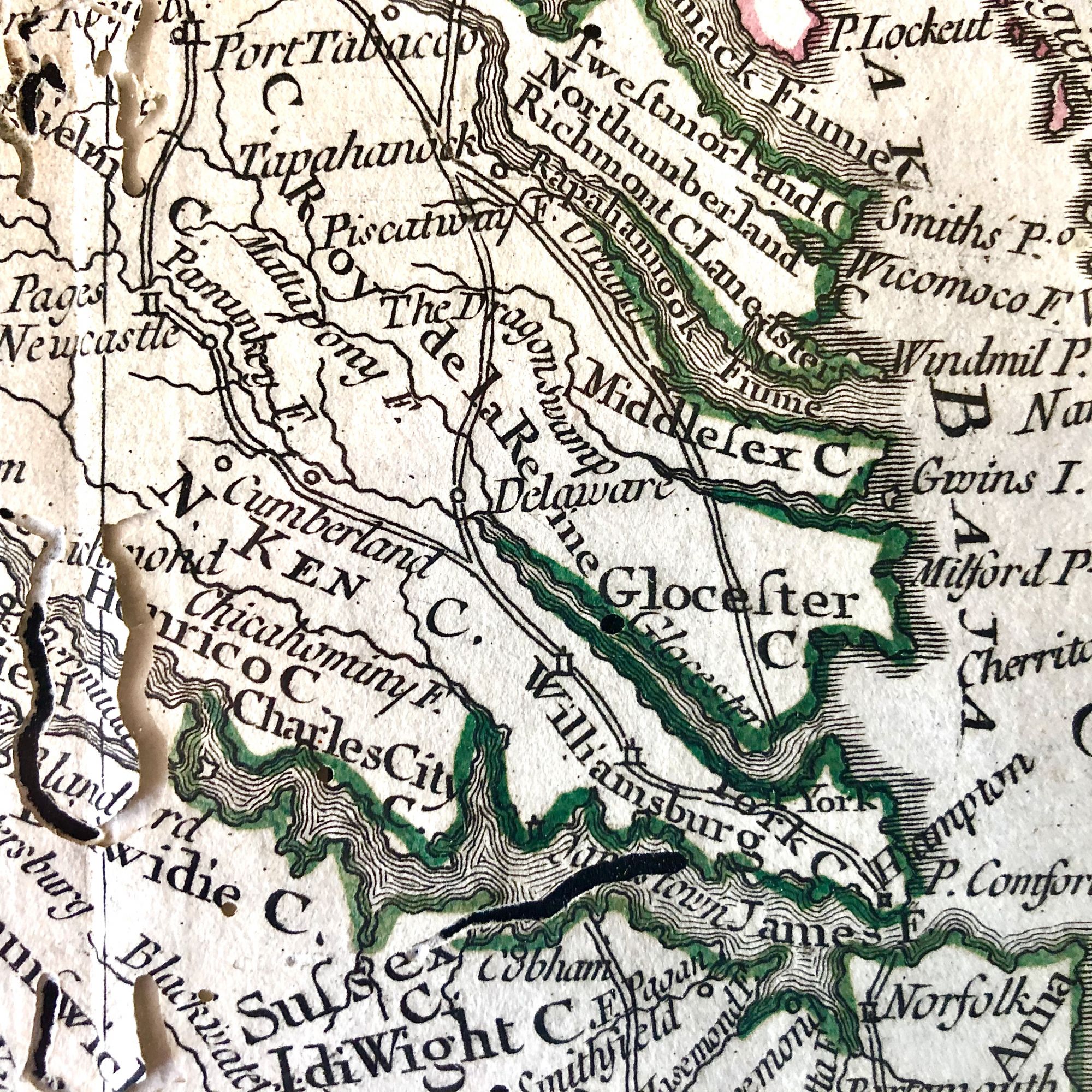
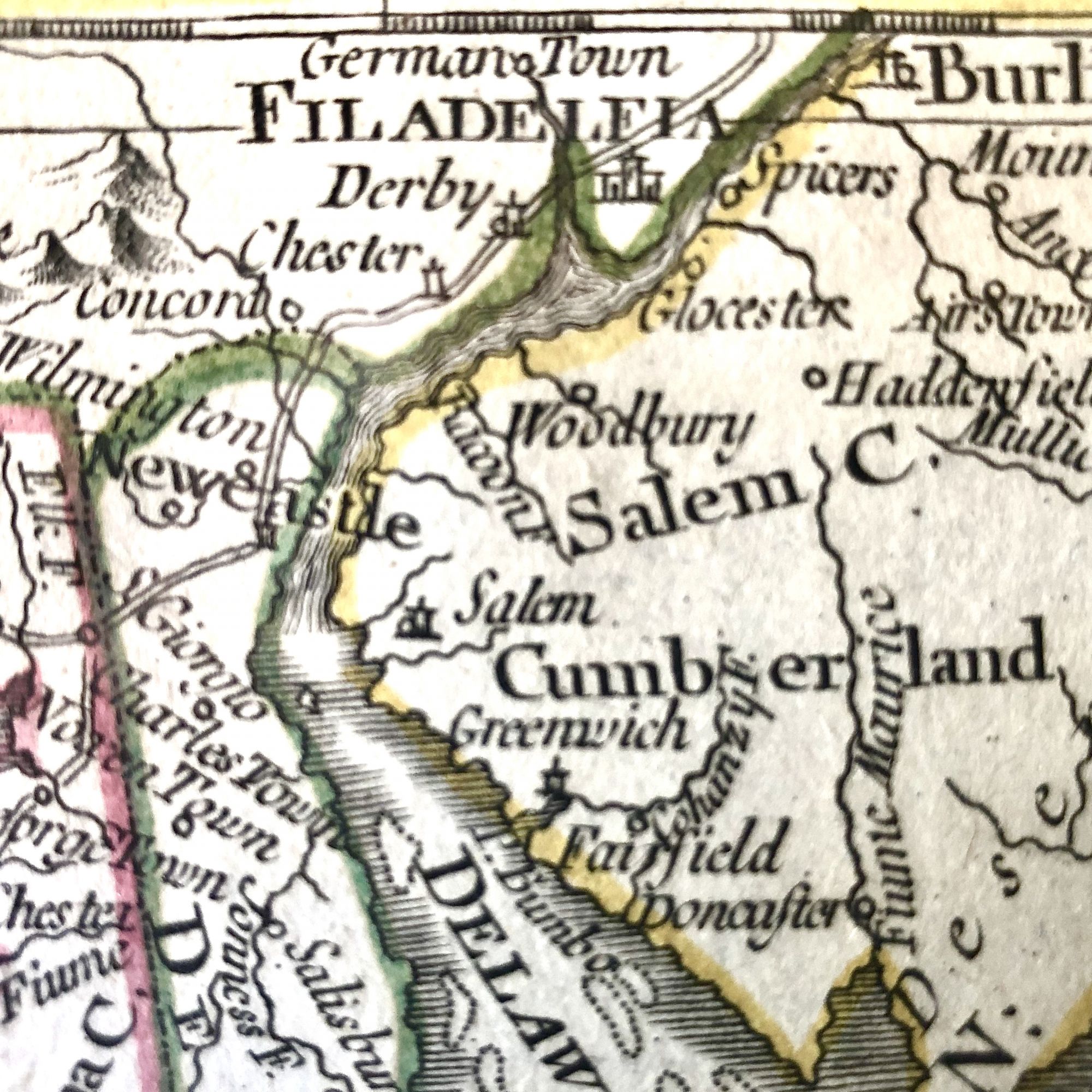
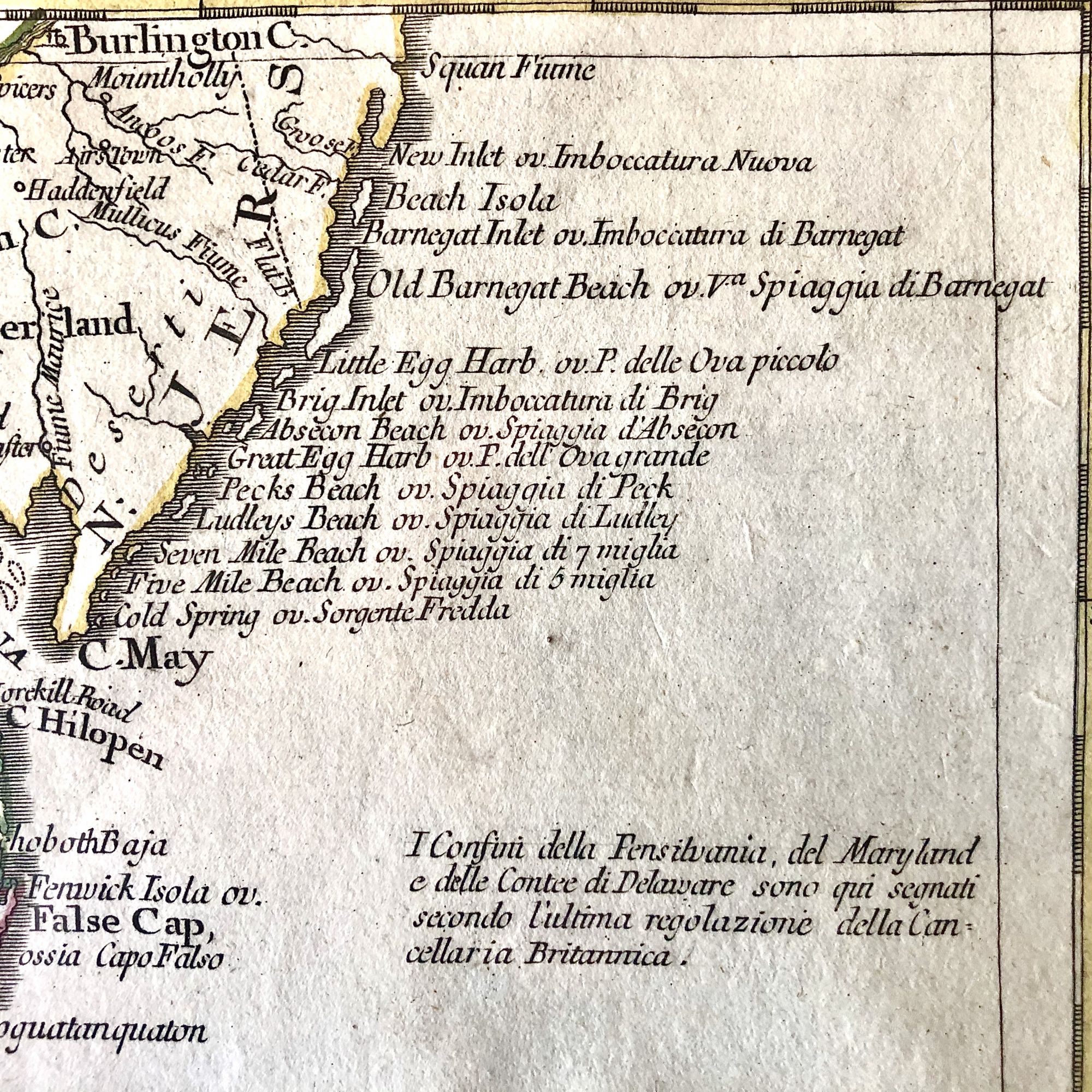
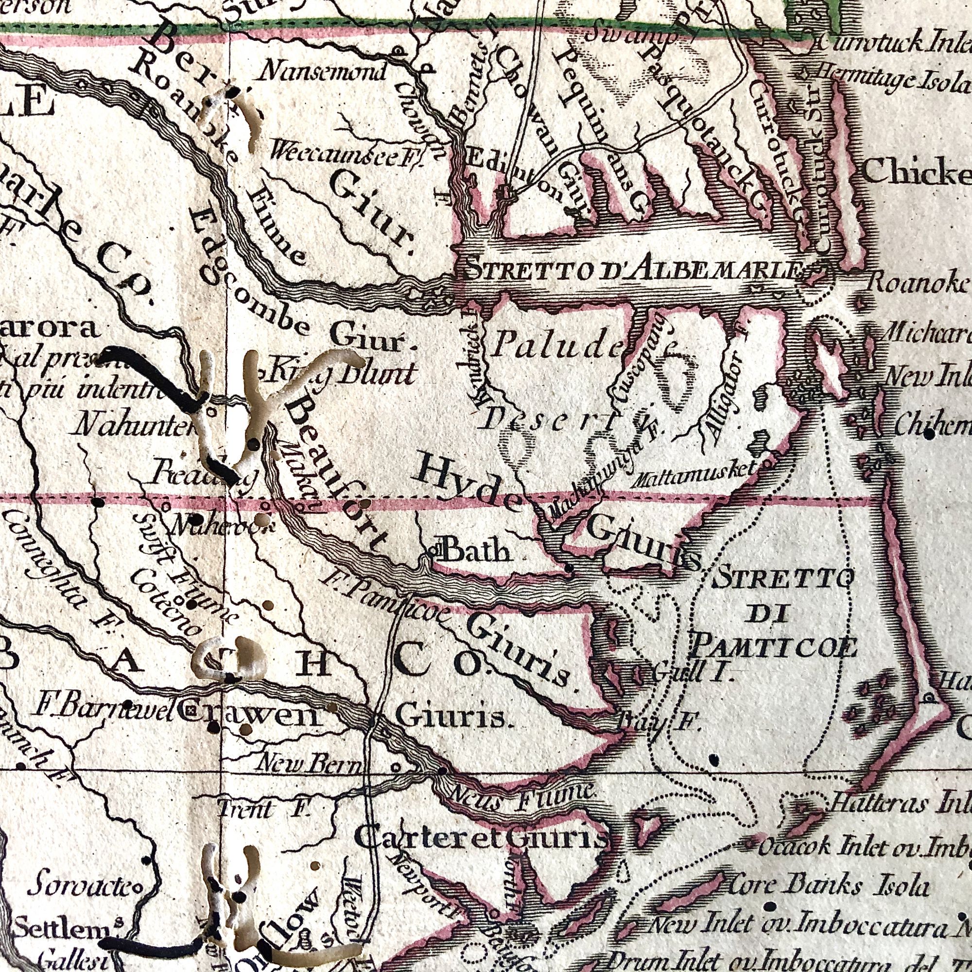
Beautiful hand-colored map published during the midst of the Revolutionary War, extending from Philadelphia and Delaware Bay in the Northeast, to Cape Lookout, Beaufort and the Welsh Settlement in South Carolina in the Southeast and extending West to show all of the Allegheny Mountains and a large portion of the Ohio River, based upon the seminal work of John Mitchell.Zatta's Map, while issued separately as part of his Atlante Novissimo, is actually one of 12 sections comprising the Italian edition of Mitchell's map of North America, one of the single-most important maps of North America during the 18th-century. very Good with occasional pinholes and worm holes along centerfold and edges. This map measures 18 5/8" X 15" and is perfect for framing and display, the ideal centerpiece to any fine Revolutionary War or Colonial Map collection.
Price: $950.00