
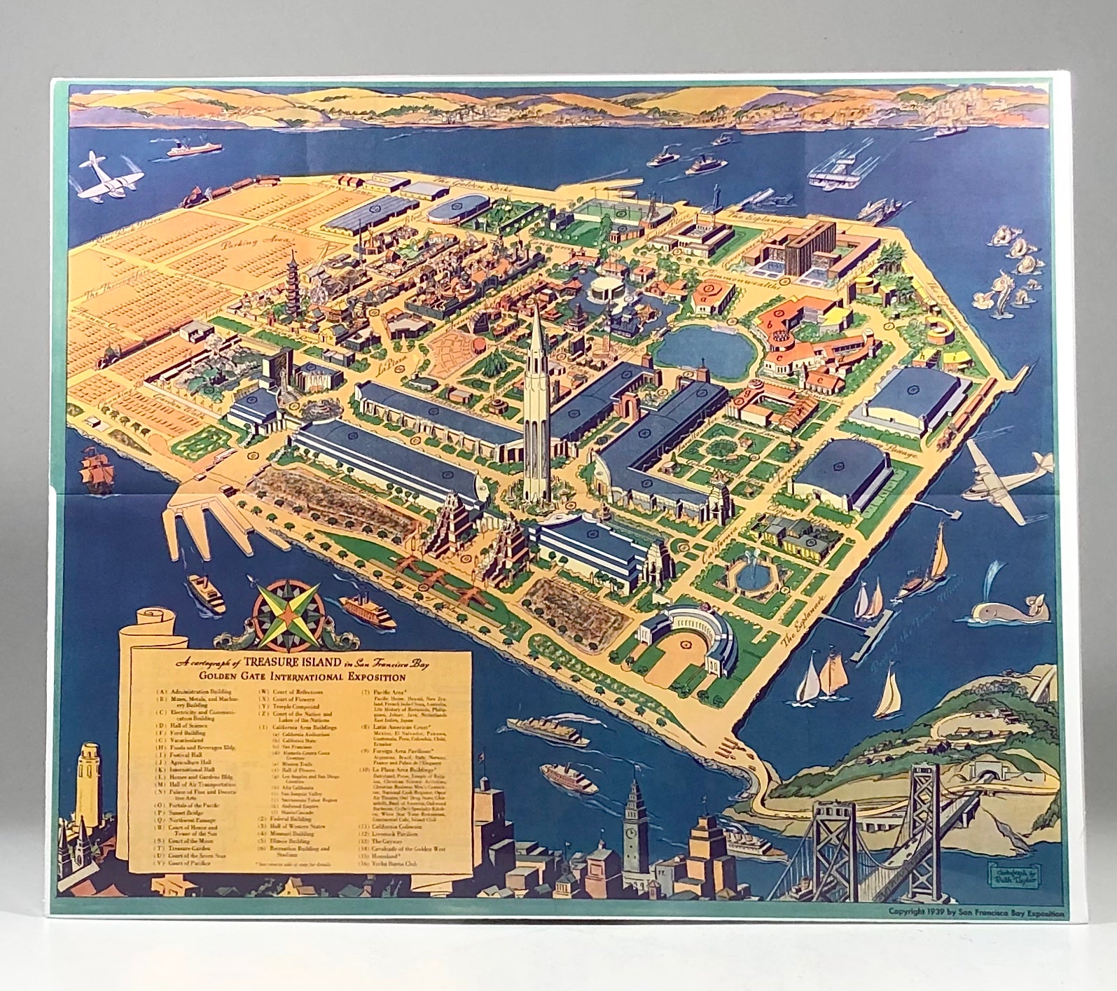
1939 Ruth Taylor (White) Pictorial Map of the Golden Gate International Exposition
San Francisco, CA: San Francisco Bay Exposition, 1939. 1st Edition. Folio - over 12 - 15" tall. Like New. Item #12405
Original 1939 Ruth Taylor Pictorial Map of the San Francisco Bay Exposition on Treasure Island, one of two World Fairs held in the U.S. that year. In the foreground is the San Francisco skyline along with the recently opened San Francisco - Oakland Bay Bridge. On the horizon is the skyline of Oakland. In the bottom left is a key identifying the buildings and key attractions. Measuring 19" X 16" this historic Art Deco piece of California history is perfect for framing and display!
Sold
See all items by Ruth Taylor