Hand-Colored 1825 French Map of Delaware, with Slave and Free Black Census
Paris: J.A.C. Buchon, 1825. 1st Edition. Folio. Near Fine. Item #13300
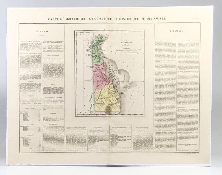
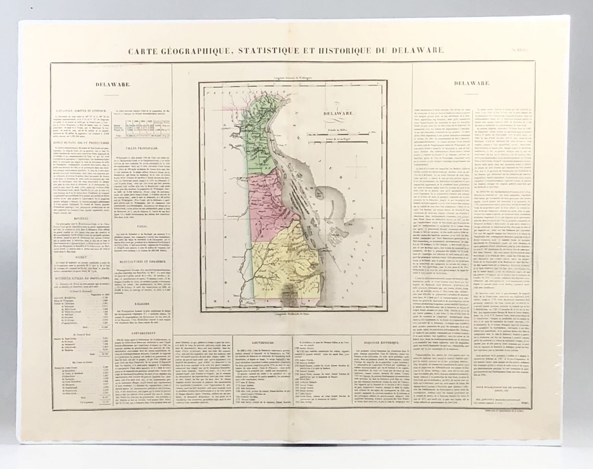
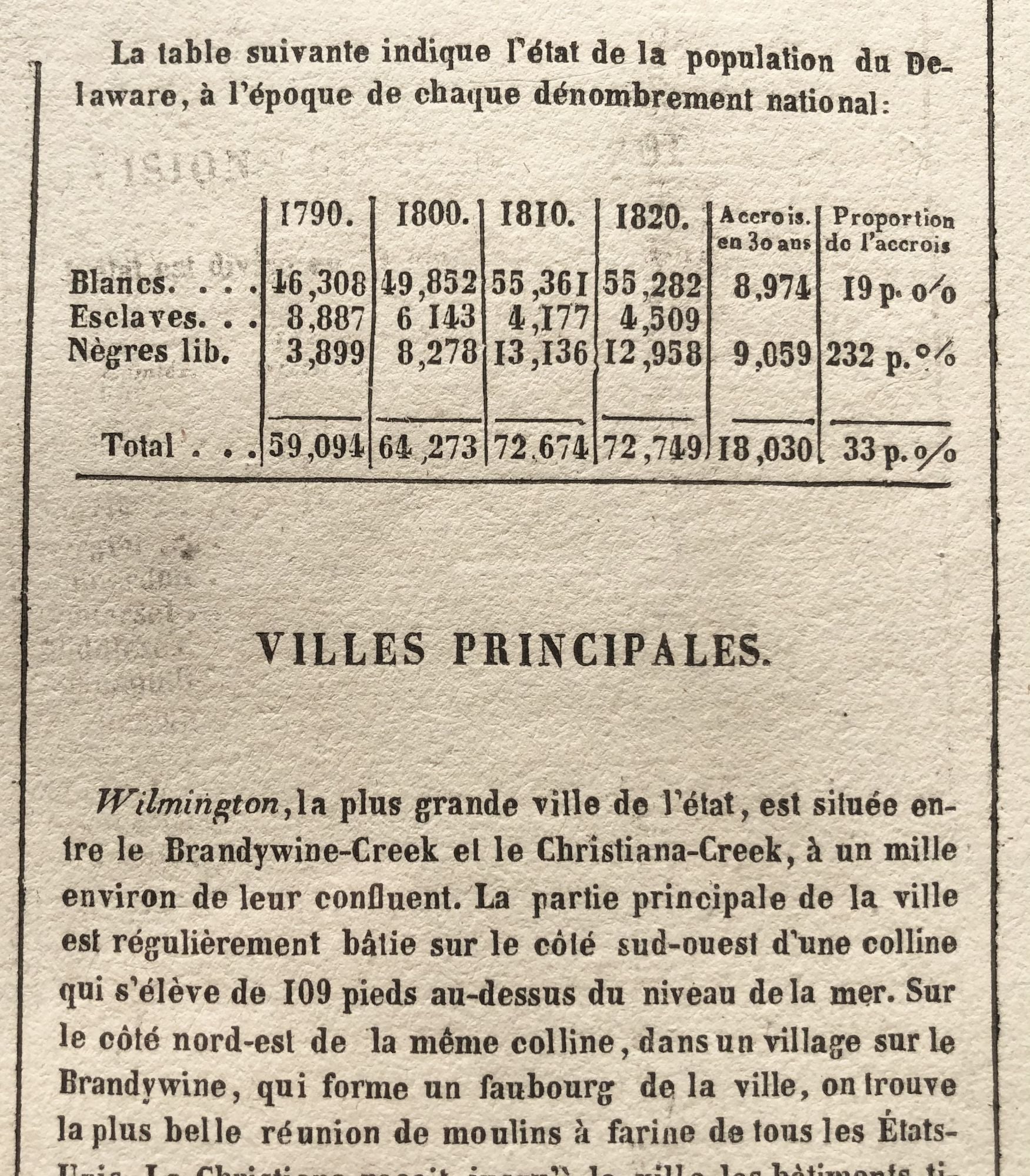
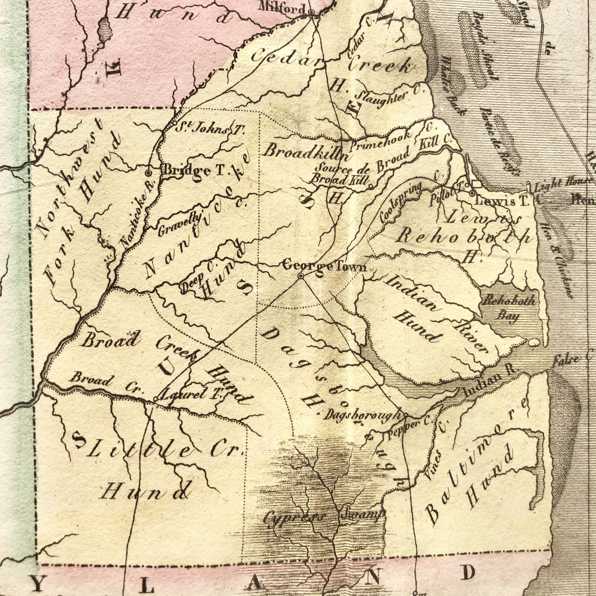
A SPECTACULAR 1825 French hand-colored map of Delaware from Lucas' 1822 map, which breaks populations by Whites, Free Blacks and Slaves.
Originally published in 1822 by Carey and Lea and then revised and republished in 1825 by J. A. C. Buchon (1791-1846 ) in a French edition entitled Atlas Geographique des Deux Ameriques, printed by J. Carez.
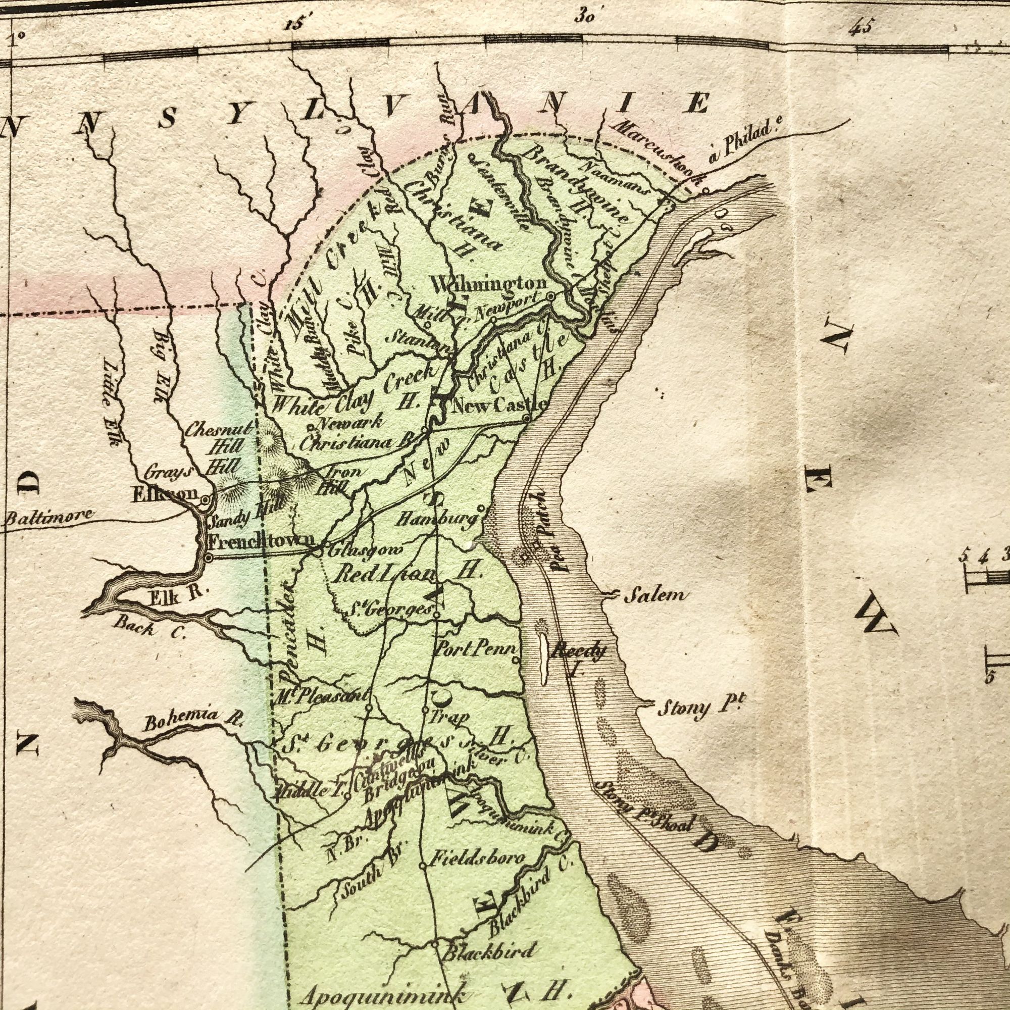
Fielding Lucas, Jr. (1781-1854), a Baltimore mapmaker and publisher, drew the map.
Of note on this map is the labelling of southeastern Delaware, which today includes the resort towns of Bethany Beach, Dewey Beach and Lewes, as 'Baltimore Hundred', the original name of the territory when it was claimed by Worcester County, Maryland.
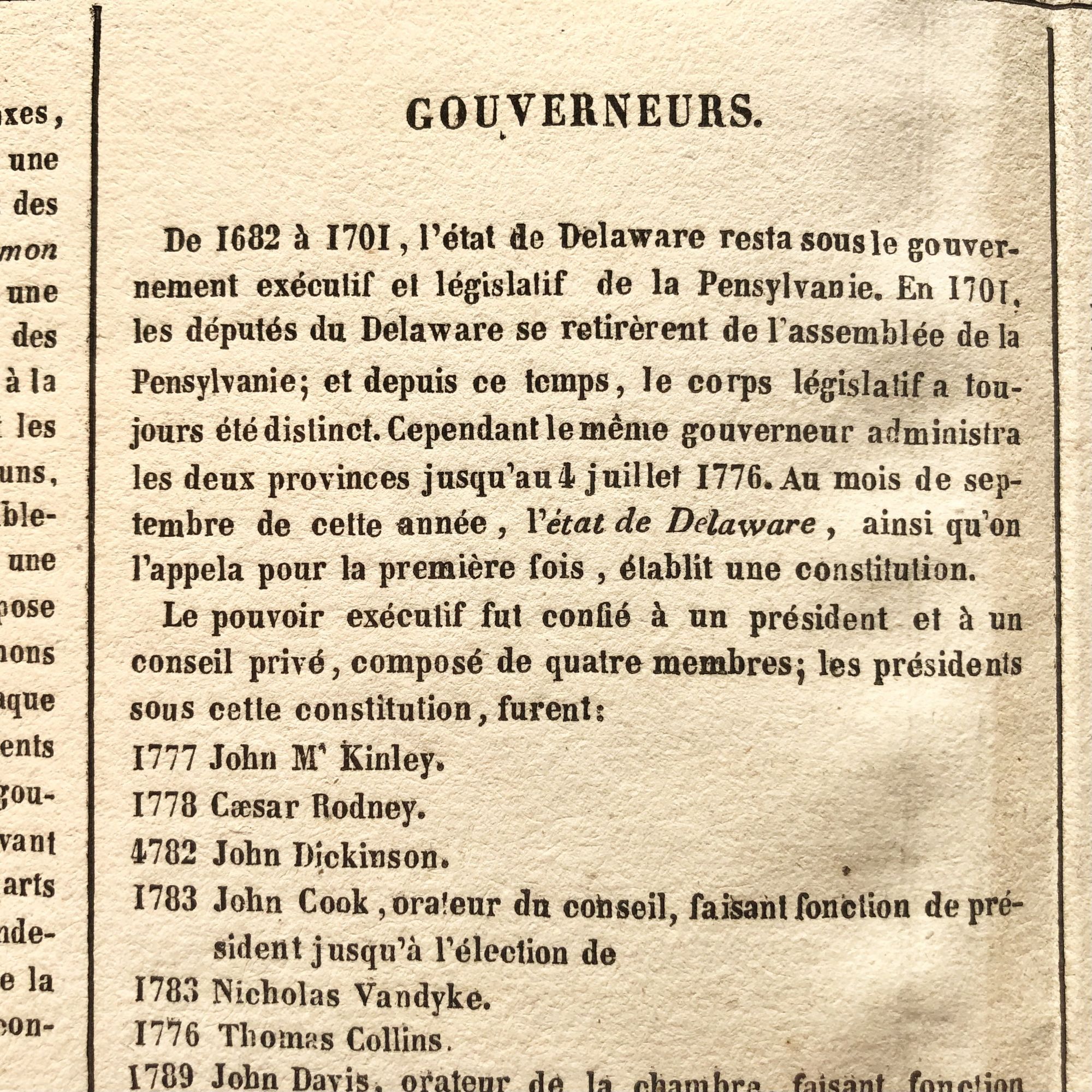
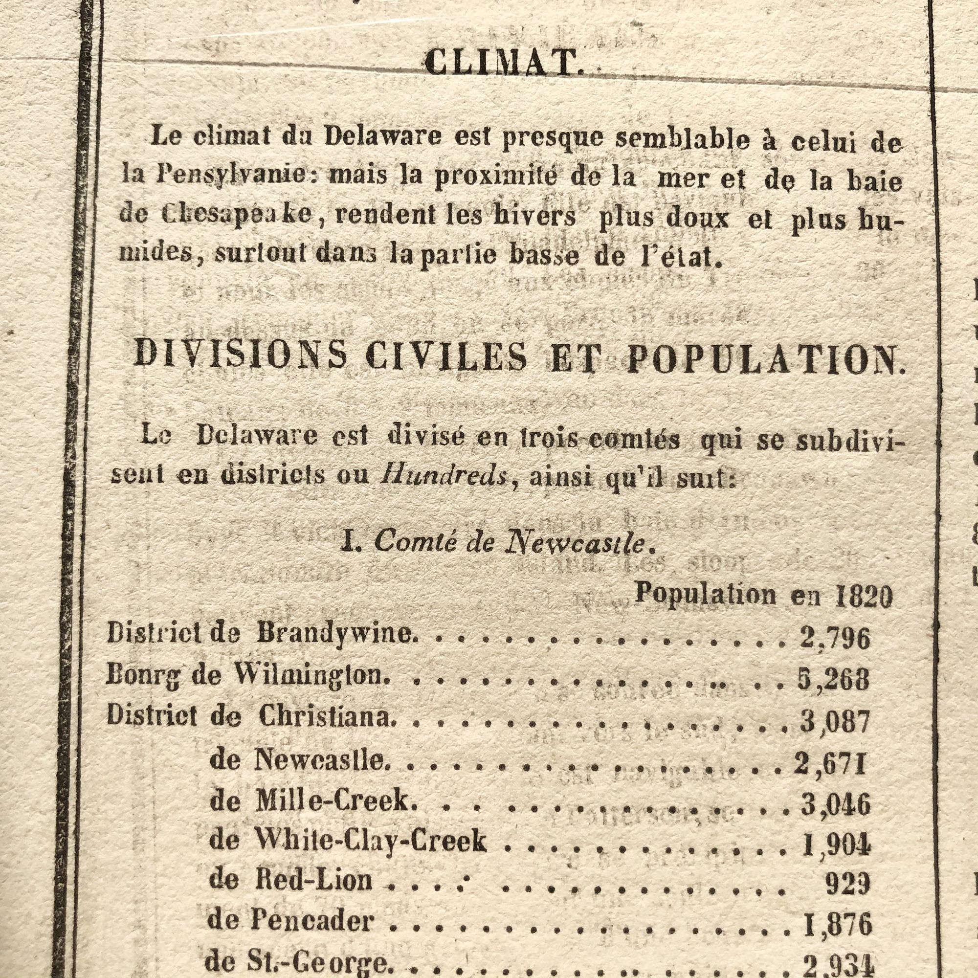
Printed on the same page as the map is geographical, statistical, and historical information about Maryland, such as descriptions of the state's important rivers, a list of Governors since its founding as well as the lone important War of 1812 Battle, the Battle of Lewes(town).
In exquisite condition, with a centerfold as issued, and a very small offset in the upper left where ink from another page of the atlas bled thru to this page.
This map measures 26 3/4 X 20 1/2" and is perfect for framing and display!
Price: $350.00