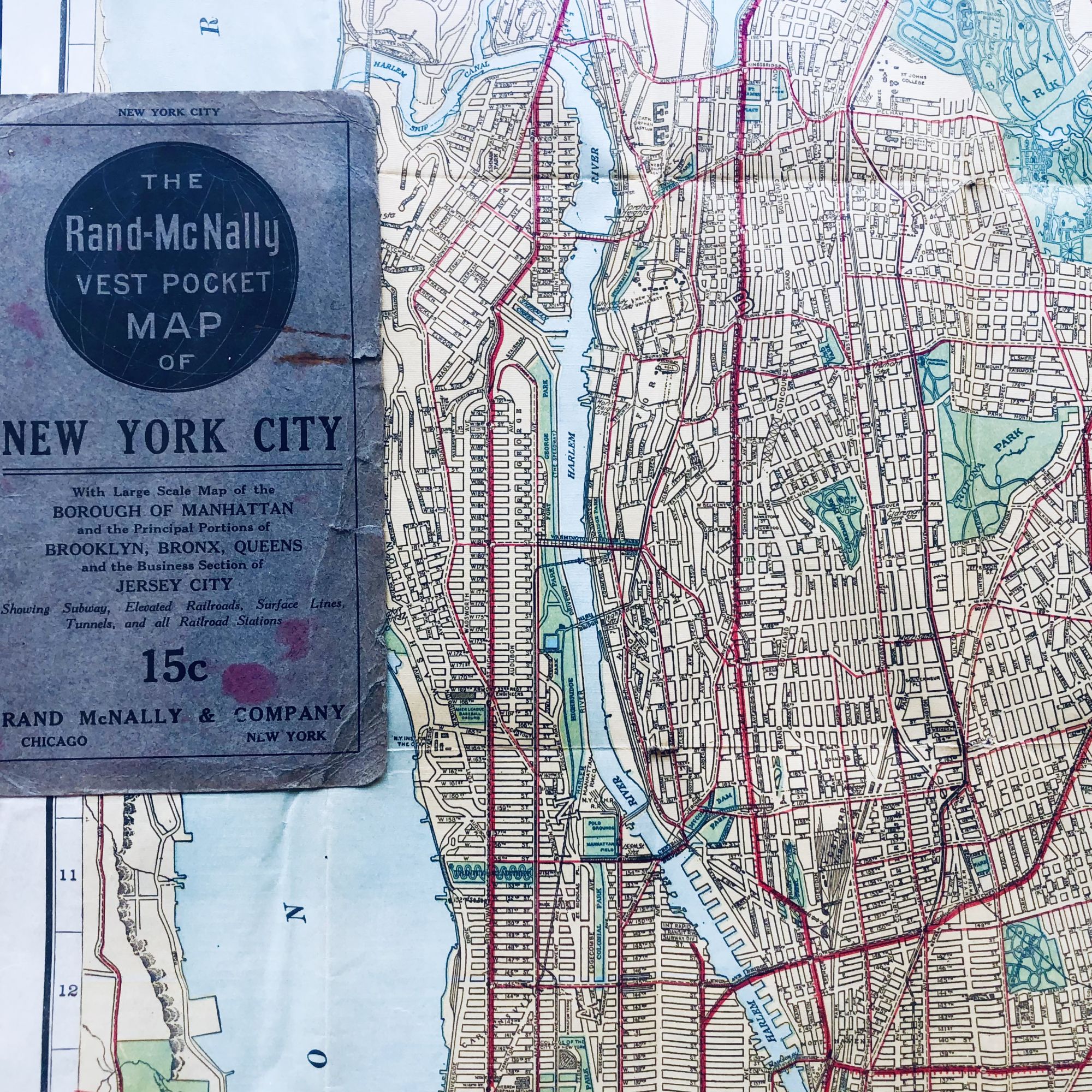
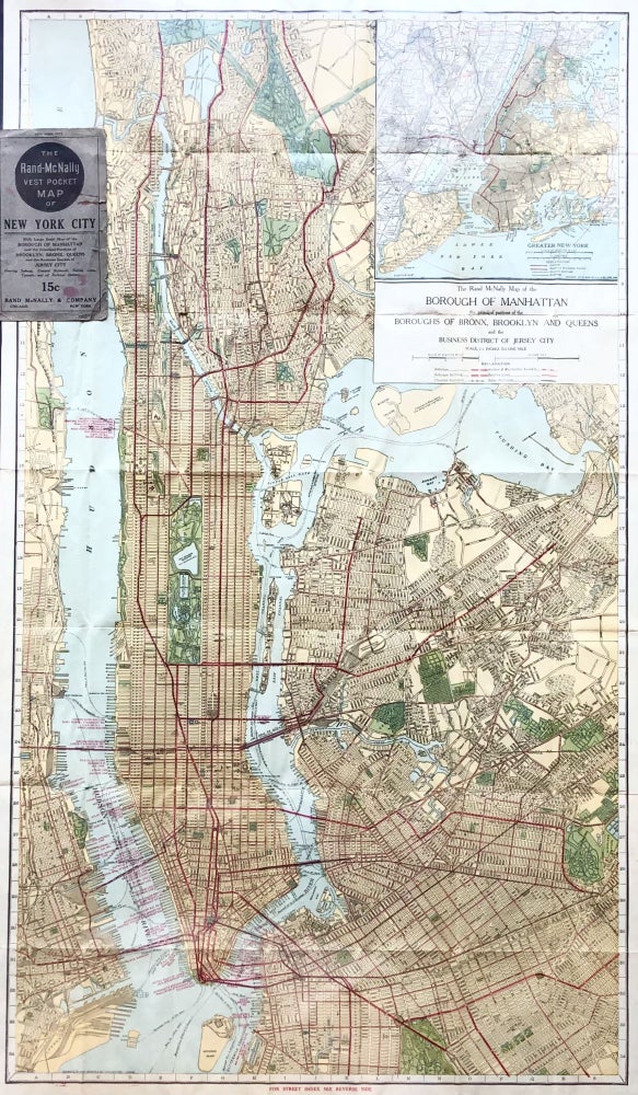
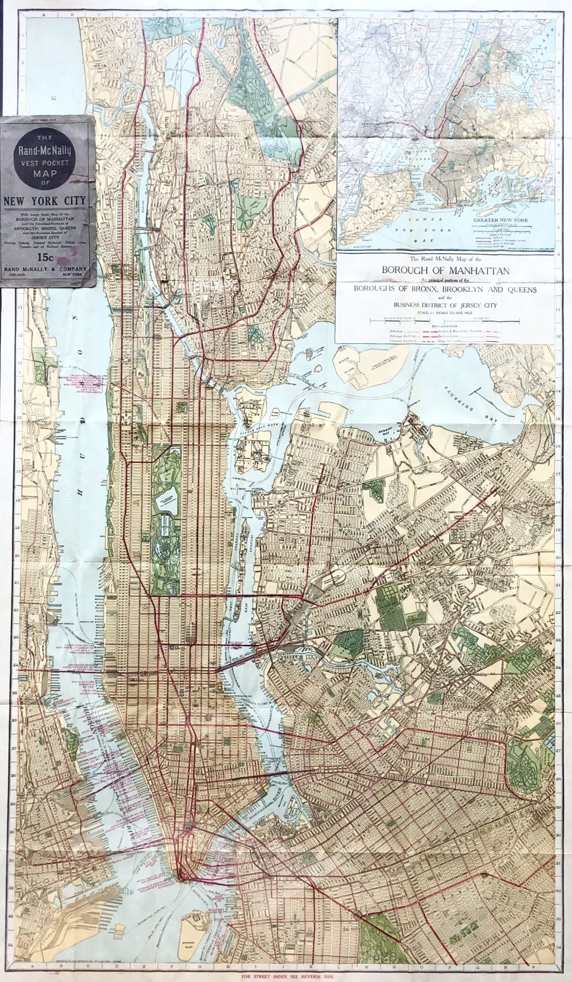
1917 WW I Era Vest Pocket Color Street Map of New York City
New York: Rand McNally, 1917. Very Good. Item #13347
GORGEOUS WW I-Era Street Map of New York city, featuring many iconic NYC landmarks.
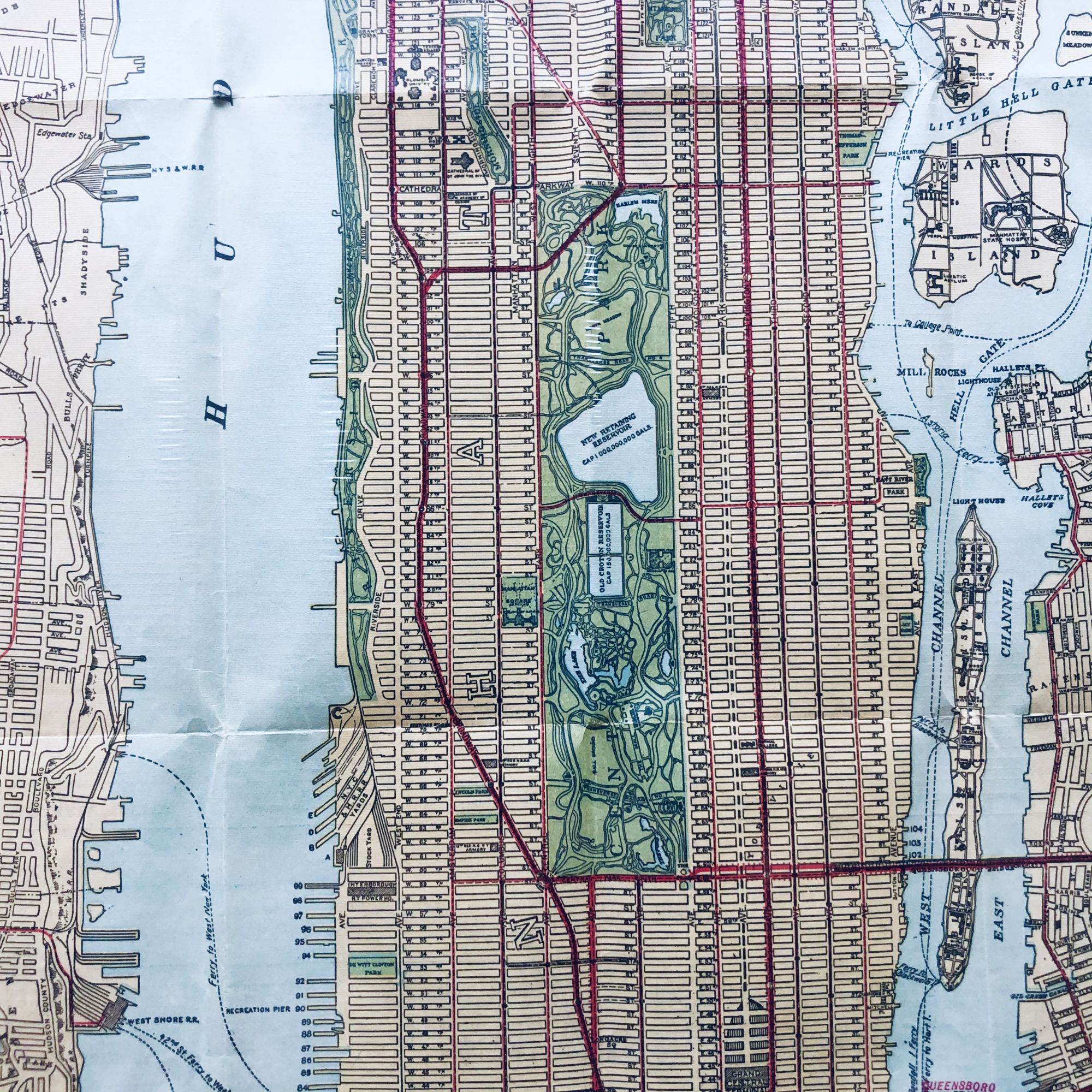
The Polo Grounds, home of the New York Yankees in 1917, is represented, as is Central Park, Grand Central Station, Battery Park, the Brooklyn Bridge and many more.
Most of the famous NYC skyscrapers we know today did not yet exist in 1917, such as the Empire State Building and the Chrysler Building.
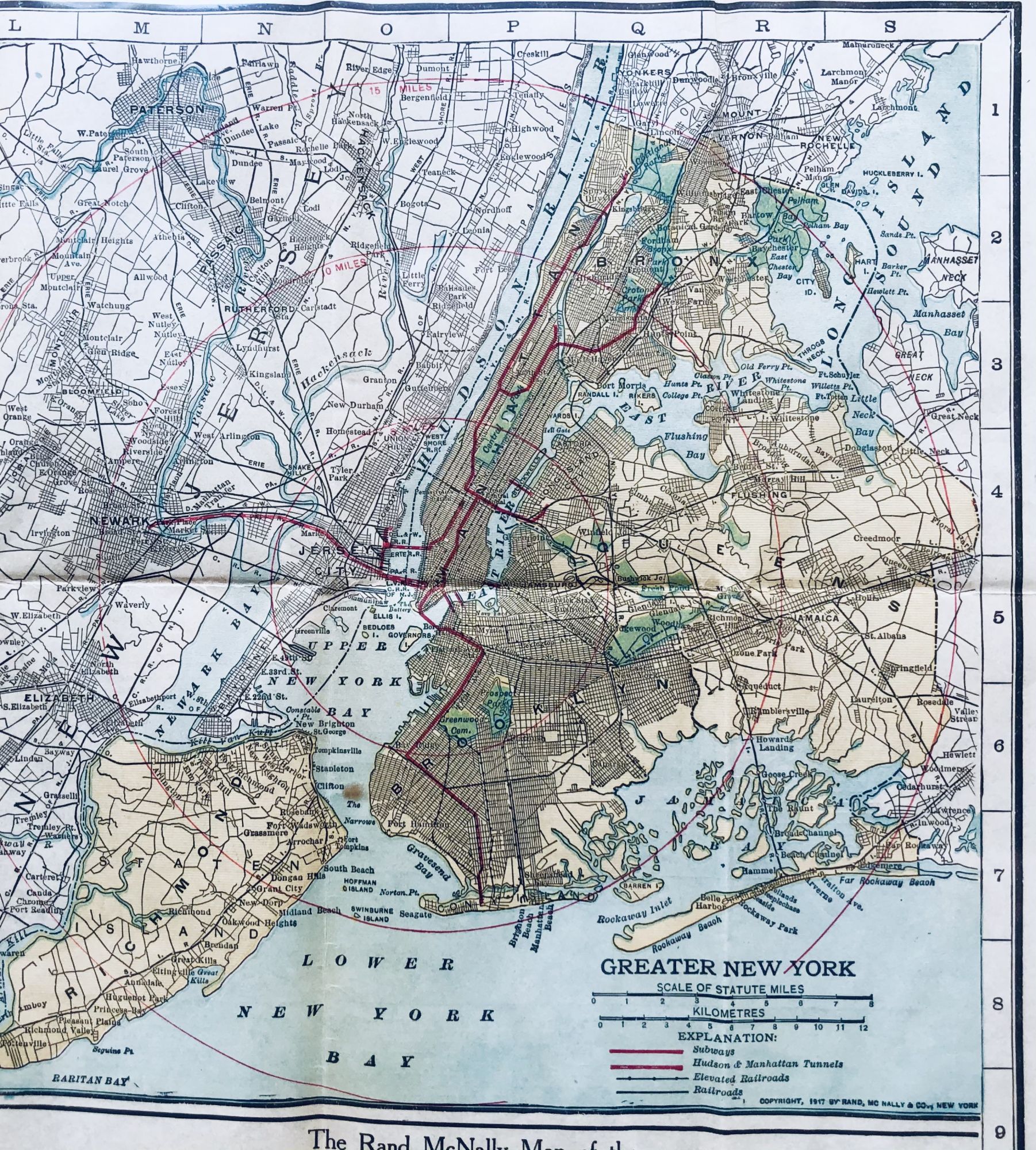
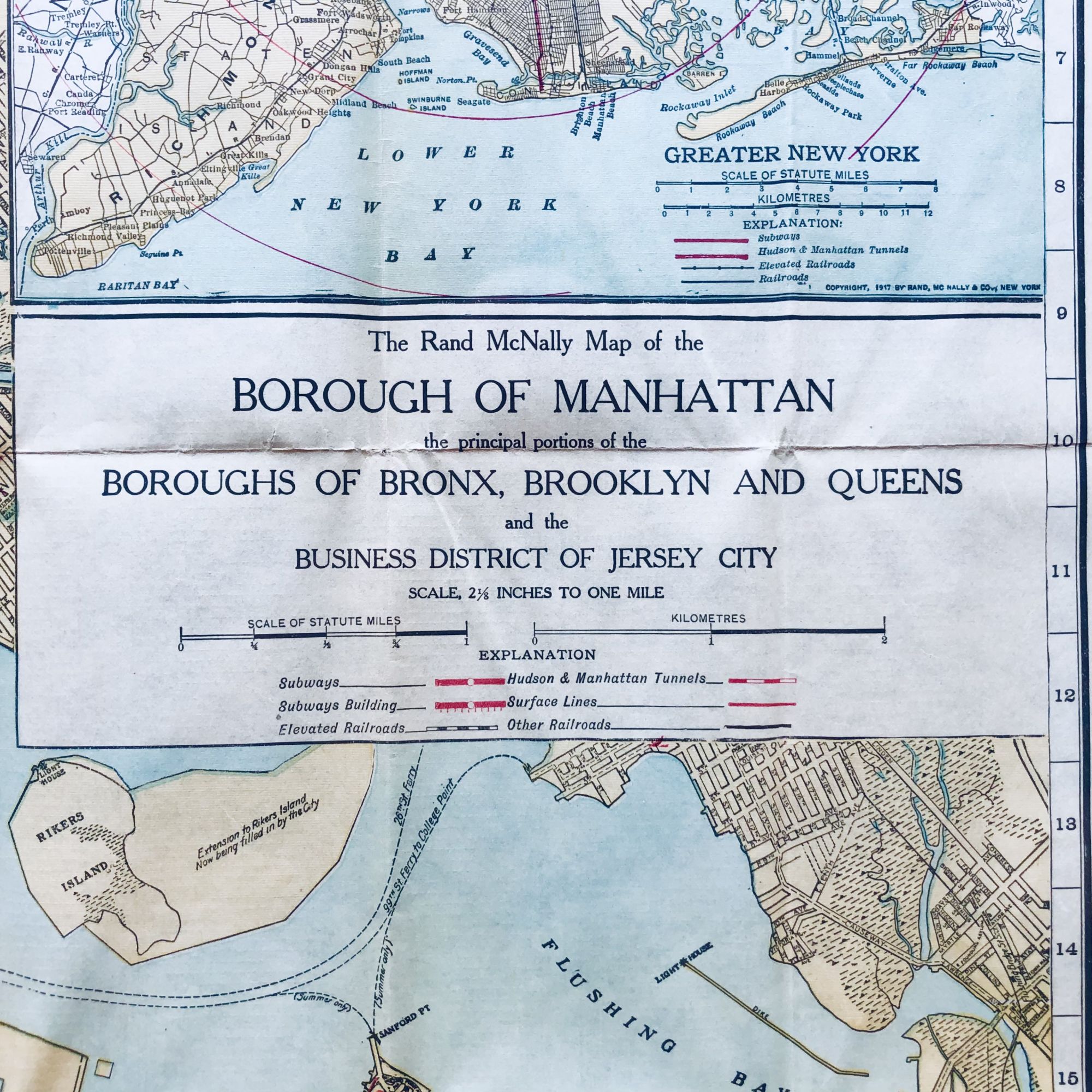
A higher level view of the five boroughs in vignette is featured in the upper right corner.
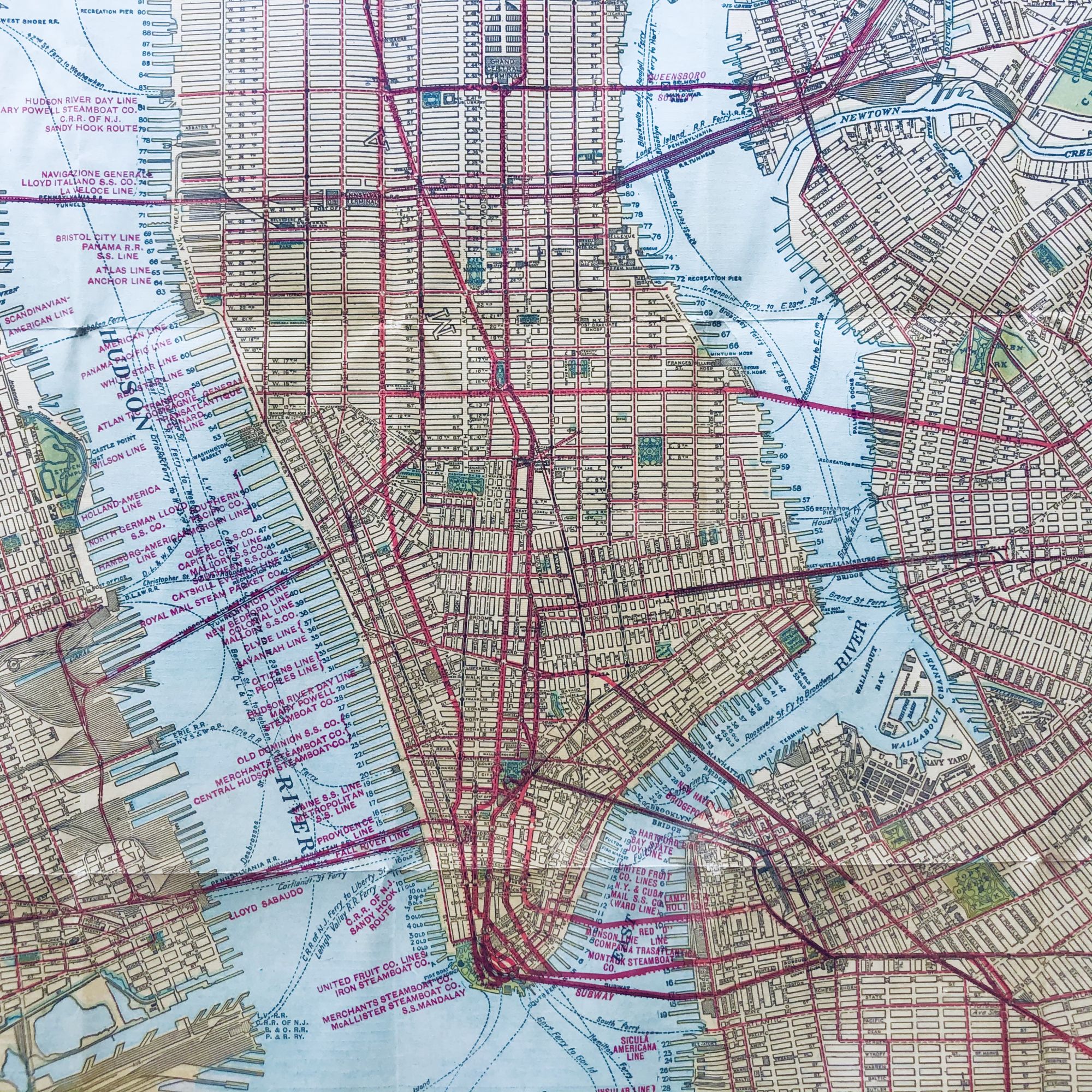
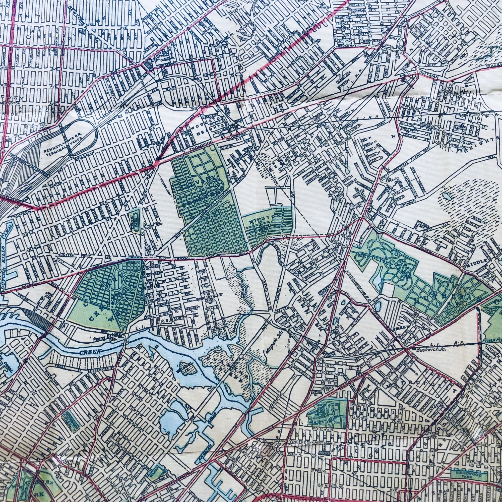
Colored in yellow, green, red, blue and black, this map also highlights ferry routes as they existed during WW I, and names many of the dock owners along the industrialized waterfonts of the Hudson and East Rivers.
Original wraps included. A few small closed separations along crease intersections with tape repair to verso.
This map measures a robust 21" X 36".
Perfect for framing and display!
Price: $150.00