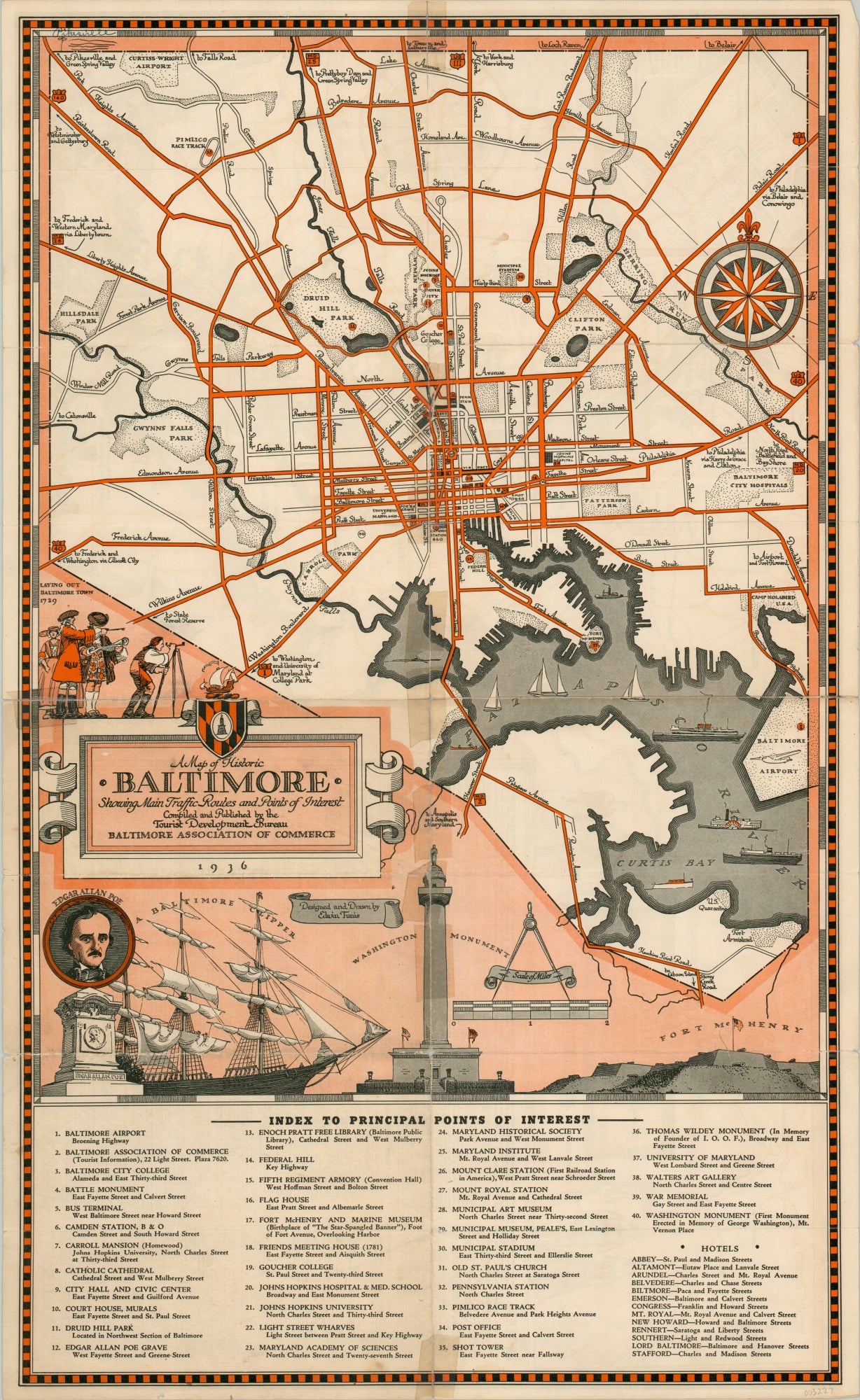
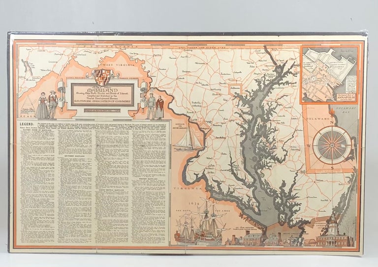
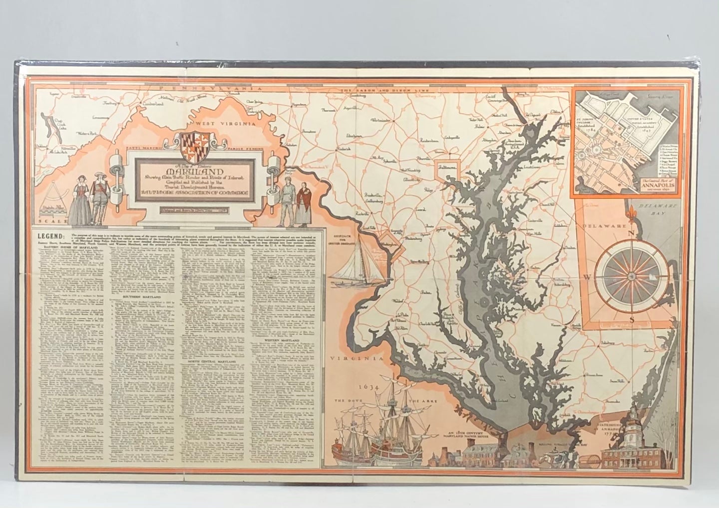
Edwin Tunis Pictorial Map of Historic Baltimore and Maryland
Baltimore, Maryland: Baltimore Chamber of Commerce, 1936. 1st Edition. Good. Item #13806
Drawn by famed Maryland illustrator Edwin Tunis and distributed by the Baltimore Chamber of Commerce, this map was published to promote tourism in Charm City during the depths of the Great Depression.
The map features a detailed map of Baltimore City on one side and the state of Maryland on the other. Featured by Tunis are depictions of the laying out of Baltimore in 1729, the Ark and the Dove landing on the Maryland shore in 1634, a portrait of Edgar Allen Poe, the Maryland State House, Fort McHenry, the Washington Monument, and much more.
Each side of the map boasts a beautiful compass rose.
In Good condition, this map has closed separations along some original creases as well as some tape repairs.
Measuring 27" X 16.5", this map, much tougher to come by now than in the past, is perfect for framing and display!
Sold