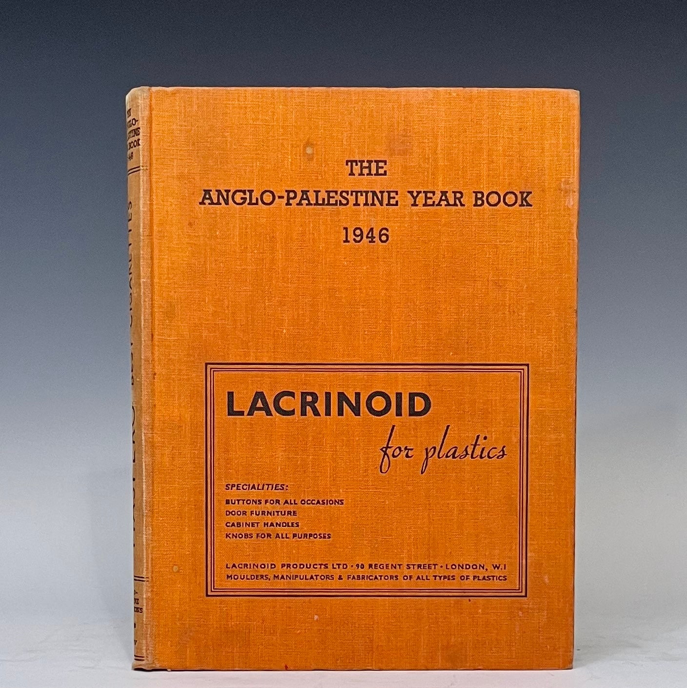
The Anglo-Palestine Year Book 1946 - With Fold-Out Map of Israel Post-WW II & Pre-Statehood
London: Anglo-Palestine Publications, 1946. 8vo. Good. Item #15230
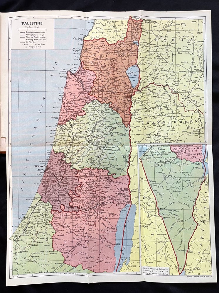
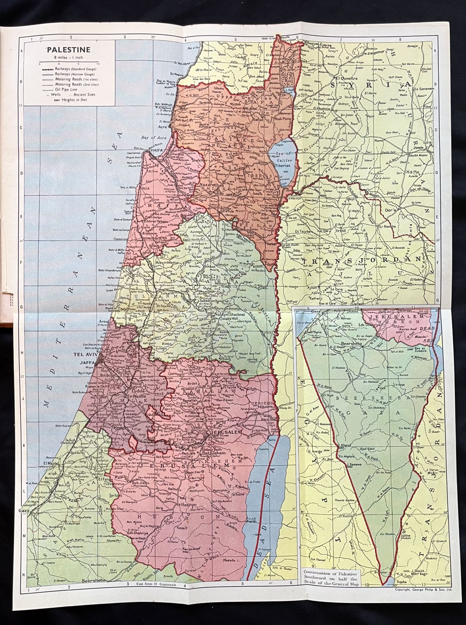
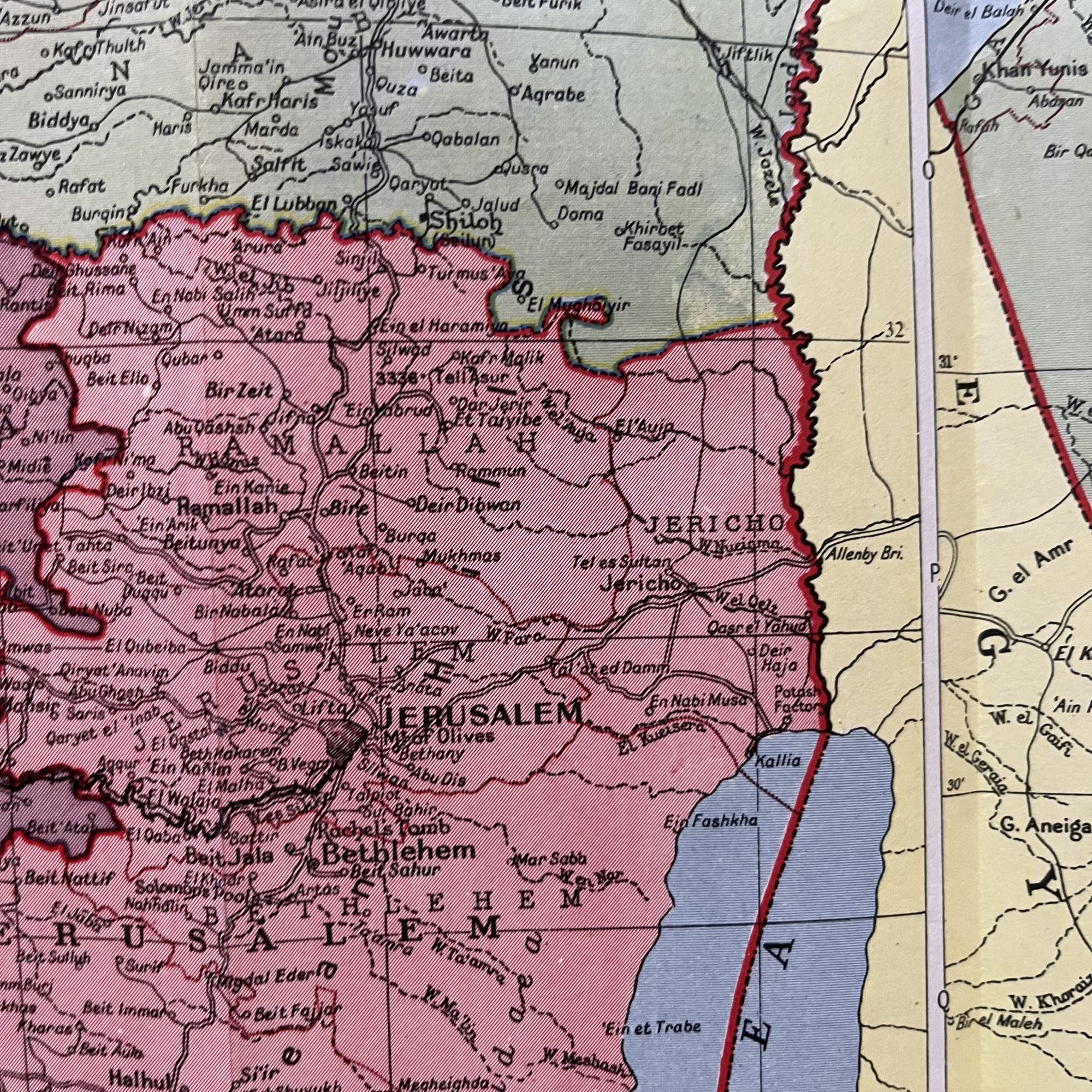
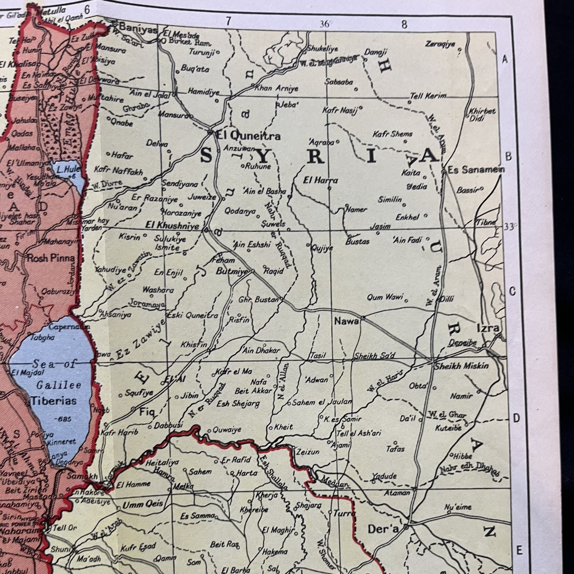
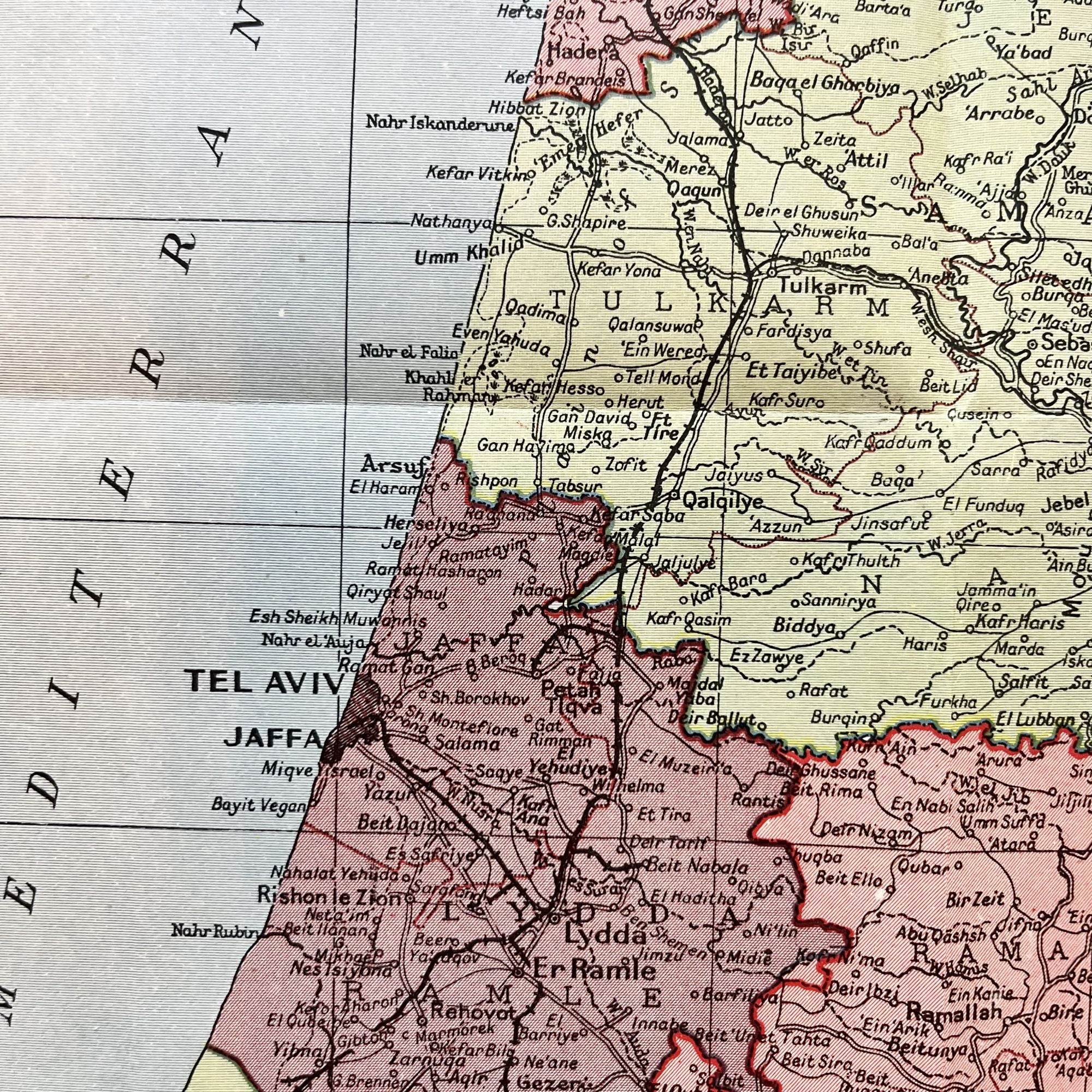
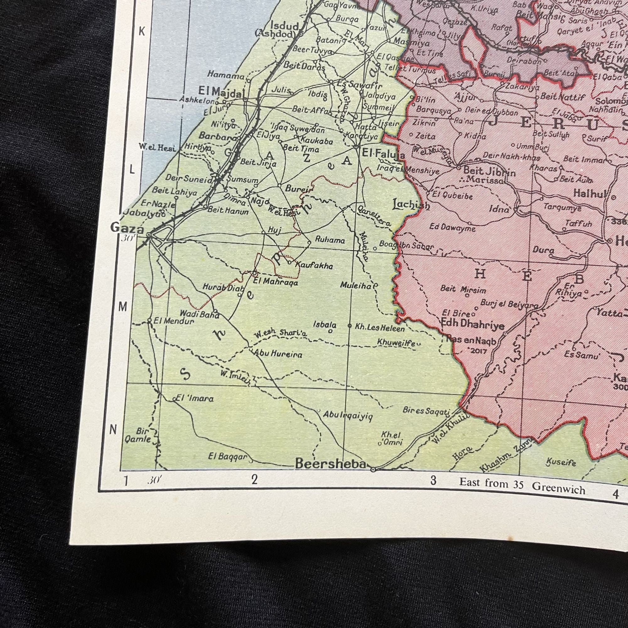
An important post-WW II Middle East Documentary on what would become the country of Israel just two years later, with large fold-out color map of Palestine.
The map depicts the Gaza Strip in Vignette at the lower right and refers to today's West Bank and Jordan as Trans Jordan.
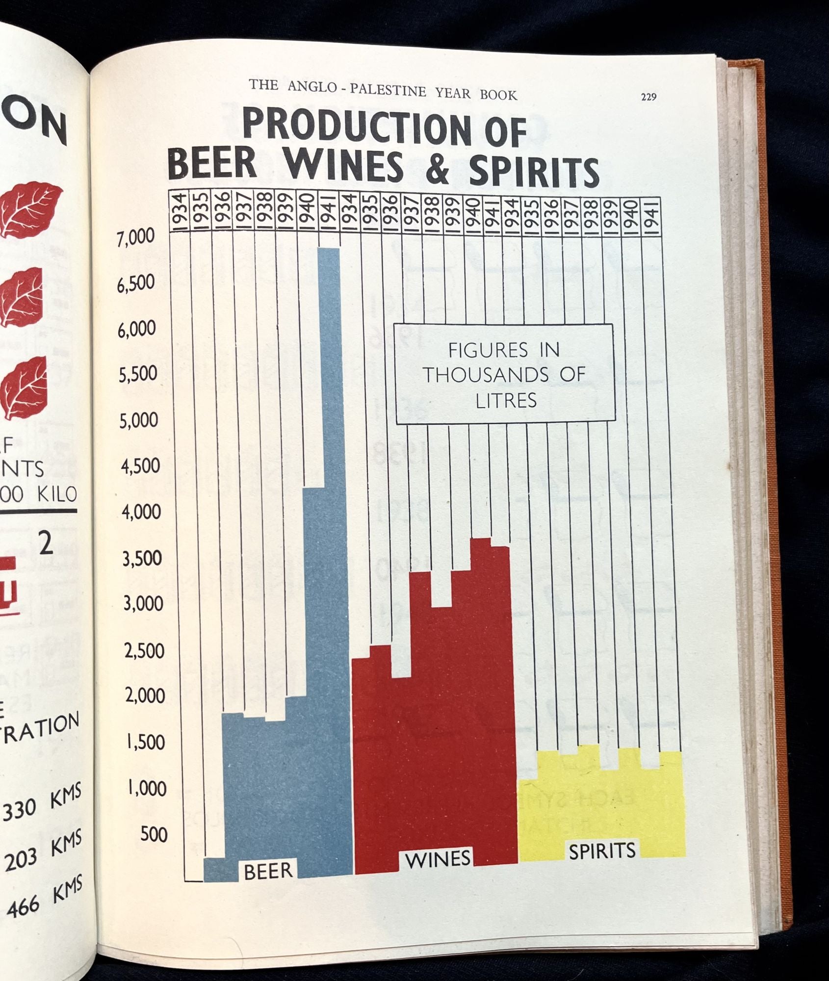
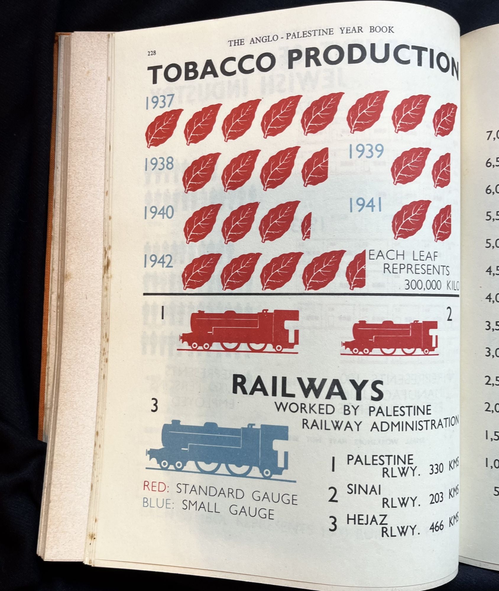
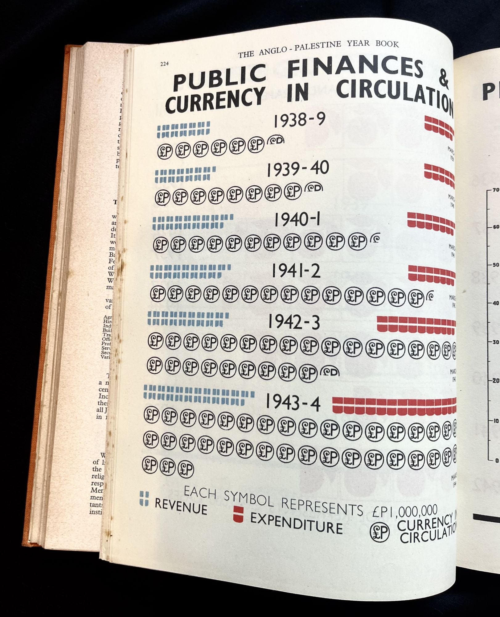
This historic piece is profusely illustrated with color graphs and charts, depicting such topis as Electric Usage, Road Signs, Industrial Societies, Telephone Usage, Budgetary Expenditures, Imports and Exports and the increasing Development of Jewish Industry, among many others.
Also described are geographic features as well as political boundaries and other statistics. Many historic black and white photographs.
Orange cloth. Square tight binding. Clean interior. Binding with light soiling and edge wear. Interior sporadically foxed. Map in beautiful condition with vibrant color.
An important pre-Israel history of the region.
Price: $225.00