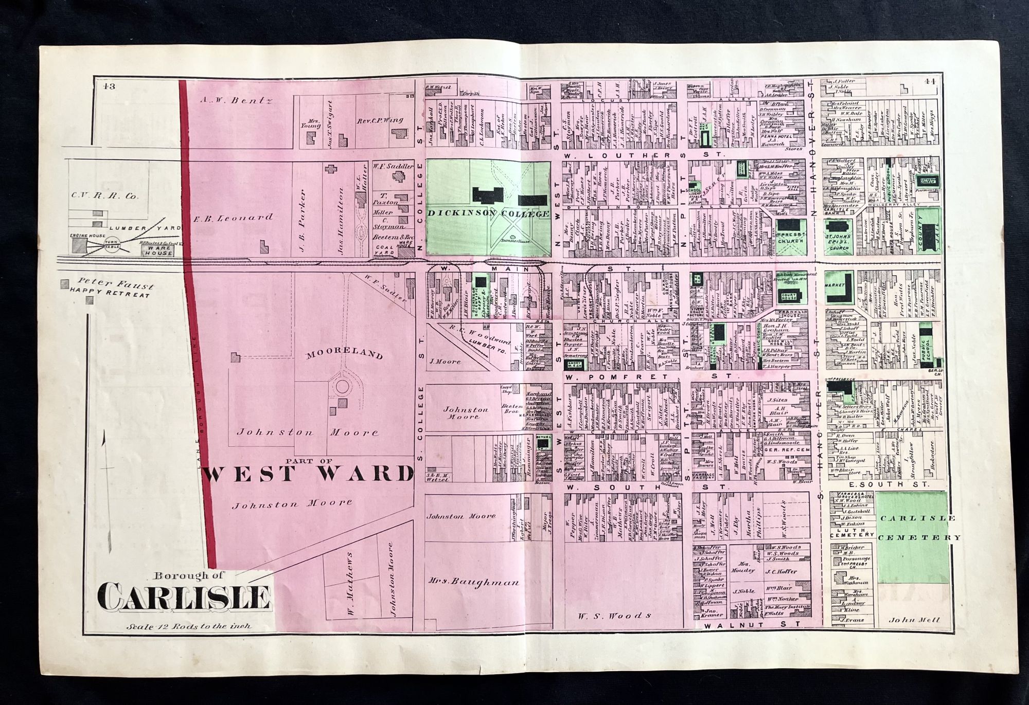
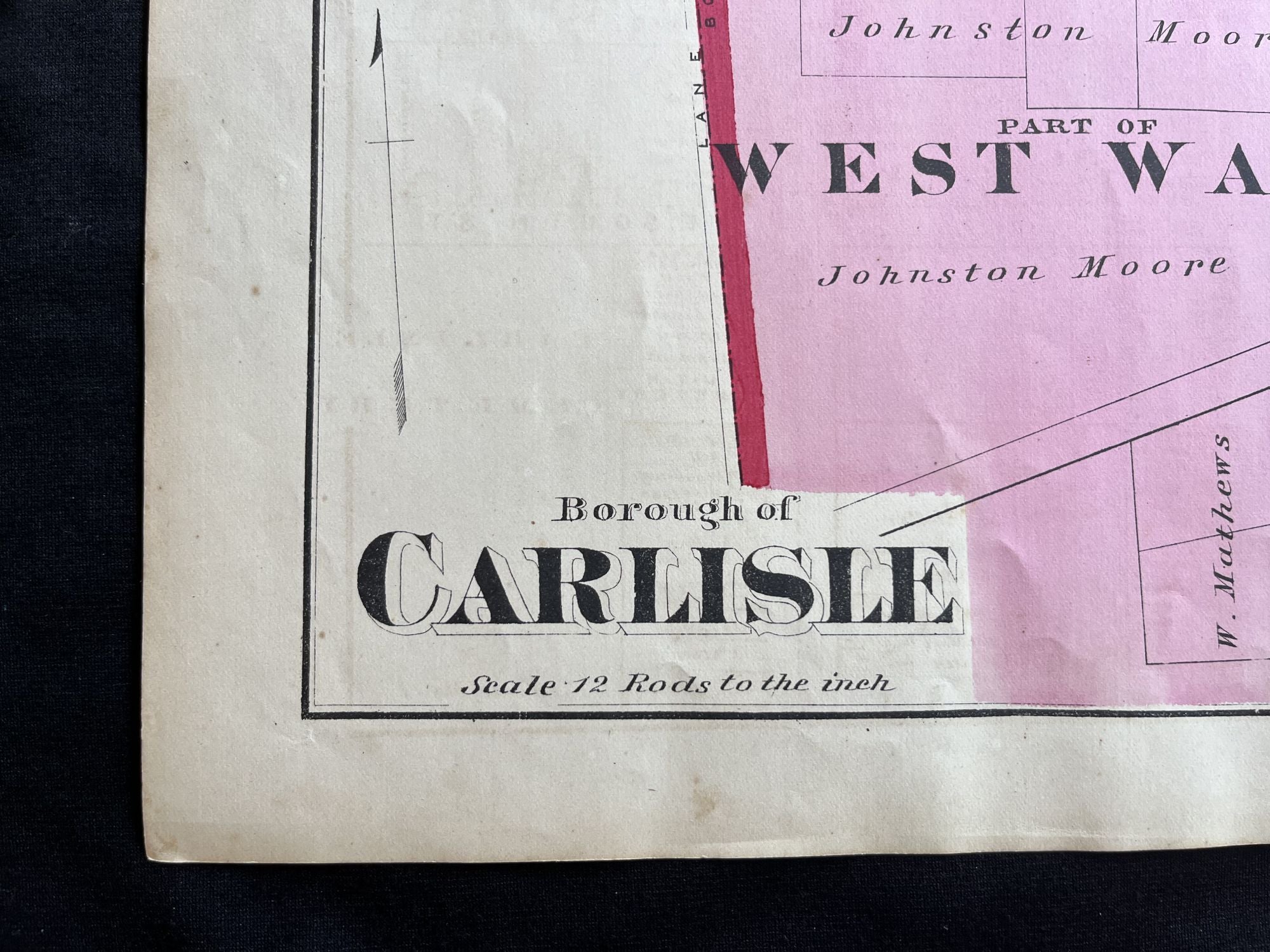
Rare 1872 Hand-Colored Map of Carlisle, Pennsylvania with Property Owner Names and Building Footprints
New York: F.W. Beers, 1872. Folio. Very Good. Item #15333
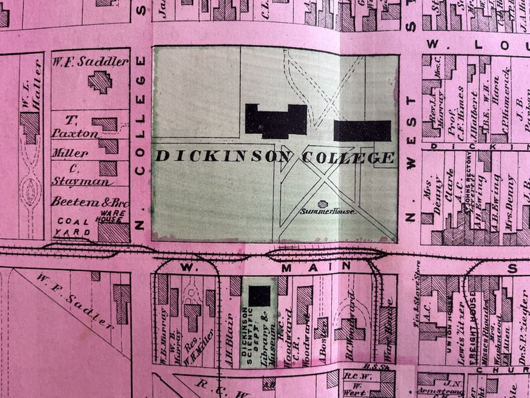
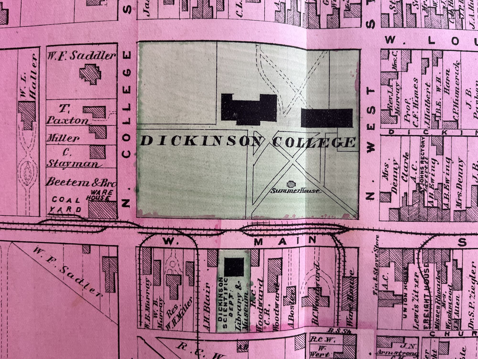
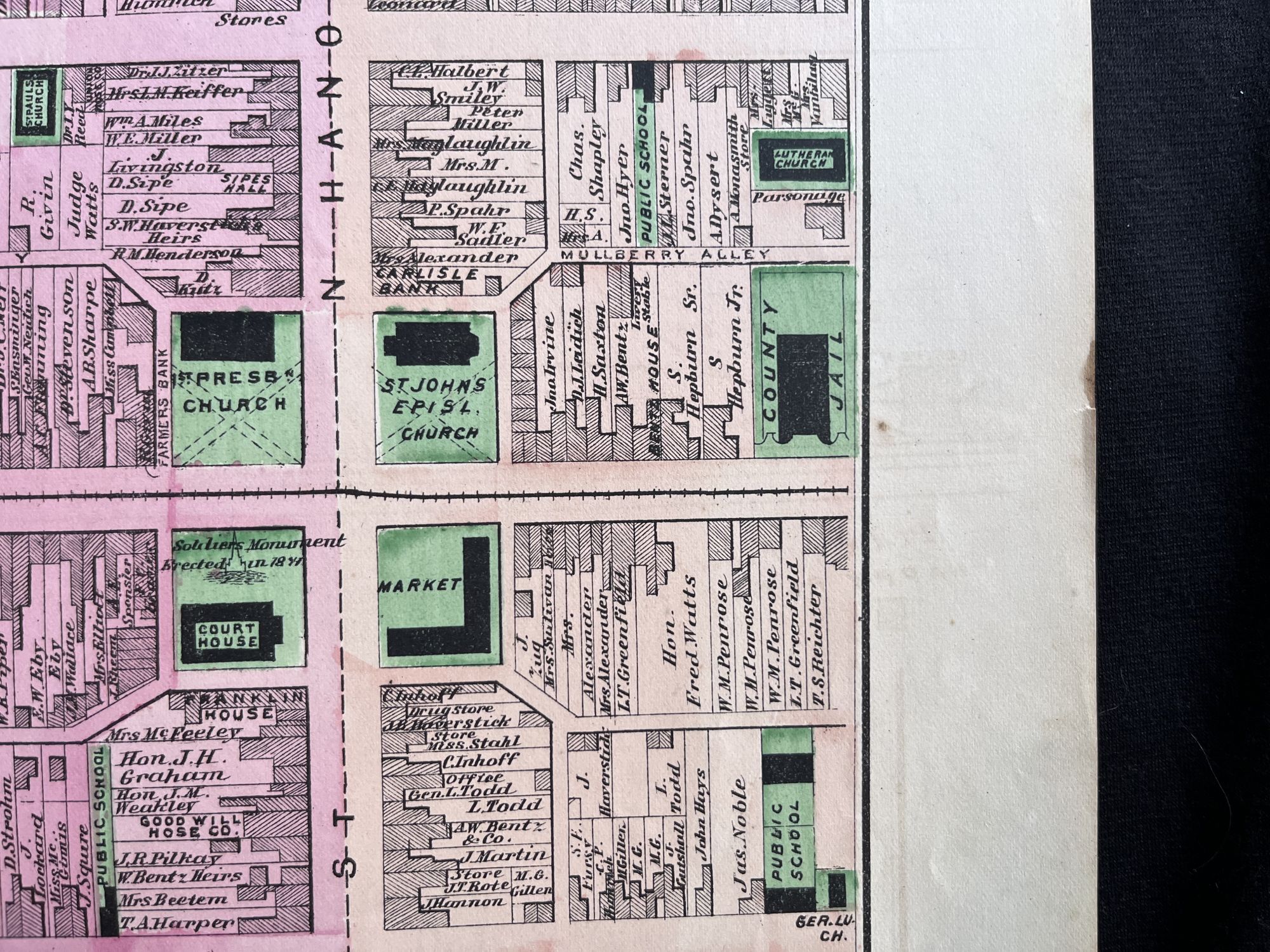
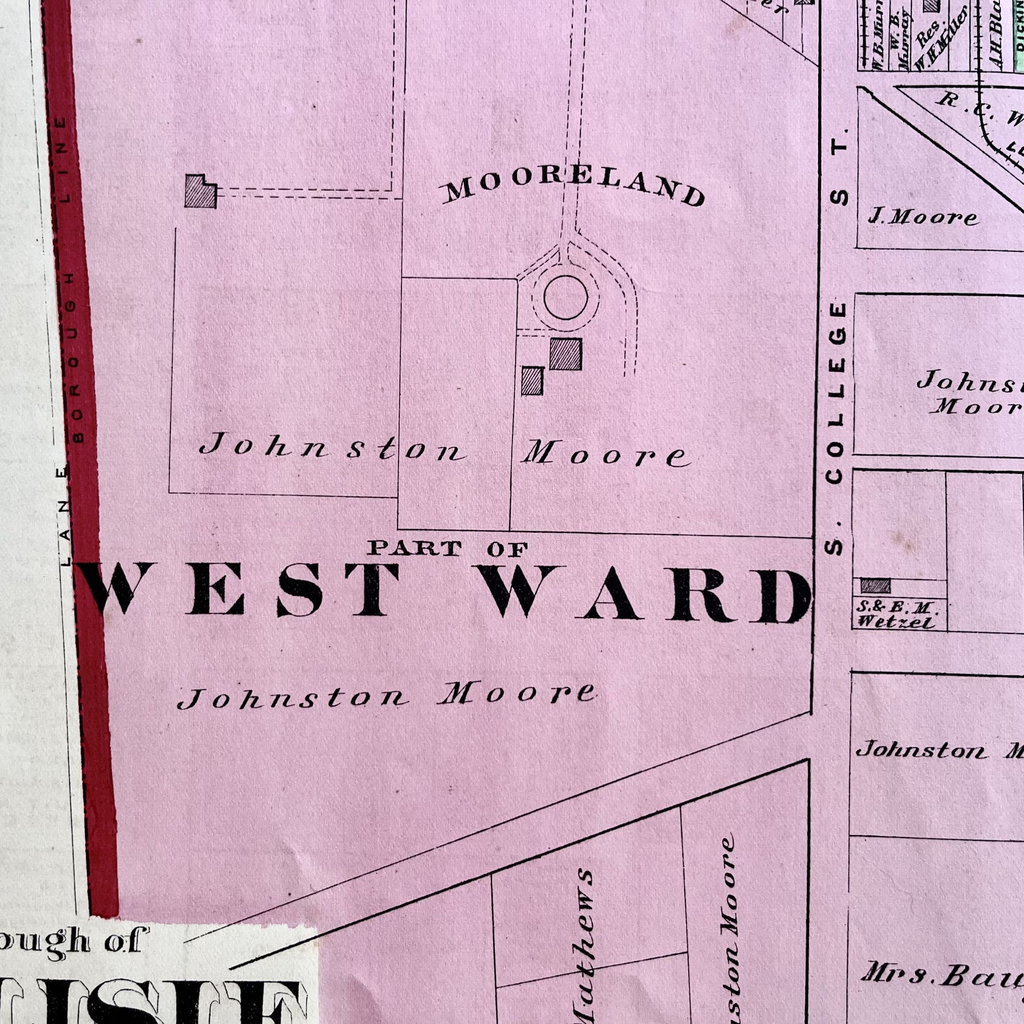
An original 1872 map of a portion of the historic town of Carlisle, Pennsylvania, with the layout and original building footprints of Dickinson College.
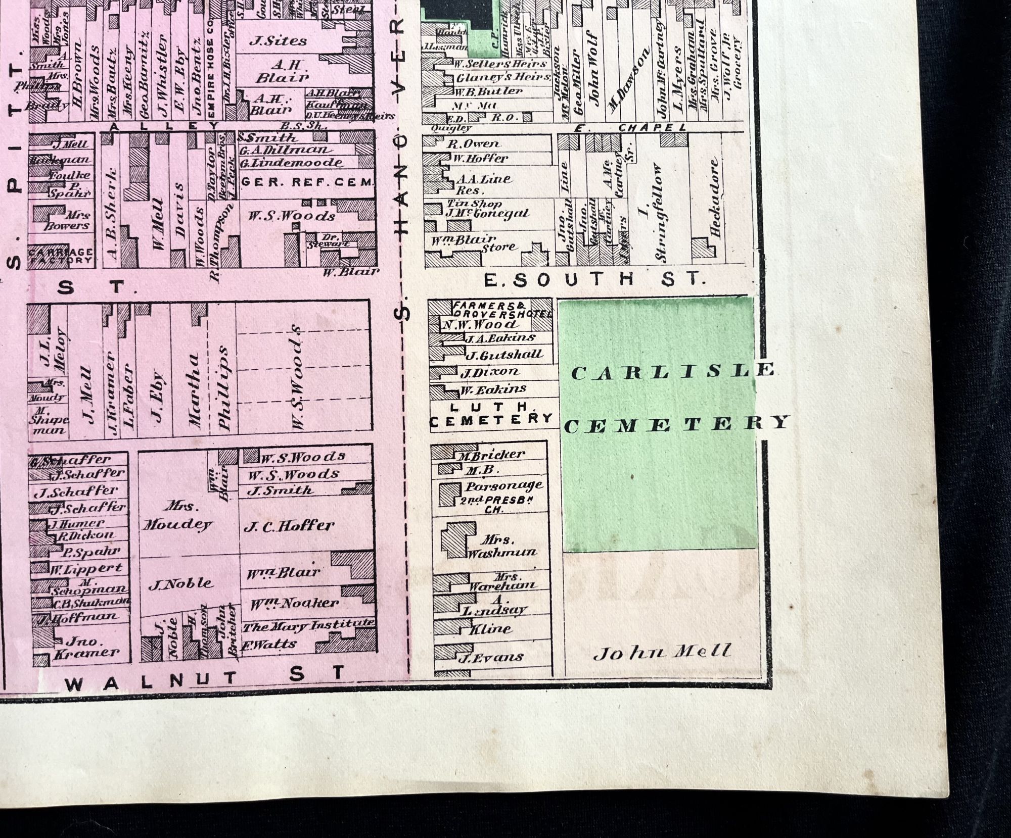
This large map was originally published in the F.W. Beers Atlas of Cumberland County, Pennsylvania and also features landmarks of the town's West Ward, such as the line of the Cumberland Valley Railroad, various churches and the Carlisle Cemetery..
This hand-colored map measures 24" X 15 1/2" and is perfect for framing and display!
#MB-189.
Price: $150.00
See all items by Early Map of Dickinson College Campus