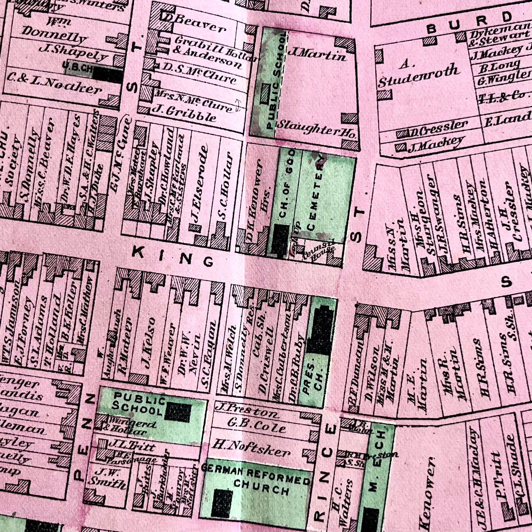
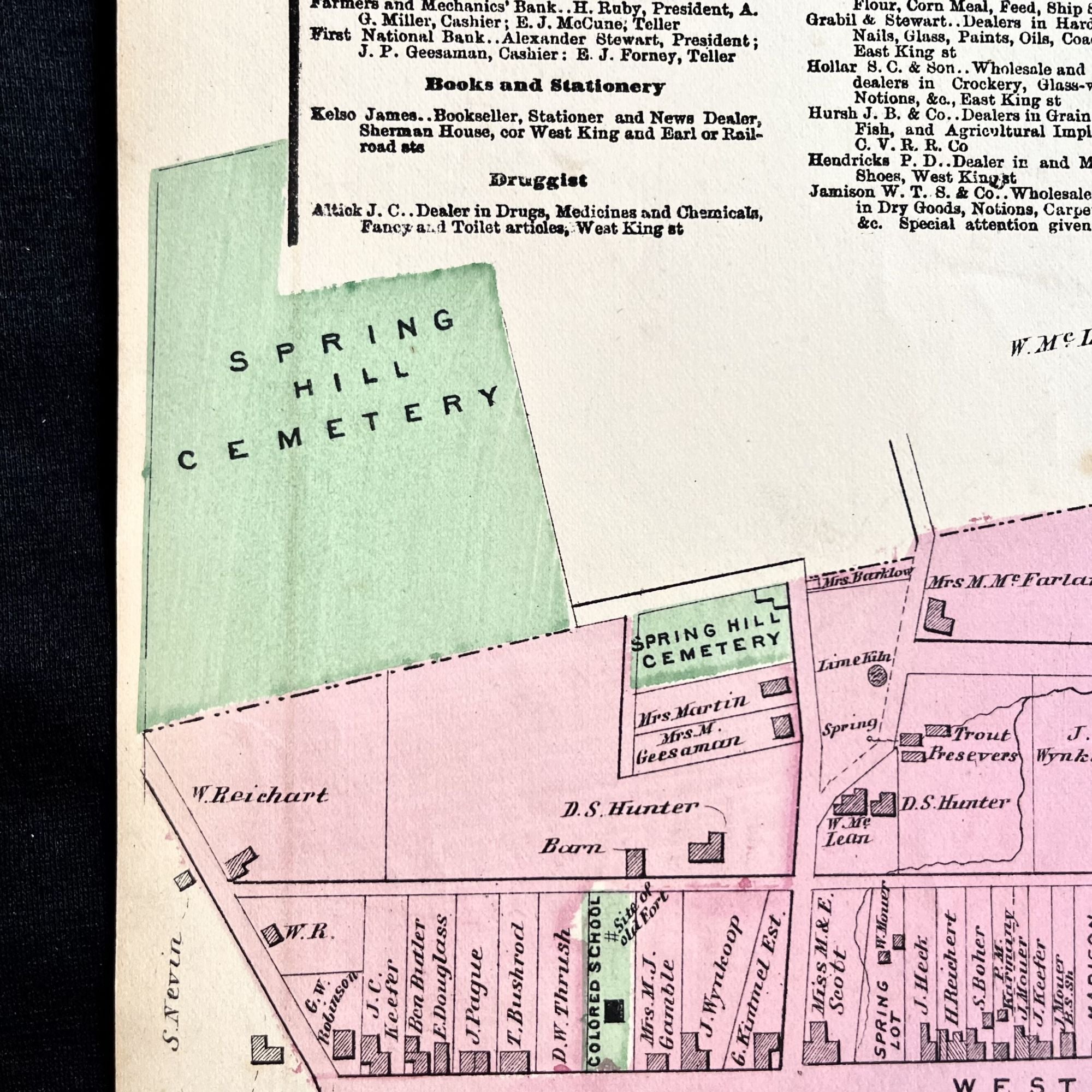
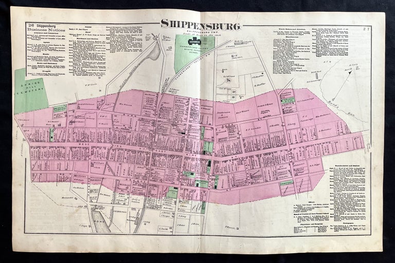
Rare 1872 Hand-Colored Map of Shippensburg, Pennsylvania with Property Owner Names and Building Footprints
New York: F.W. Beers, 1872. Folio. Very Good. Item #15334
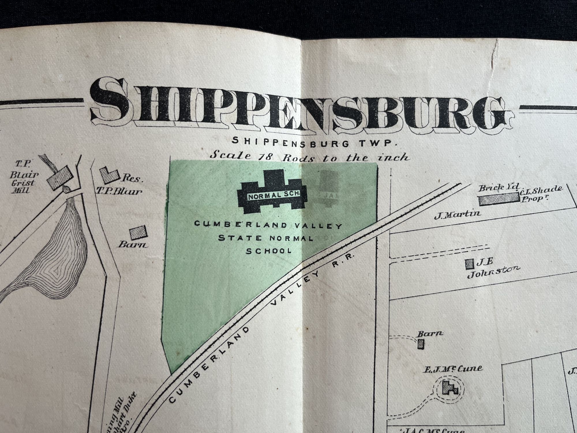
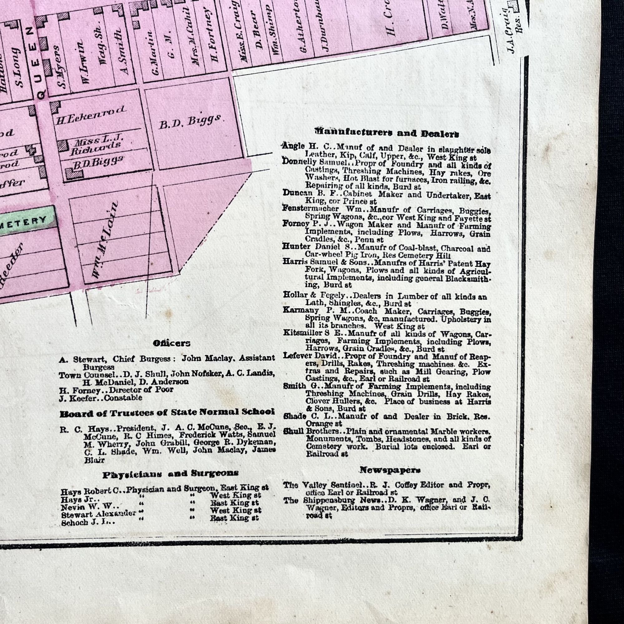
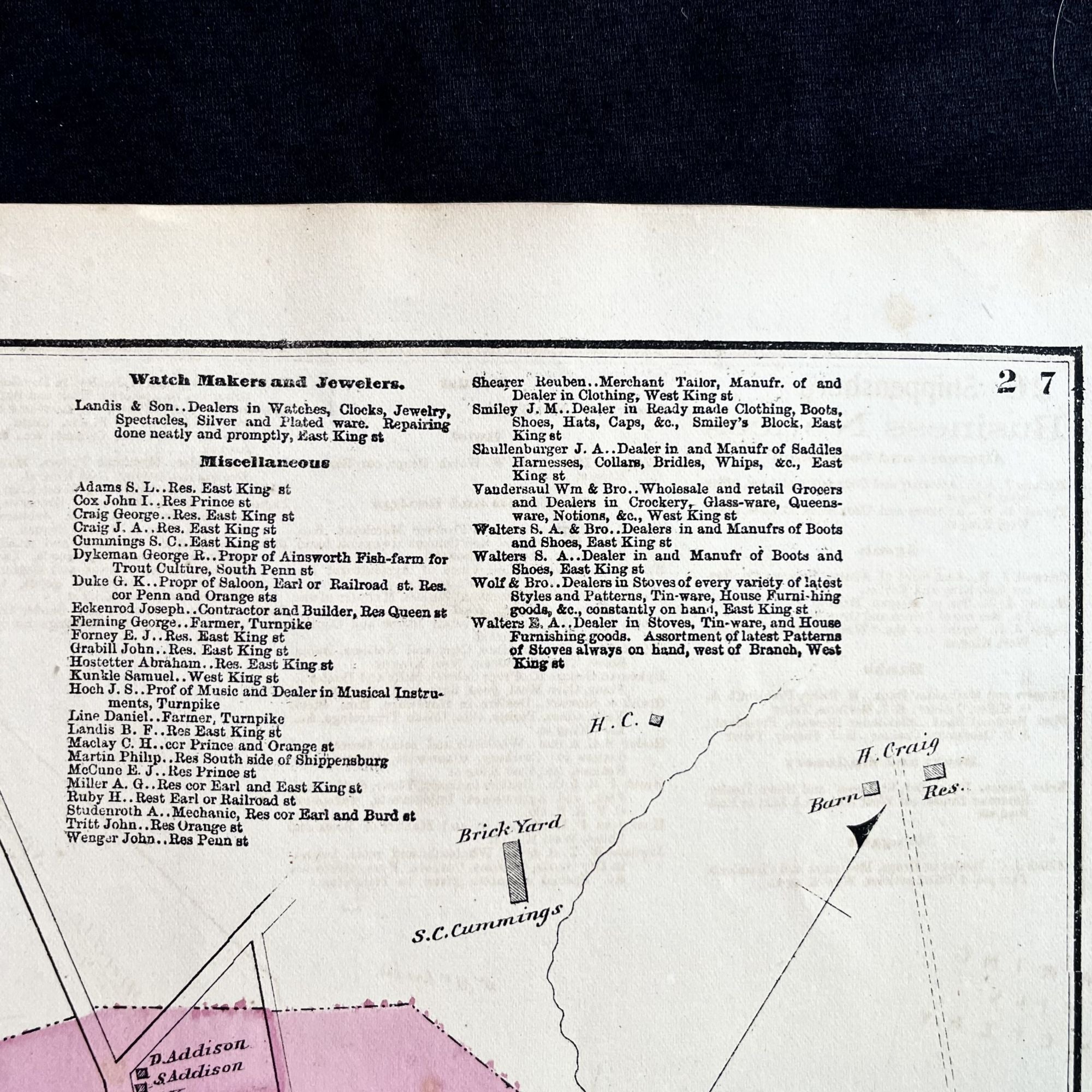
An original 1872 map of a portion of the historic town of Shippensburg, Pennsylvania, with building footprint of the Colored School for NEGR0ES, the NEGR0 Methodist Church, local cemeteries and more.
This large map was originally published in the F.W. Beers Atlas of Cumberland County, Pennsylvania and also features the line of the Cumberland Valley Railroad as well as the building footprint and layout of the Cumberland Valley State Normal School, which later became Shippensburg University.
This hand-colored map measures 24" X 15 1/2" and is perfect for framing and display!
#MB-190.
Price: $125.00