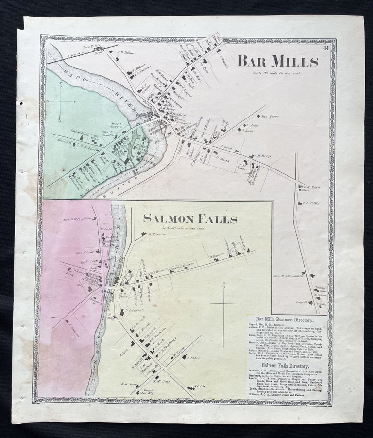
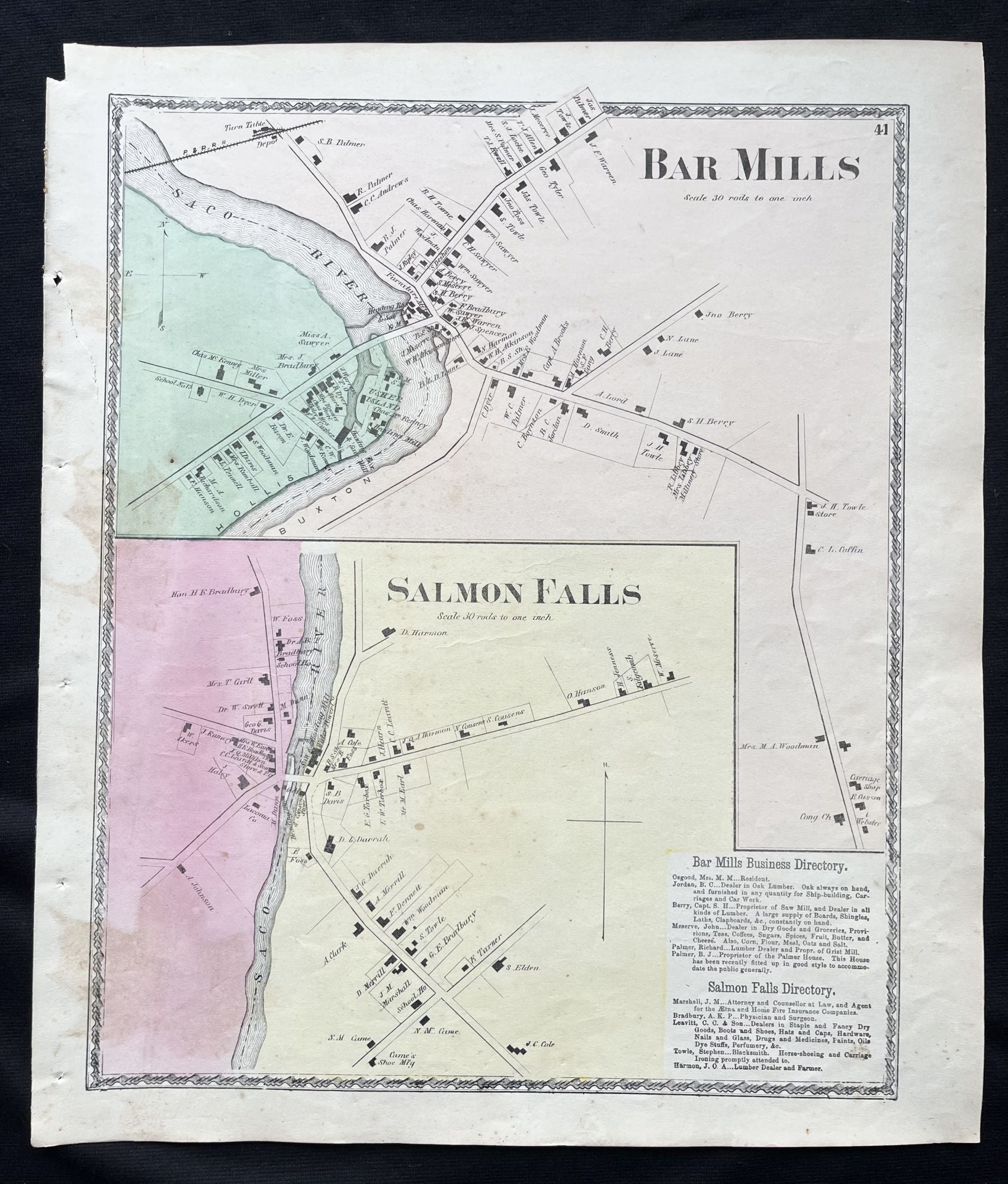
1872 Hand-Colored Street Map of Bar Mills, Maine and Rollinsford, New Hampshire with property owner names and building footprints
Philadelphia, Pa: Sanford, Everts & Co., 1872. 1st Edition. Folio. Very Good. Item #15736
A beautiful 1872 hand-colored map of Bar Mills, Maine and Salmon Falls, New Hampshire (Now Rollinsford), and surrounding area in York County, ME
This map includes property owner names, and lines of the defunct P&R Railroad.
"The area was once within the domain of the Newichawannock people, an Abenaki sub-tribe which took its name from the Newichawannock River, meaning "river with many falls", now the Salmon Falls River. Their village was located at what later was known as Salmon Falls Village and is now Rollinsford. They fished at the falls, stretching nets across the river to catch migrating salmon and other species swimming upriver to spawn. But war and disease, probably smallpox brought from abroad, decimated the native population.
Settled by about 1630, the land was part of Dover, one of the original townships of New Hampshire. The area was first called "Sligo", likely after County Sligo in Ireland, and the name survives on a town road. An historical marker on Sligo Road reads, "Near this place lived David Hamilton of Westburn born in the parish of Cambuslang, Scotland in October 1620; captured by Oliver Cromwell at the Battle of Worcester, England, September 3, 1651; Brought to America as a prisoner in chains on the "John and Sarah" in the same year; settled near here and married Annah Jaxson of Lanark, Scotland. Killed by Indians on September 28, 1691."
In 1729 the area was established as a parish called "Summersworth", meaning summer town, because the ministers preached here during the summer. In 1754, it was set off and incorporated as a town by colonial governor Benning Wentworth, although thereafter spelled "Somersworth" due to a clerical error. Since the first settlers' arrival, small communities had developed near various sawmills and gristmills along the Salmon Falls River, but the center of "Summersworth" was located at Rollinsford Junction.
Beginning in the early 1820s, water powered textile mills were established at the larger falls, and the town was divided between them—Great Falls became Somersworth, and Salmon Falls became Rollinsford, incorporated in 1849. It was named in honor of the Rollins family, whose ancestor Judge Ichabod Rollins had settled there many generations before and had become the first probate judge for the state."
This map measures 16" X 14" and is perfect for framing and display!
#2D-0010.
Price: $75.00