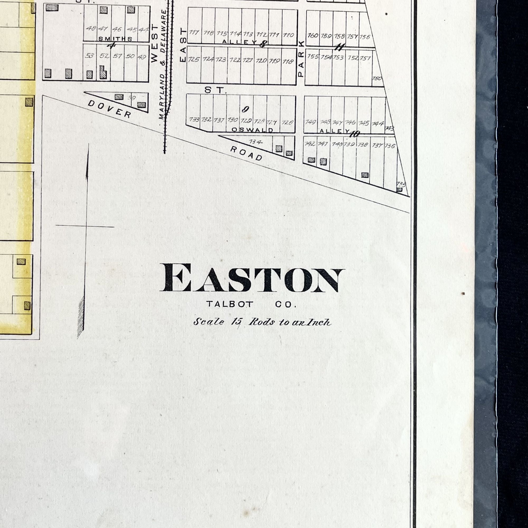
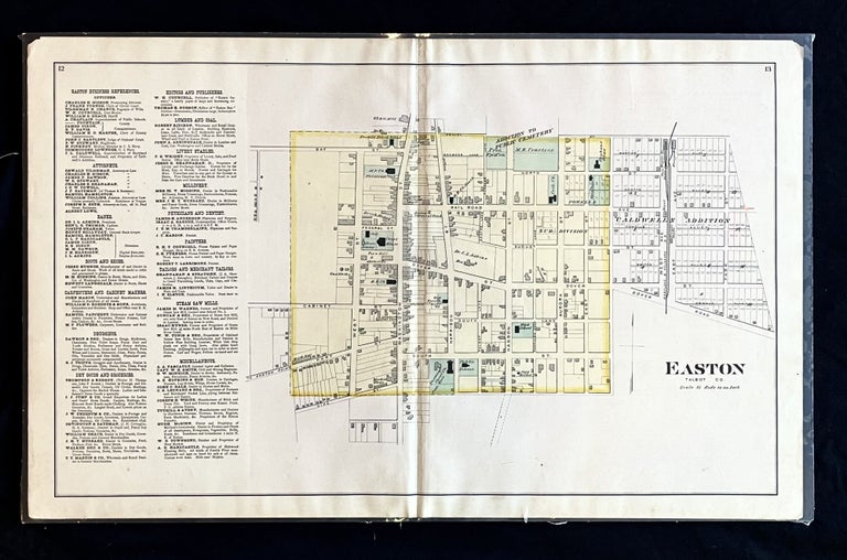
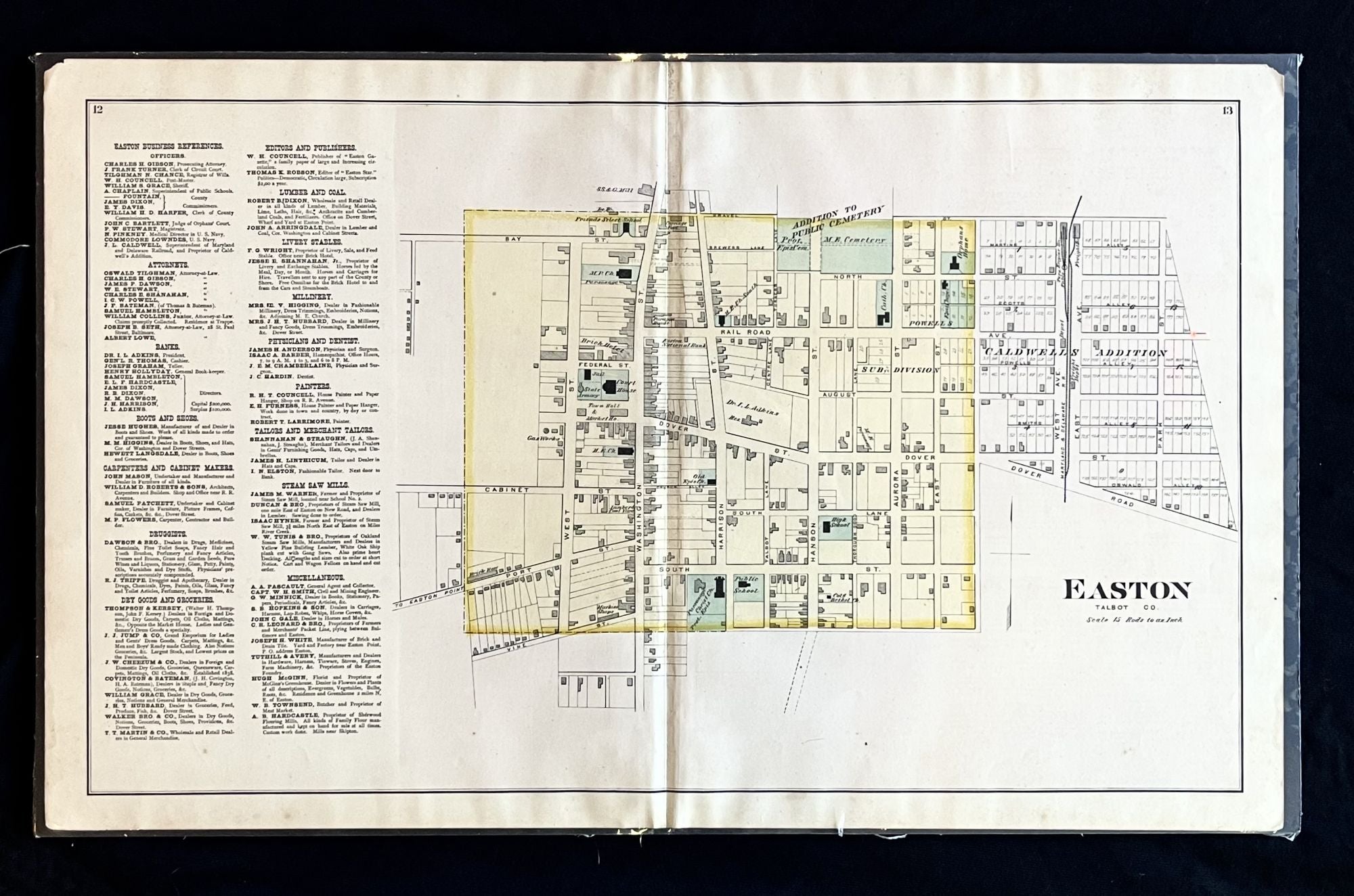
Rare 1877 Hand-Colored Street Map of Easton, the Seat of Talbot County, Maryland
Philadelphia, PA: Lake, Griffing & Stevenson, 1877. 1st Edition. Folio. Very Good. Item #16000
A scarce 1877 Hand-Colored Street Map of the historic Eastern Shore of Maryland town of Easton, seat of Talbot County.
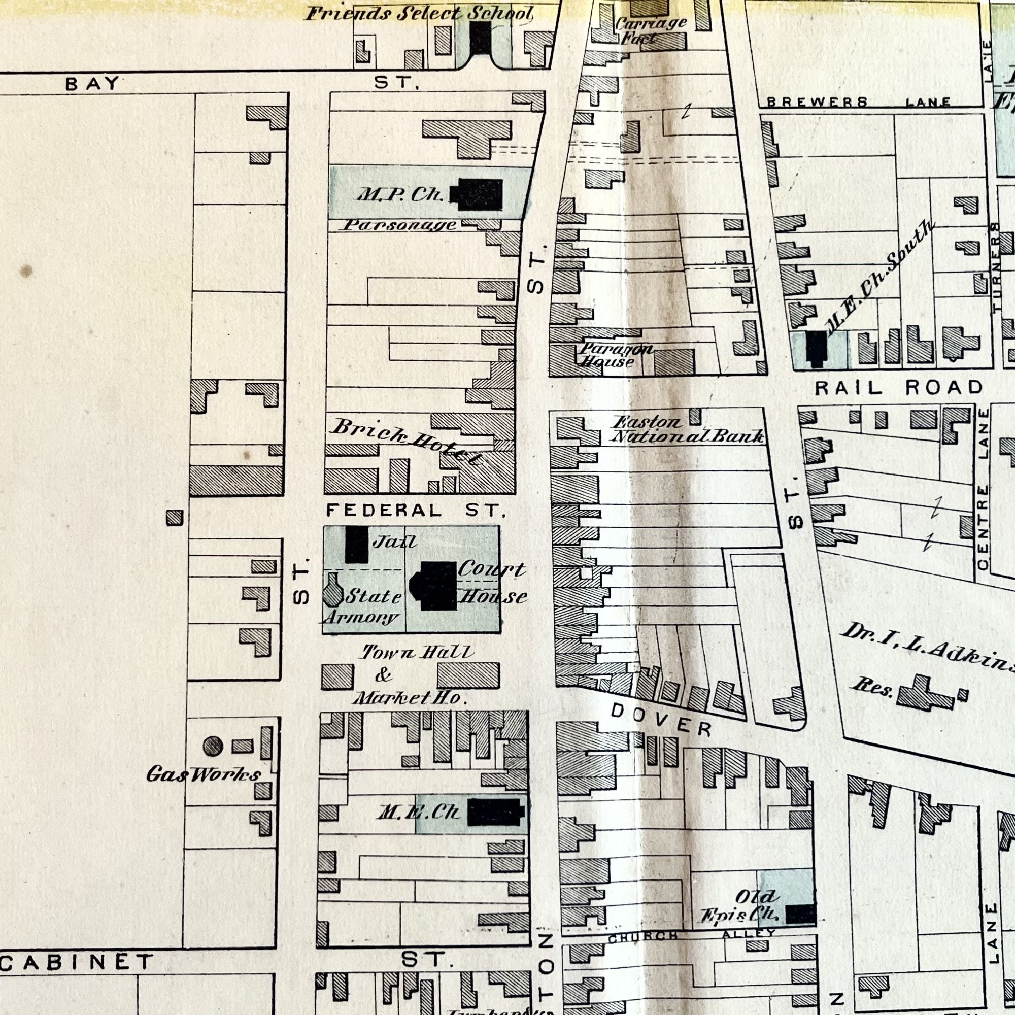
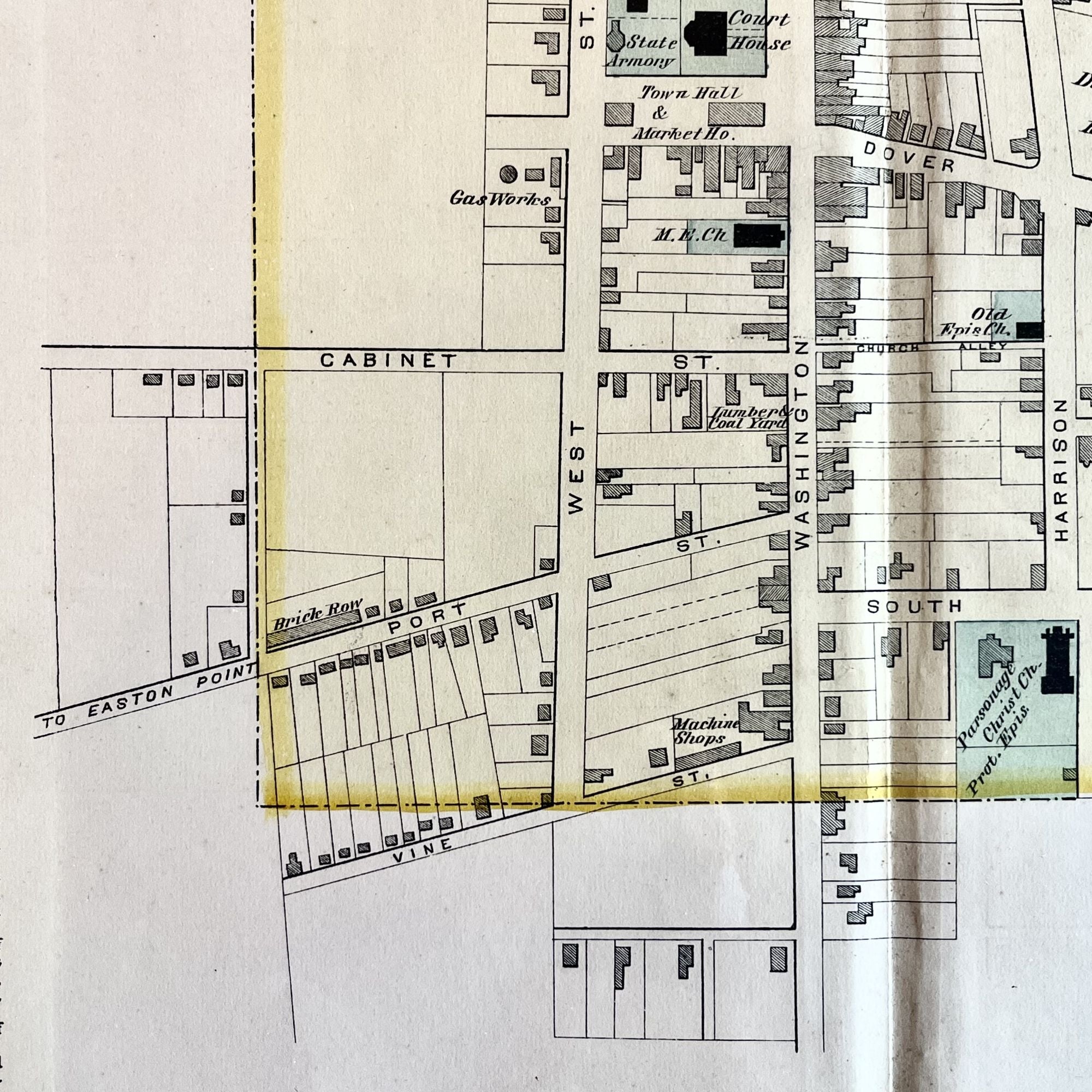
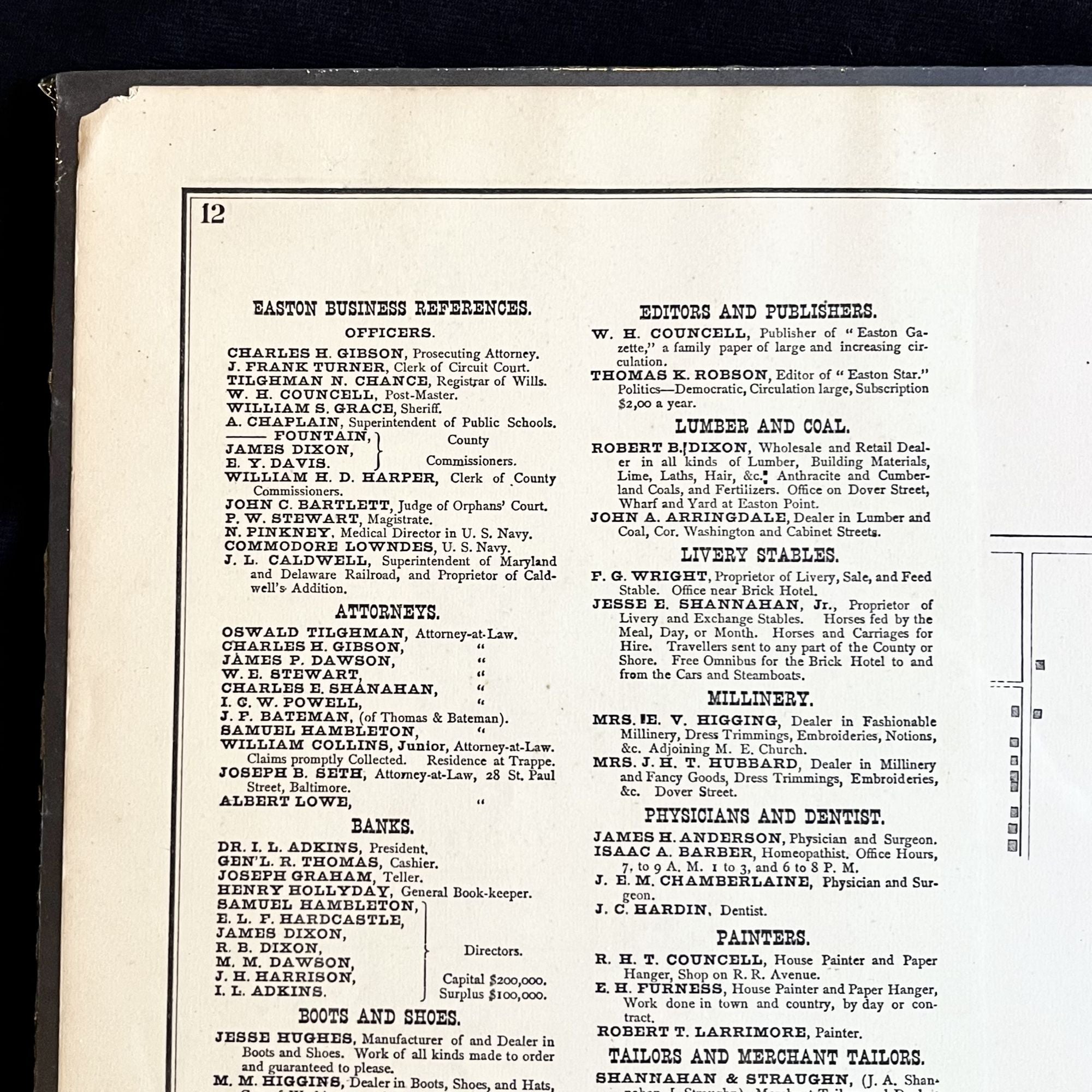
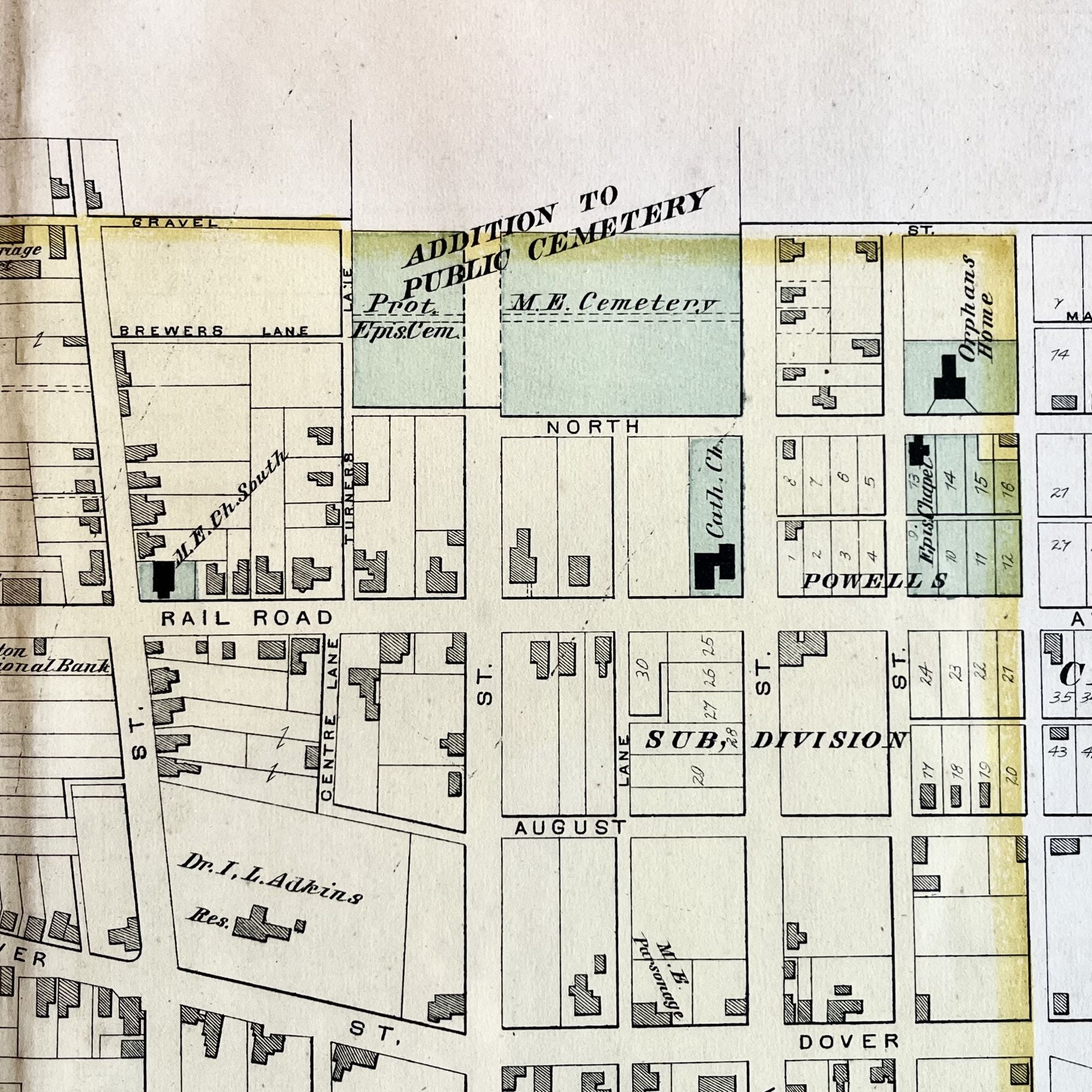
This map, from the "Atlas of Talbot & Dorchester Counties", features building footprints, property owner names and a listing of the original business sponsor names. And while many things on the map have changed in the intervening 150 years, many have remained the same. Christ Church is depicted as is the 18th-century courthouse. Where the Tidewater Inn now stands, the residence of Dr. I.L. Adkins was then standing. Goldsborough Street was then known as railroad Ave. and Glenwood known by two names, separated by Washington Street as it is today, cabinet St and Church Alley.
Also featured is the railroad line of the Maryland and Delaware Railroad, along with the turntable engine house.
The business sponsor list boasts a myriad of Names belonging to founding families of the Eastern Shore, such as Harrison, Hambleton, Seth, Trippe, Shannahan and more. One of the sponsors is attorney Oswald Tilghman, Confederate Army officer and grandson of Tench Tilghman, aide-de-camp to George Washington during the Revolutionary War.
This map, with just a touch of edge wear, measures approximately 26" X 16" and is perfect for framing and display!
Sold