Rare 1877 Hand-Colored Street Map of Oxford and Trappe, Talbot County, Maryland
Philadelphia, PA: Lake, Griffing & Stevenson, 1877. 1st Edition. Folio. Very Good. Item #16001
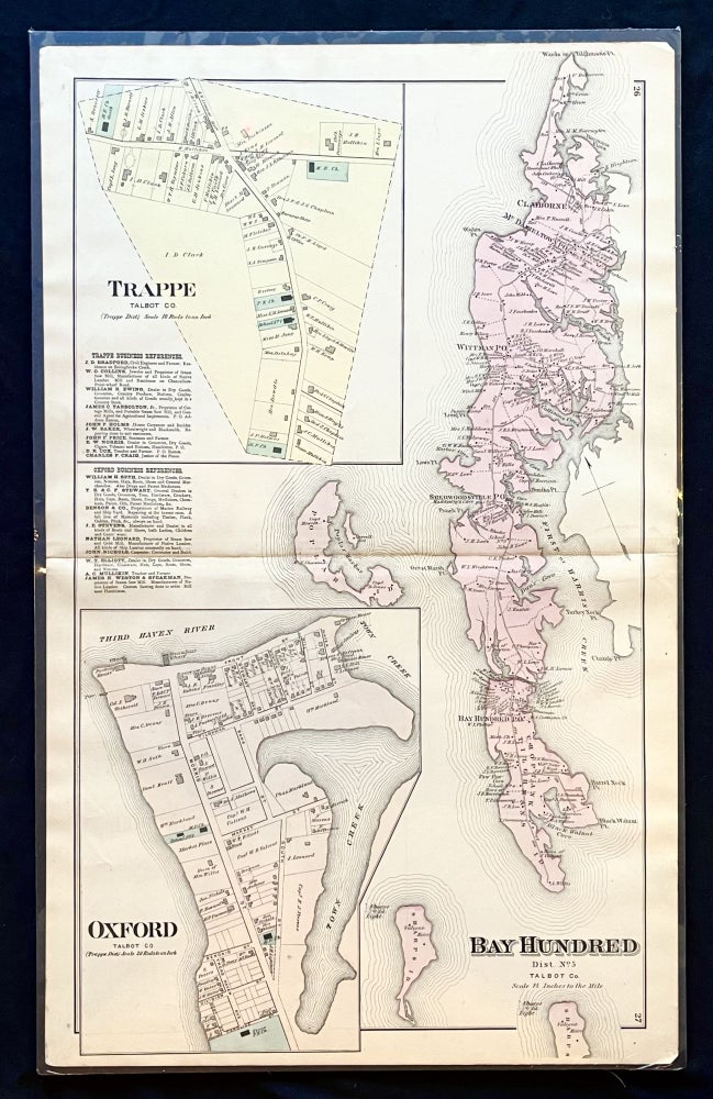
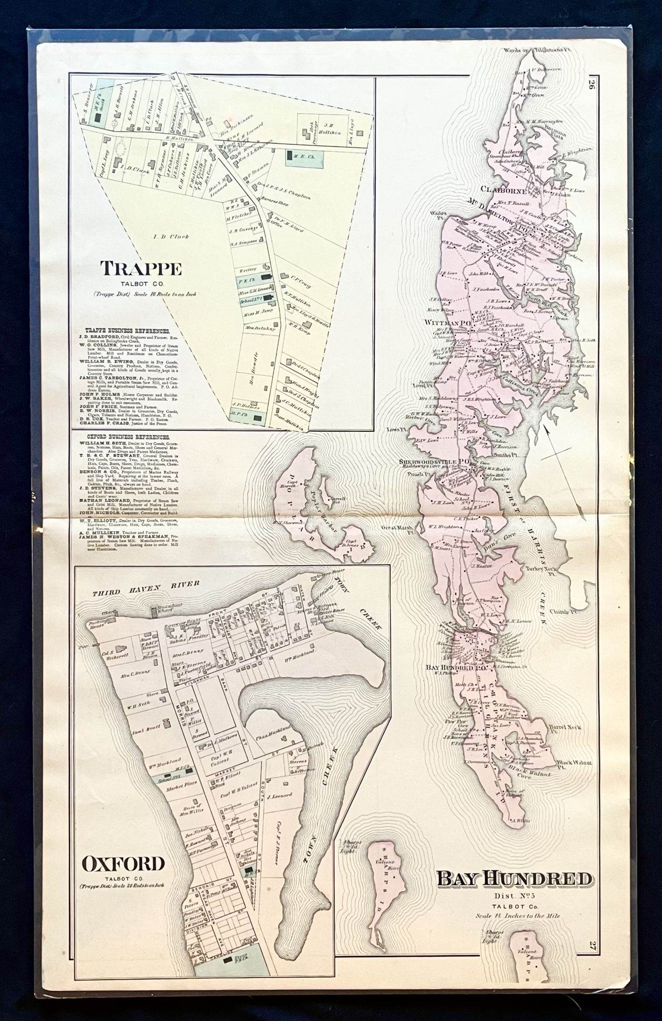
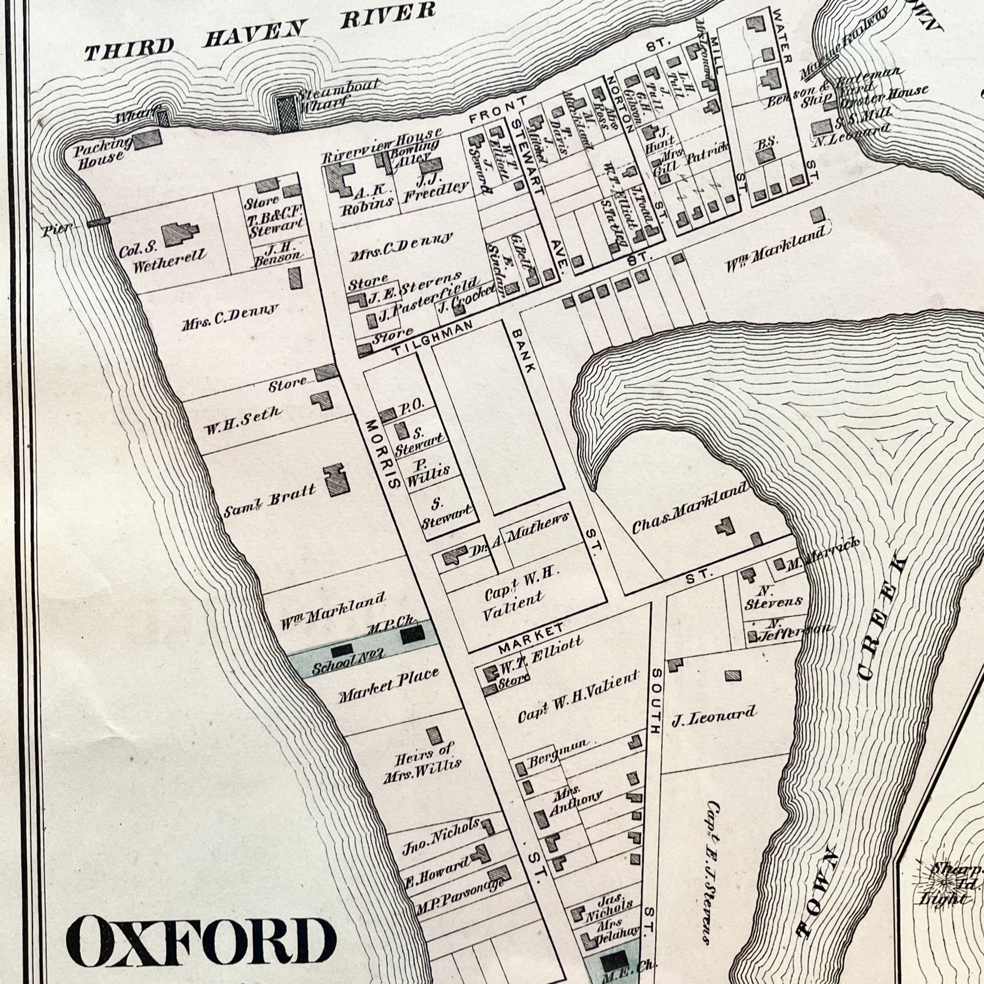
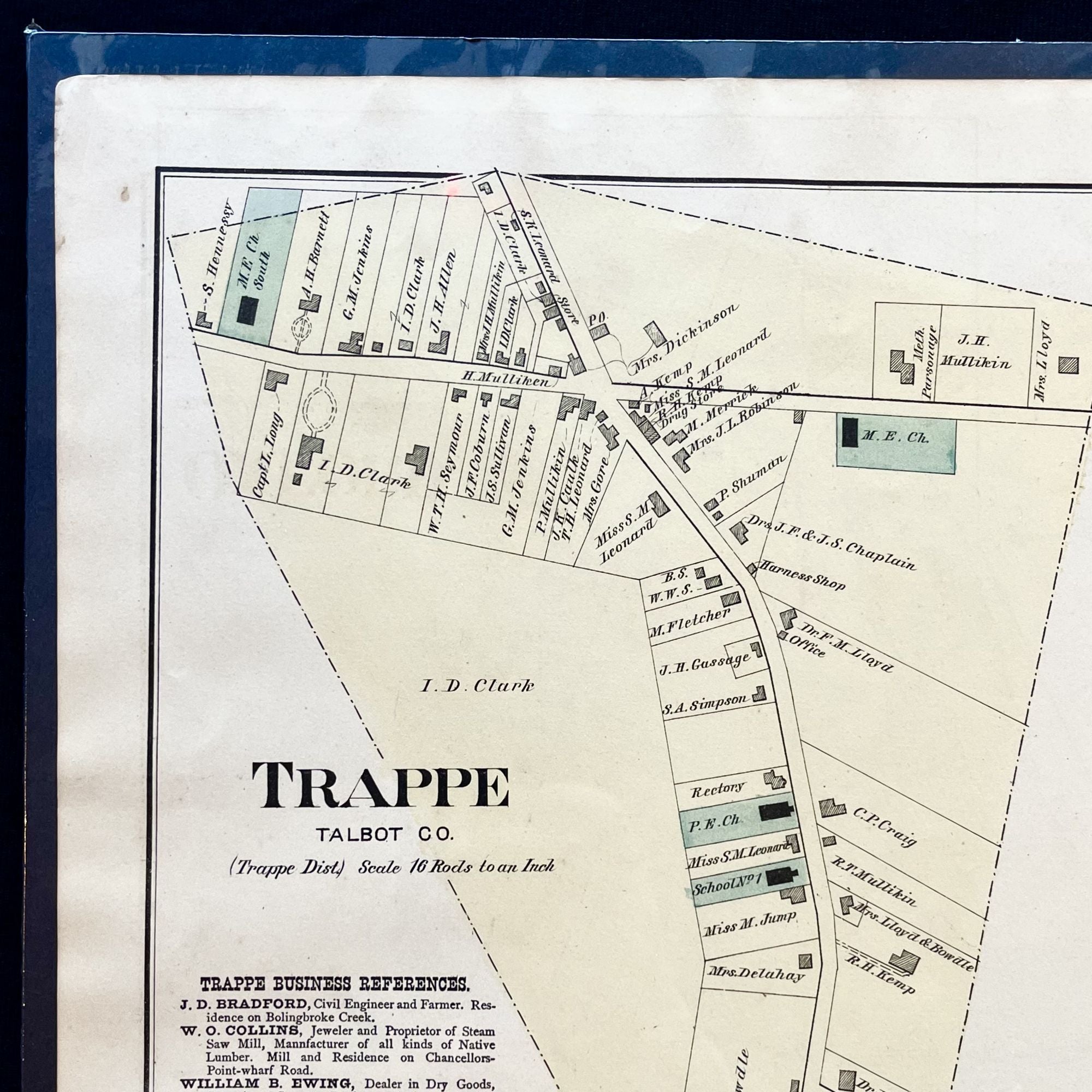
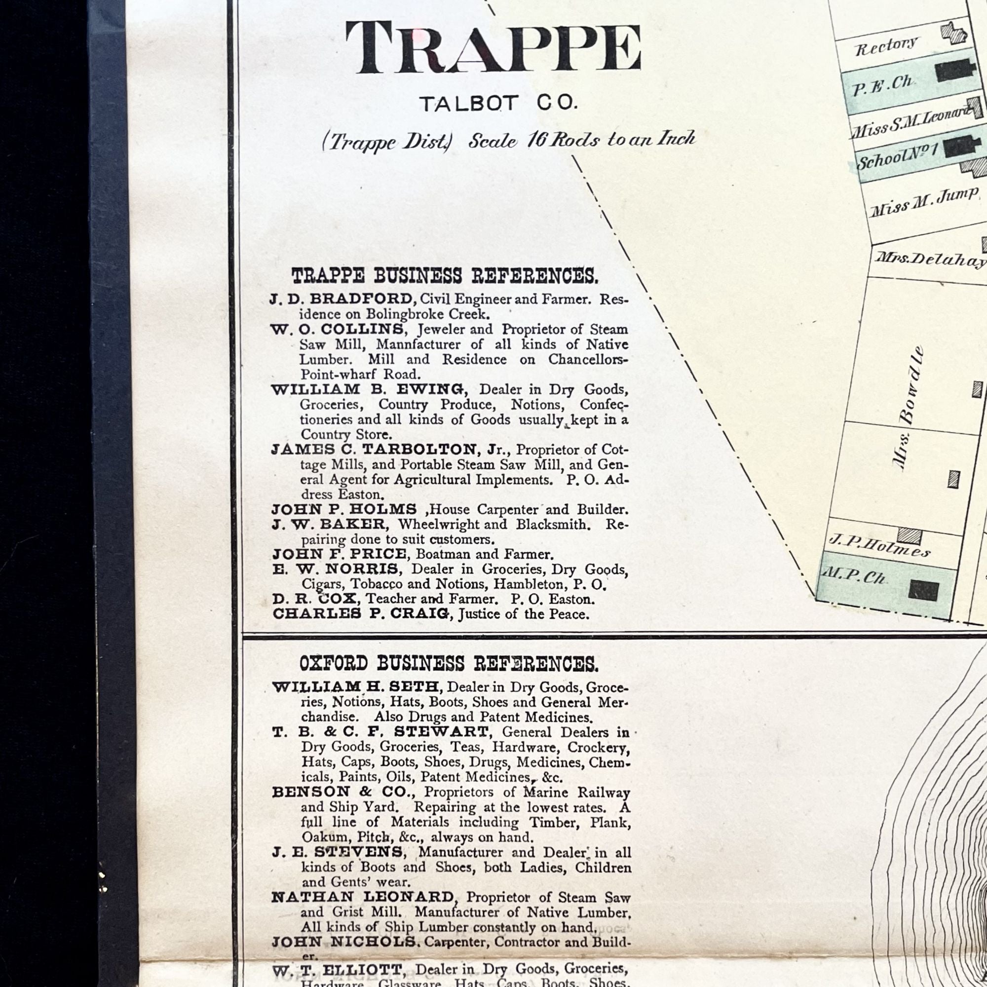
A scarce 1877 Hand-Colored Street Map of the historic Eastern Shore of Maryland towns of Oxford, the oldest town in the Shore, first settled in the 1660s, and Trappe.
This map, from the "Atlas of Talbot & Dorchester Counties", features building footprints, property owner names and a listing of the original business sponsor names. And while many things on the map have changed in the intervening 150 years, many have remained the same. While this era was during the era of the Chesapeake Oyster Wars and the coastal towns were booming with new residents, the towns were relatively undeveloped compared to today. In Oxford there was a packing house where the Tred Avon yacht Club now stands, and the land along Town Creek is virtually undeveloped. Today's Town park was home to the two public schools, which later burned. Trinity Church, then in ruins, is depicted as is St. Paul's.
The business sponsor list boasts a myriad of Names belonging to founding families of the Eastern Shore, such as Stevens, Stewart, Seth, and more.
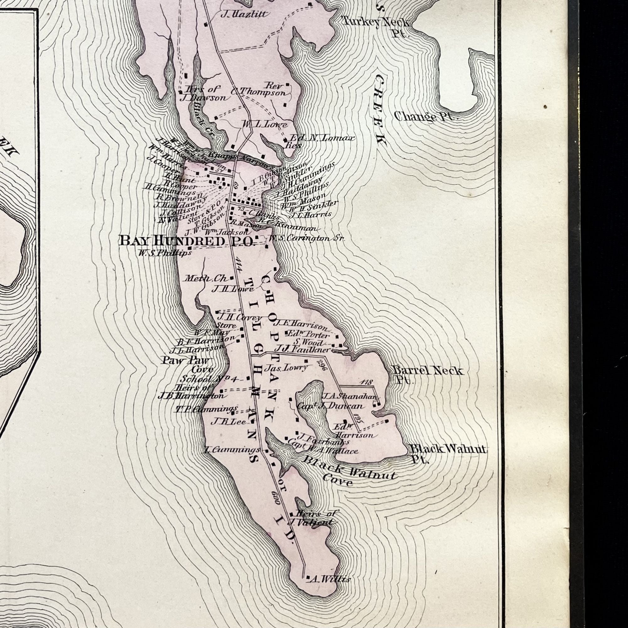
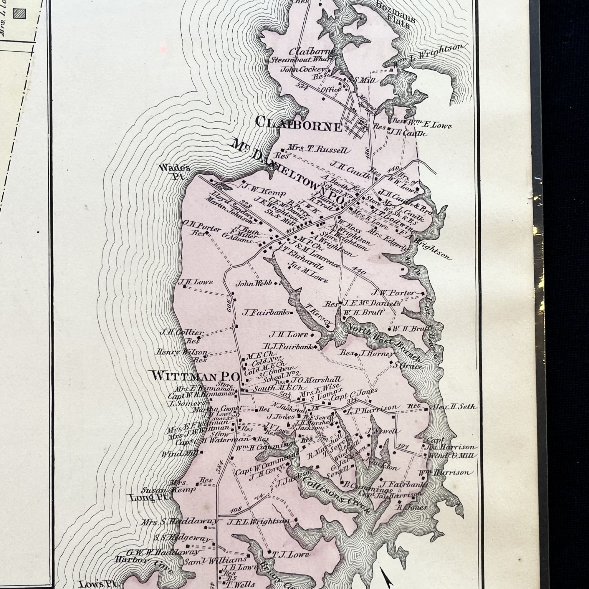
Also depicted is the bay Hundred District, running down the right side of the map, featuring Tilghman Island.
This map, with just a touch of edge wear, measures approximately 26" X 16" and is perfect for framing and display!
Price: $2,200.00