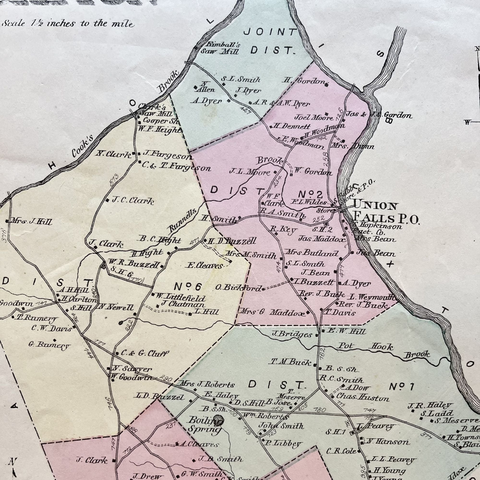
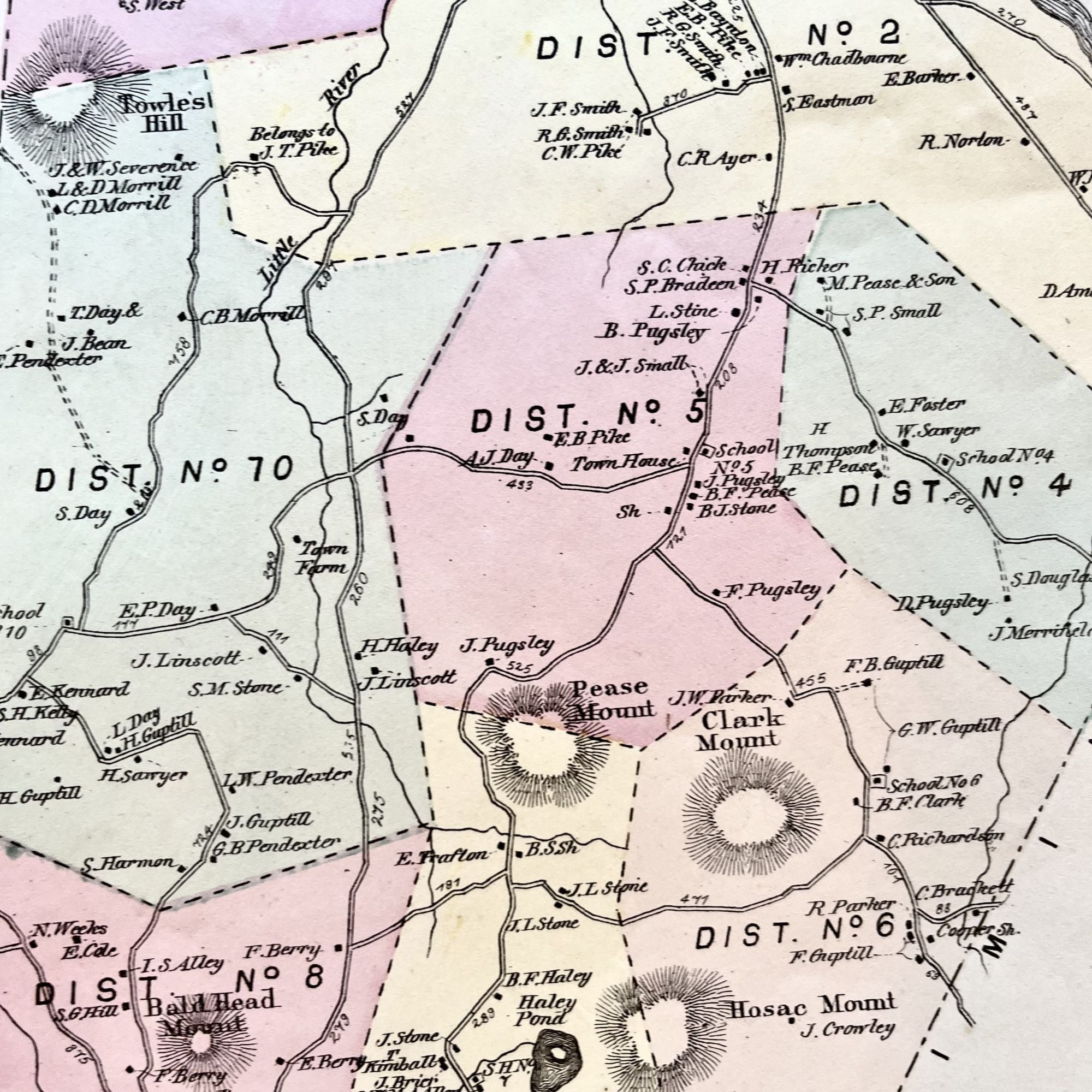
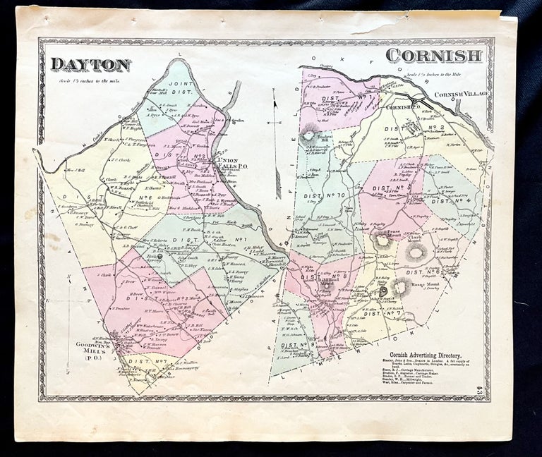
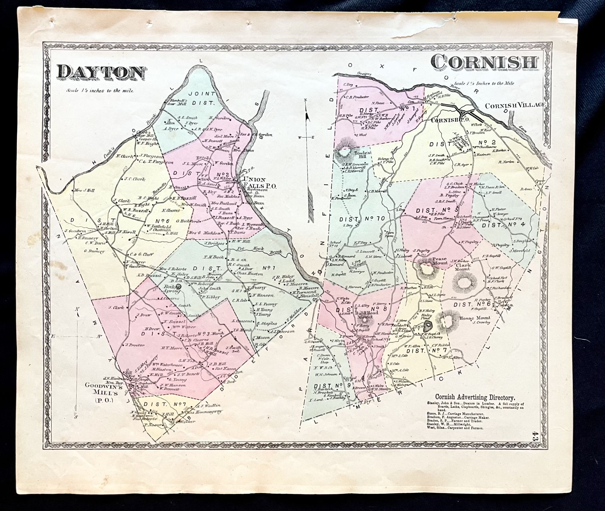
1872 Hand-Colored Street Map of Dayton and Cornish, Maine w Property Owner Names and district lines just after the Civil War
Philadelphia, Pa: Sanford, Everts & Co., 1872. 1st Edition. Folio. Very Good. Item #16075
A beautiful 1872 hand-colored map of Dayton and Cornish, Maine.
This map includes property owner names and lines of the districts featuring Union Falls and Bald Head Mount. Includes Cornish advertising directory.
Small closed tear affecting the upper margin with very light foxing.
This map measures 16" X 14" and is perfect for framing and display!
#2D-031.
Price: $75.00
See all items by Maine History! Early York County