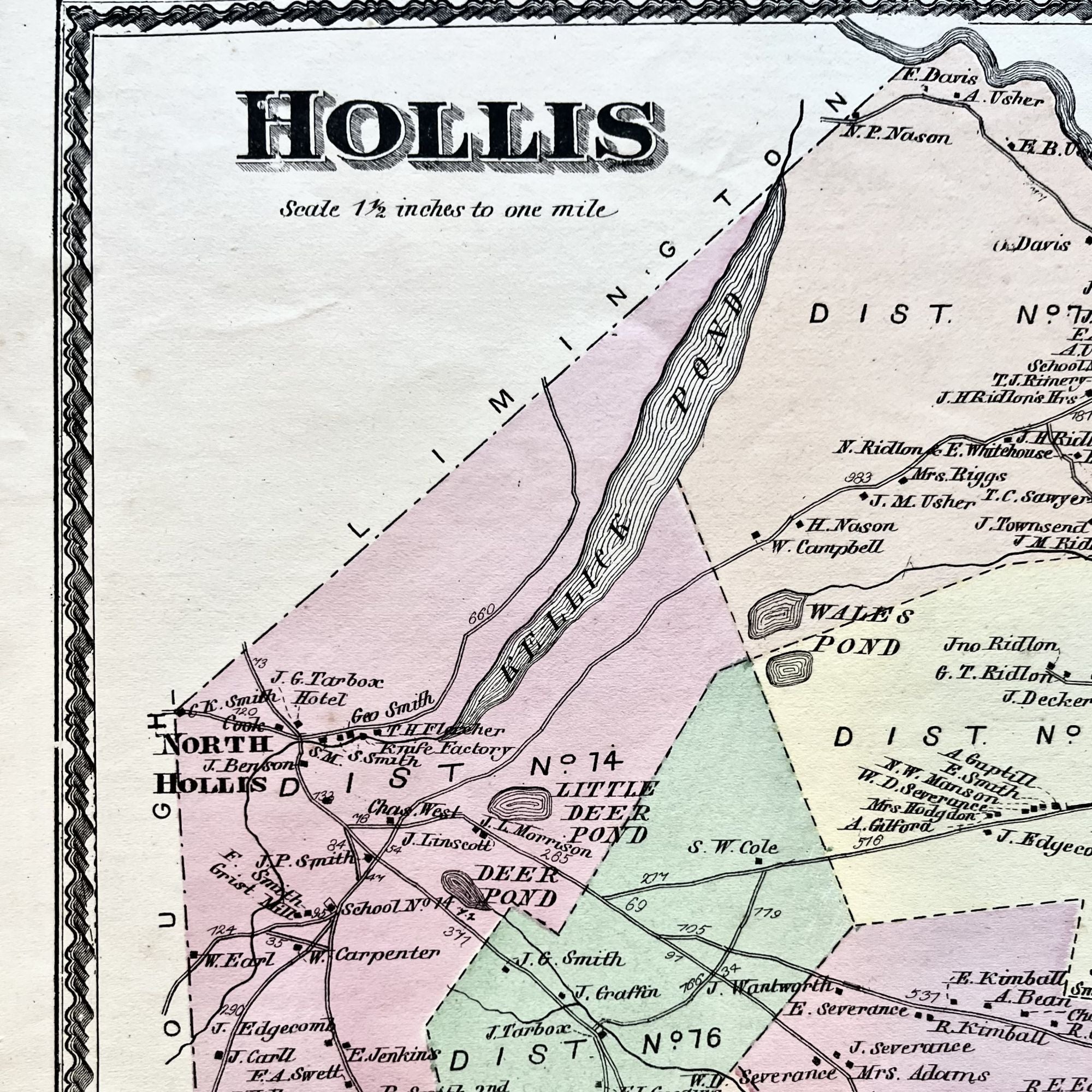
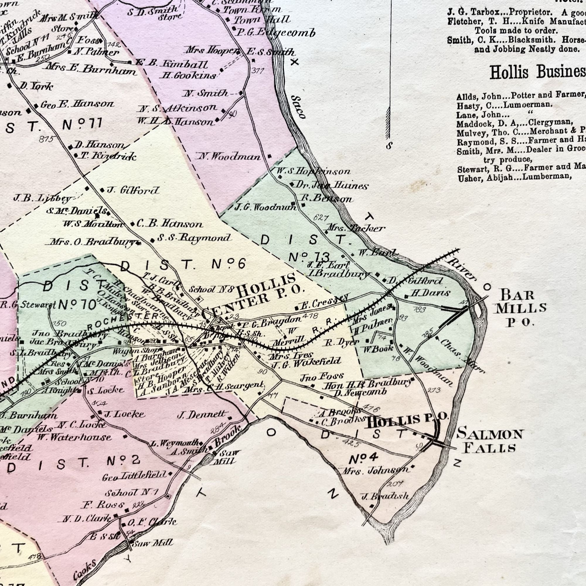
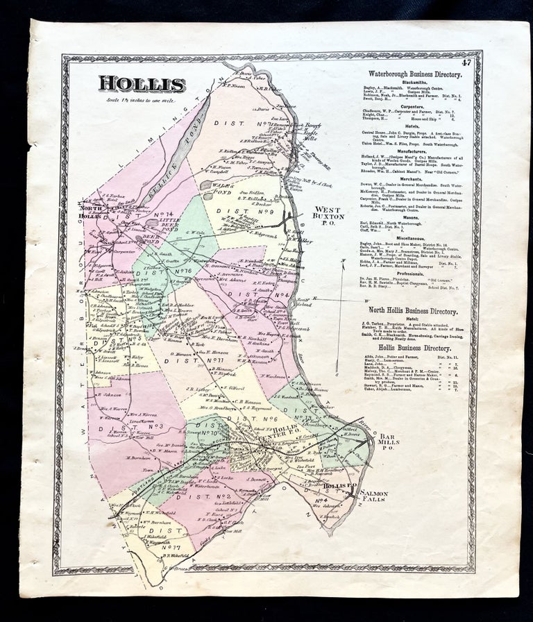
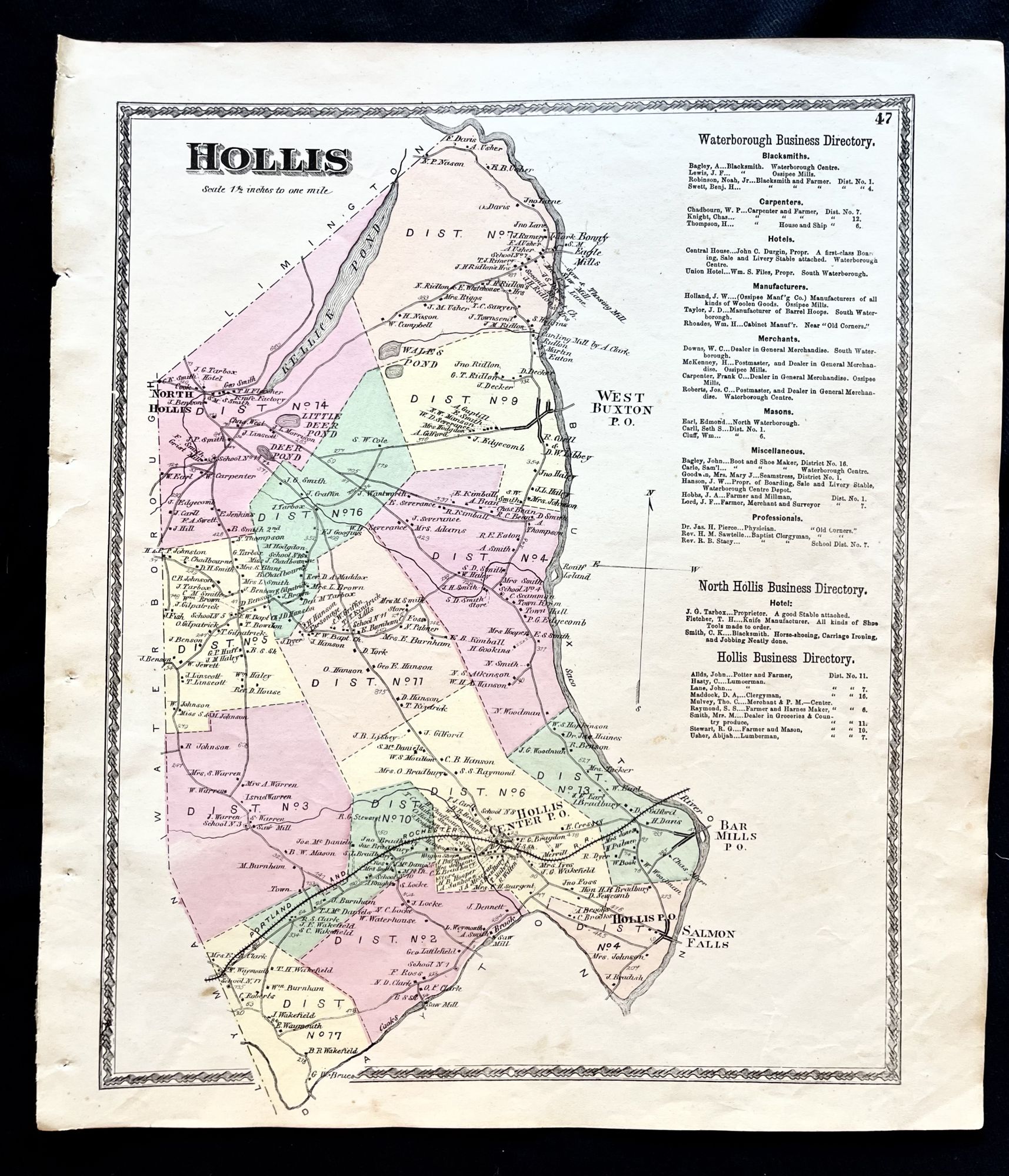
1872 Hand-Colored Street Map of Hollis, Maine w Property Owner Names just after the Civil War
Philadelphia, Pa: Sanford, Everts & Co., 1872. 1st Edition. Folio. Very Good. Item #16077
A beautiful 1872 hand-colored map of Hollis, Maine.
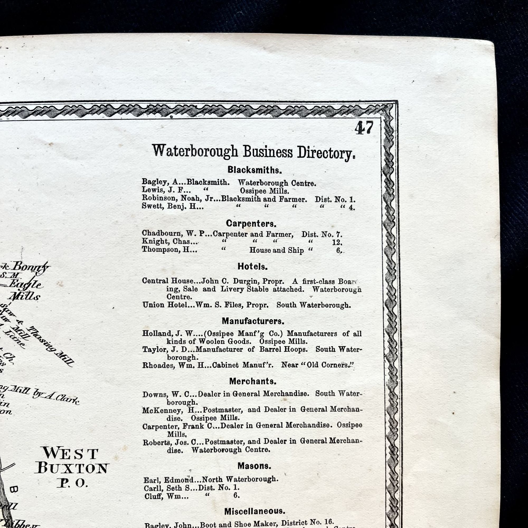
This map includes property owner names and lines of the districts, and the now defunct Portland and Rochester Railroad line. Featuring the Saco River. Includes the Waterborough, North Hollis and Hollis advertising directory.
This map measures 16" X 14" and is perfect for framing and display!
#2D-033.
Price: $75.00
See all items by Maine history 19th Century Hollis