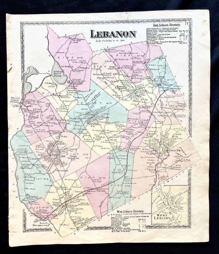
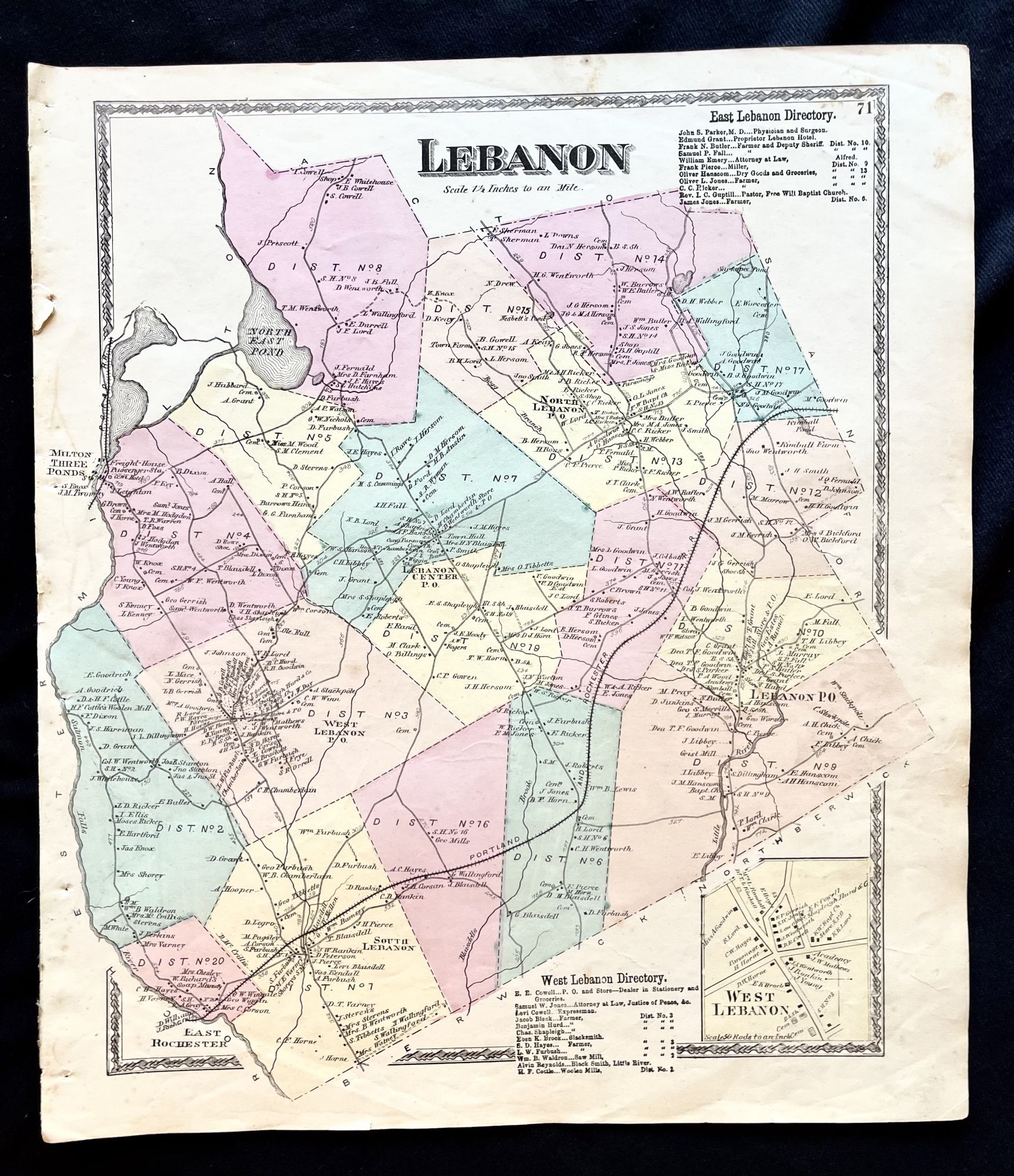
1872 Hand-Colored Street Map of the Lebanon, Maine Region w Property Owner Names just after the Civil War
Philadelphia, Pa: Sanford, Everts & Co., 1872. 1st Edition. Folio. Very Good. Item #16079
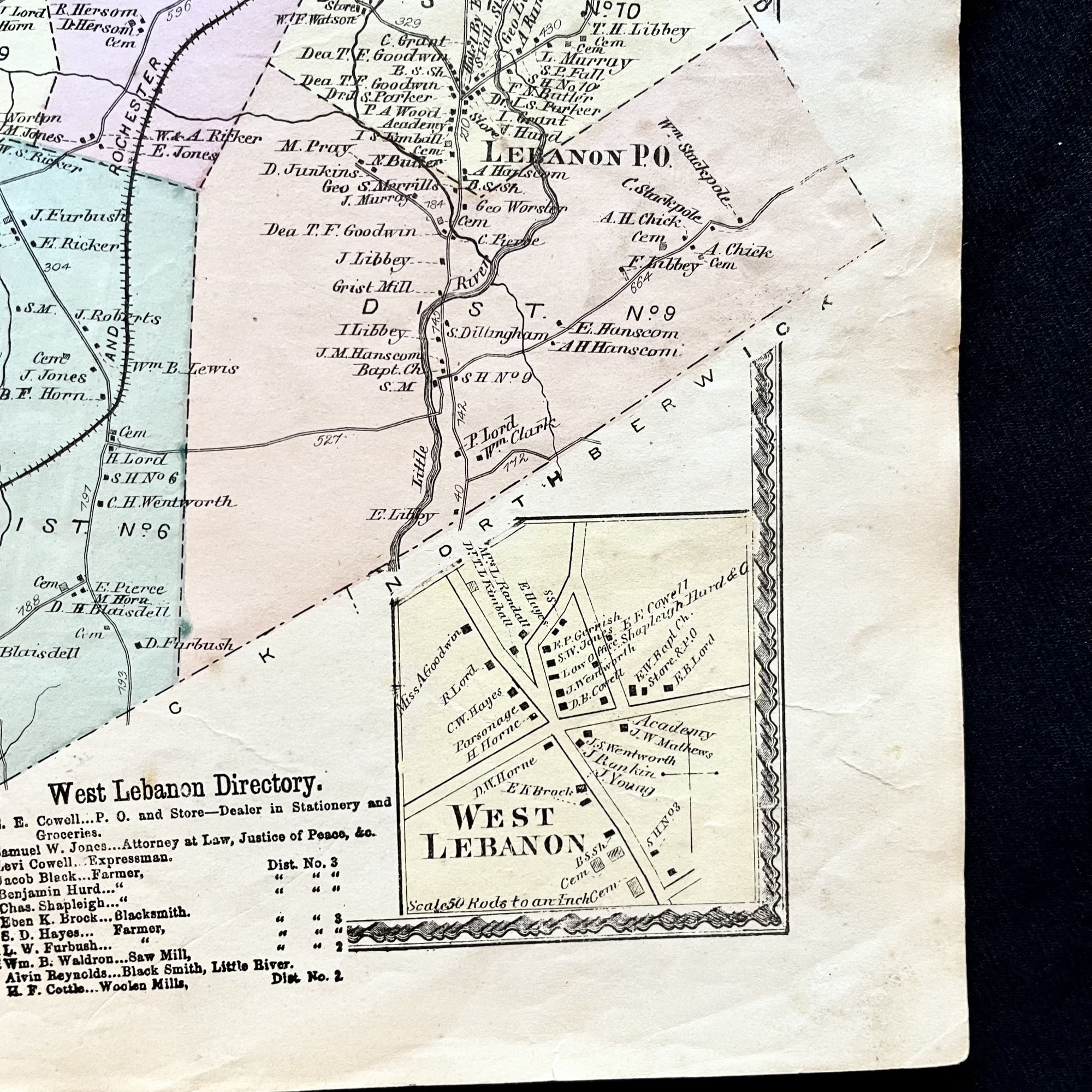
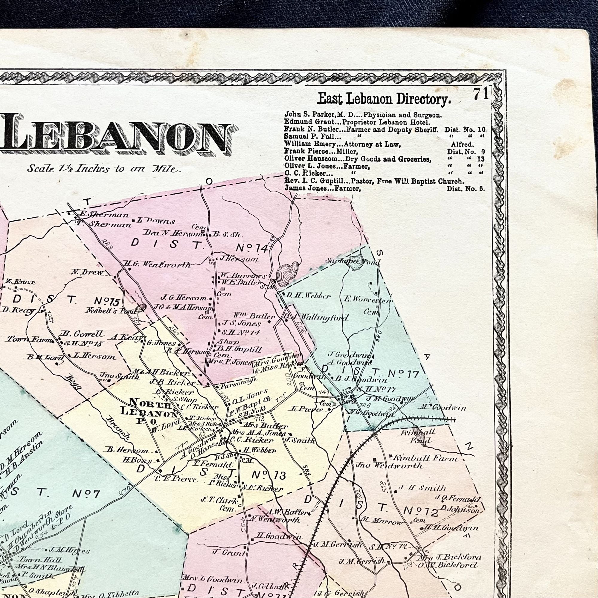
A beautiful 1872 hand-colored map of Lebanon, Maine and surrounding area in York County, Maine.
This map includes property owner names, district lines and lines of the now defunct Portland and Rochester Railroad. Vignette of West Lebanon as well as a Listing of East and West Lebanon business directory.
This map measures 16" X 14" and is perfect for framing and display!
#2D-035.
Price: $75.00
See all items by Maine History! Early York County