
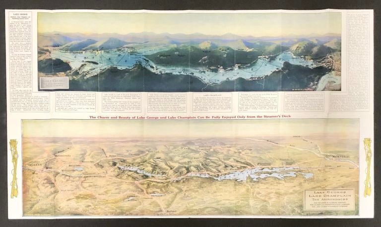
1927 Pictorial Map of Lake George, Lake Champlain & the Adirondack Mountains
Lake George: The Champlain Transportation Co. & Lake George Steamboat Co., 1927. Very Good. Item #16112
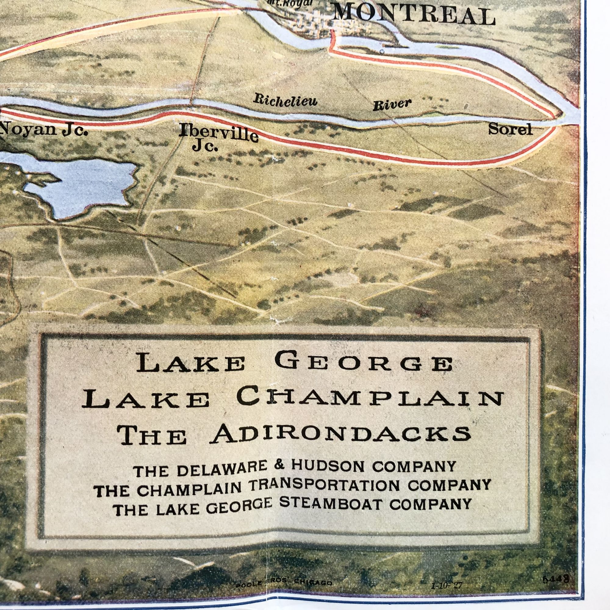
A beautiful 1927 Pictorial map, originally given a way to tourists in the Lake George & Champlain region of New York, promoting steamboat tours up and down the lakes during the leisure boom of the early 20th century.
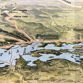
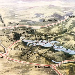
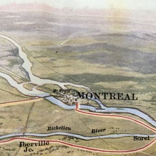
This map features such iconic landmarks such as Roger's Rock, Fort Ticonderoga, Mt. Defiance, the ruins of Forts William Henry & George, before the Ft. William Henry reconstruction, as well as natural landmarks such as Mt. Marcy, Saranac Lake, and both the Mohawk and St. Lawrence Rivers.
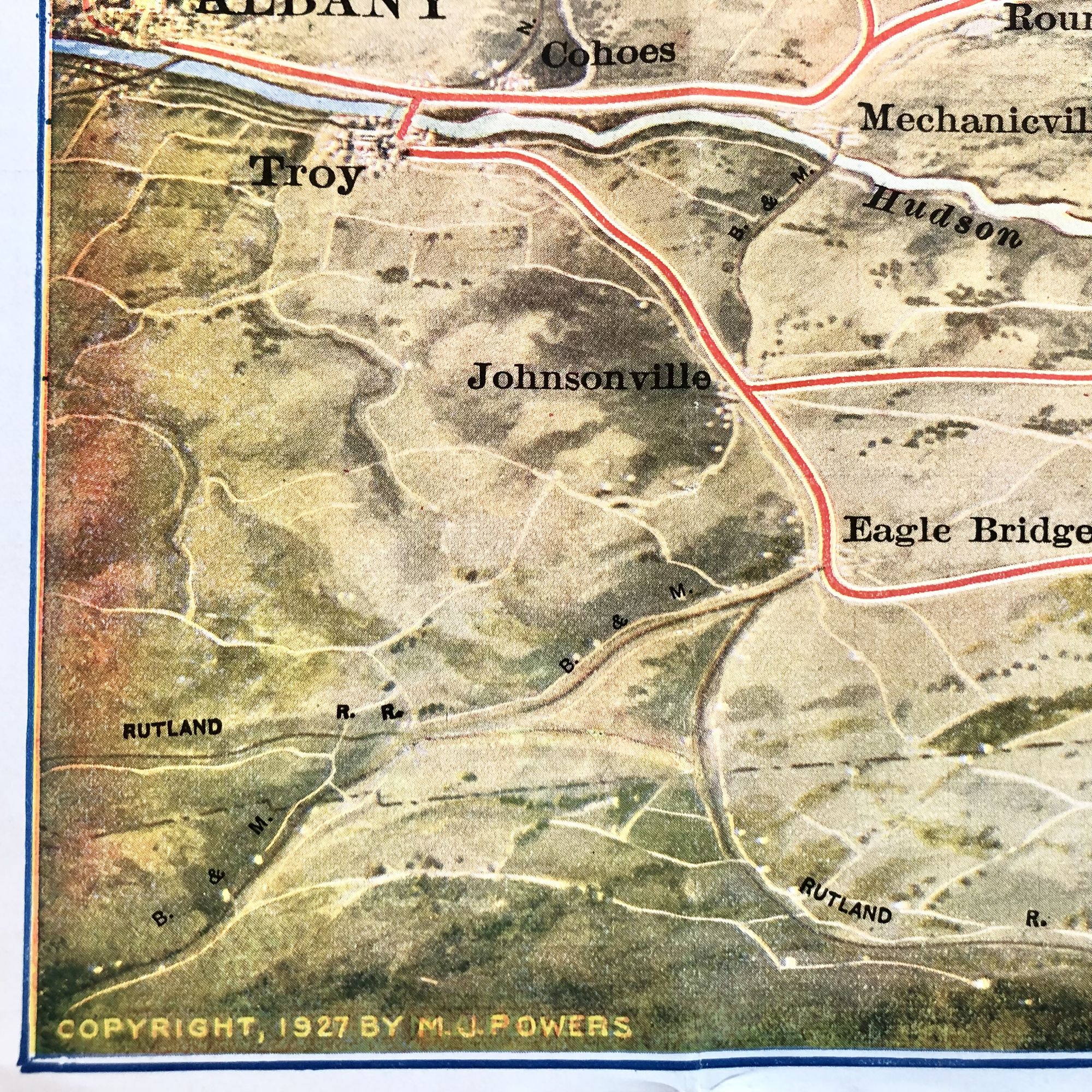
Important towns represented include Montreal, Ottawa, Plattsburgh, Albany, Schenectady, Troy and many more.
This map has its original fold lines. Two small closed tears at creases with tape repair to verso. Measures 32 1/2" X 18 1/2" and is PERFECT for framing and display!
Sold