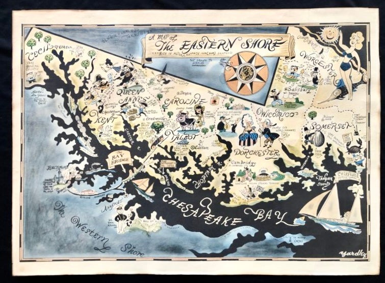
c. 1950s Richard Yardley Pictorial Map of the Eastern Shore of Maryland
Baltimore, Md: Baltimore Sun, c.1952. Yardley, Richard. First Edition. Folio. Very Good. Item #16113
Large c. 1950s Pictorial Map of Maryland's Eastern Shore by famed illustrator Richard Yardley, including the extremely rare original shipping tube.
This beautiful map depicts iconic landmarks such as the Chesapeake Bay, the Naval Academy in Annapolis, Oxford (the Shore's oldest town), Ocean City and the Shore's oldest settlement on Kent Island. This map was originally sent to select Baltimore Sun subscribers via the USPS in a shipping tube. This map includes the rare original shipping tube.
Yardley was born in Baltimore in 1903 and spent most of his career as an editorial cartoonist for the Baltimore Sun papers, both morning and evening. He also was a prolific book illustrator and had his work published in the New Yorker and the Reporter.
His work is highly sought after in the mid-Atlantic region and this is one his more scarce maps. Thick paper stock, lightly tanned.
This piece shows mild wear, including a few wrinkles along the right margin.
Measures 32" X 23" and is perfect for framing and display!
Sold