![Item #16115 A Historical Map of the Lake Champlain Tour along the Warpath of the [Iroquois] Nations. Promoting the Lake Champlain/Lake George Tourism during the 1939 World's Fair.](https://vintagebooksmd.cdn.bibliopolis.com/pictures/16115.jpeg?width=768&height=1000&fit=bounds&auto=webp&v=1680192155)
![A Historical Map of the Lake Champlain Tour along the Warpath of the [Iroquois] Nations.](https://vintagebooksmd.cdn.bibliopolis.com/pictures/16115_2.jpeg?auto=webp&v=1680192155)
![A Historical Map of the Lake Champlain Tour along the Warpath of the [Iroquois] Nations.](https://vintagebooksmd.cdn.bibliopolis.com/pictures/16115_3.jpeg?auto=webp&v=1680192155)
![A Historical Map of the Lake Champlain Tour along the Warpath of the [Iroquois] Nations.](https://vintagebooksmd.cdn.bibliopolis.com/pictures/16115_4.jpeg?auto=webp&v=1680192155)
![A Historical Map of the Lake Champlain Tour along the Warpath of the [Iroquois] Nations.](https://vintagebooksmd.cdn.bibliopolis.com/pictures/16115_5.jpeg?auto=webp&v=1680192155)
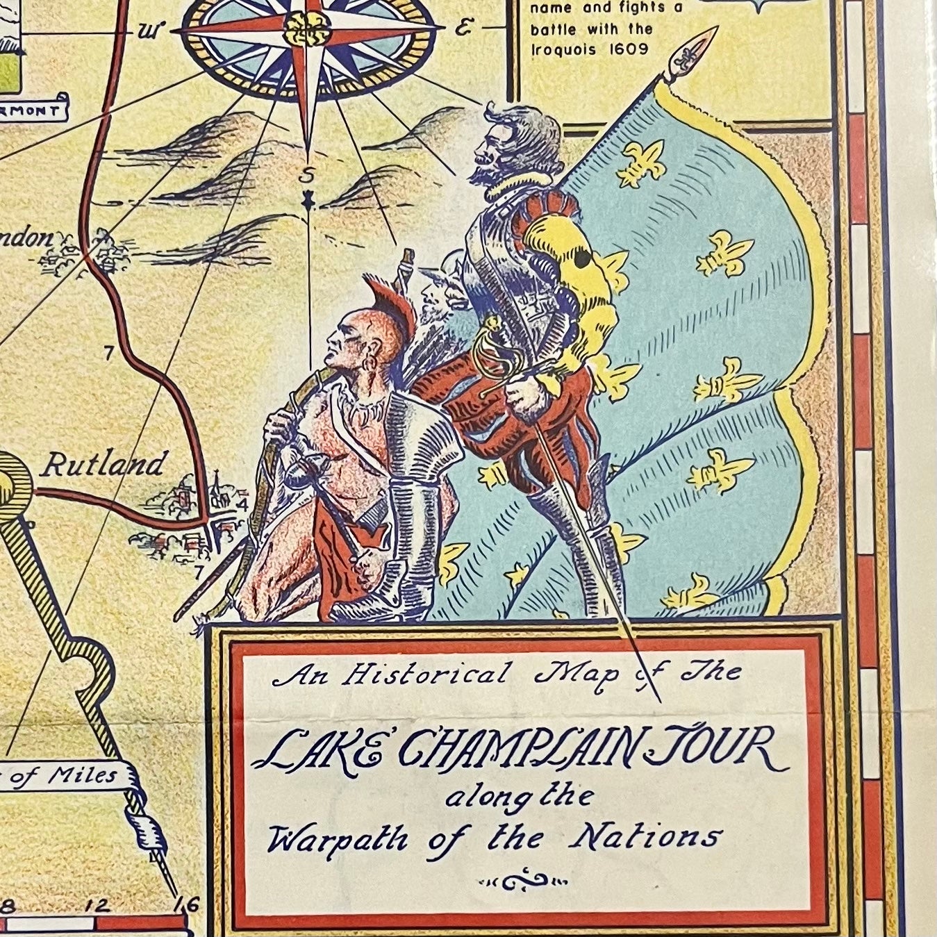
A Historical Map of the Lake Champlain Tour along the Warpath of the [Iroquois] Nations.
Lake Champlain Bridge Commission, 1939. Very Good. Item #16115
An attractive 1939 Pictorial map of the Lake Champlain/Lake George, NY region designed to funnel motorists through two routes in particular during the 1939 World's Fair.
Colorful map drawn by H.C. Larter surrounded by many vignettes of important historic events such as the 1755 Battle of Lake George, the 1814 Battle of Plattsburgh, the 1814 Battle of Lake Champlain, the 1776 Battle of Valcour Island, and the 1775 Ethan Allen Raid which captured Fort Ticonderoga during the early days of the American Revolution.
Two bridges are highlighted Rouses Point Bridge and Lake Champlain Bridge.
This map has its original fold lines, measures 9" x 16". Perfect for framing and display!
Sold