
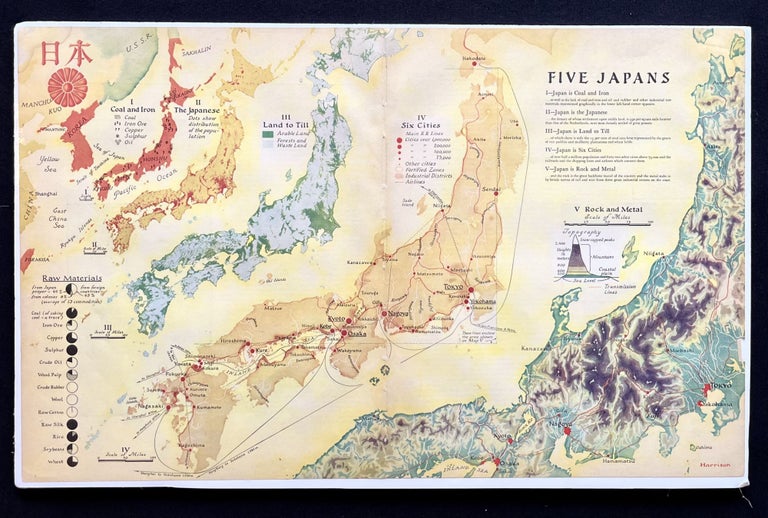


Five Japans - A 1936 Pictorial map of the Japanese Empire Shortly Before the Outbreak of WW II
New York: Fortune, 1936. 1st Edition. Quarto. Very Good. Item #18073
A vibrantly colorful 1936 pictorial map depicting the resources of the Japanese Empire shortly before the outbreak of WW II, by influential 20th-century cartographer Richard Edes Harrison.
The map features five types of Japanese resources, giving each category its own map, gradually getting larger as they move left to right.
I Japan is Coal and Iron
II Japan is the japanese
IIIJapan is Land to Till
IV japan is Six Cities
V Japan is Rock and Metal.
Harrison (1902-1994), a Baltimore native, redefined 20th-century cartography, adding flairs of artistic perspective, color and shading to produce maps which were not only beautiful, but much more accessible to the average person. He teamed up with Fortune Magazine in the 1930s and together they produced some of the most striking illustration of the Great Depression and WW II eras.
Vibrantly colored, this historic piece maintains its original fold line down the center and measures approximately 14" X 22".
Perfect for framing and display!
Sold