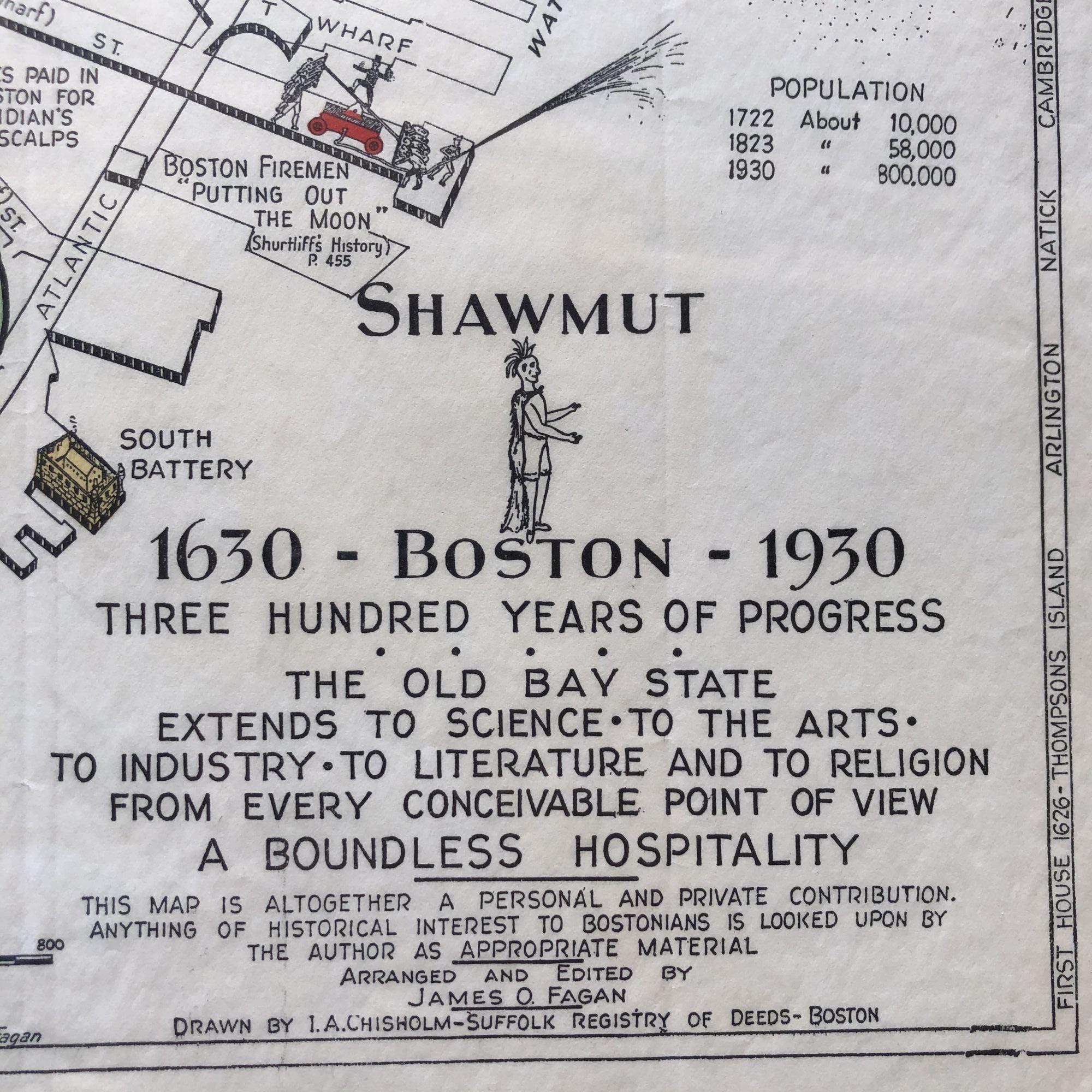
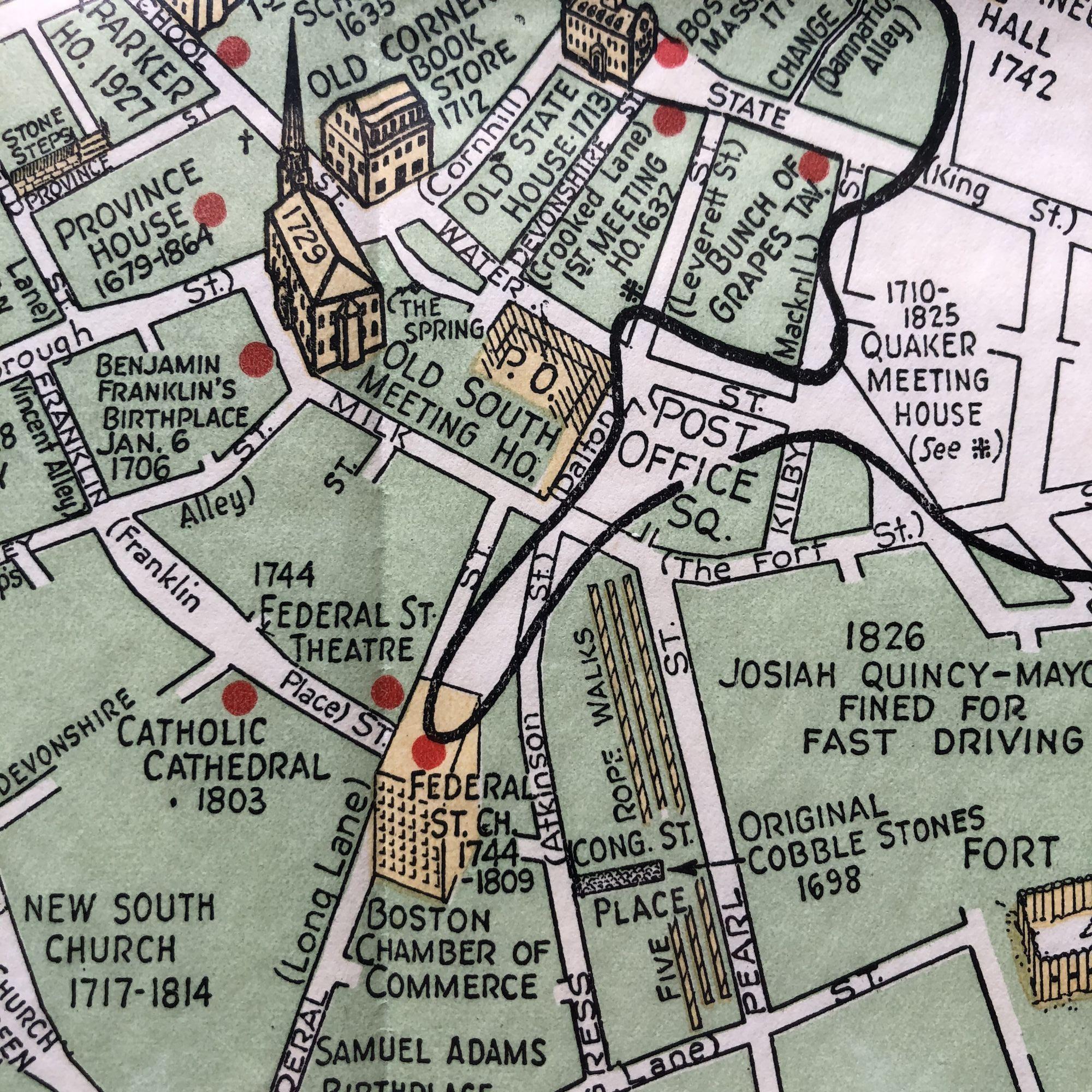
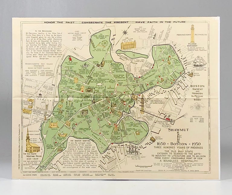
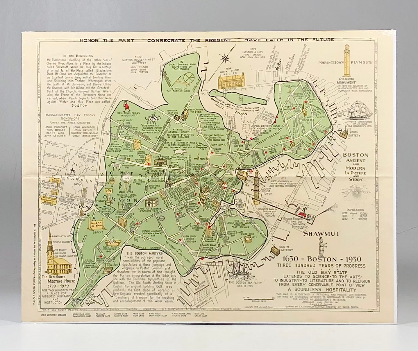
1928 Illustrated Pictorial Map of Boston Massachusetts, published for the Boston Tricentennial
Boston: James O Fagan, 1928. I.A. Chisolm. First Edition. Fine. Item #900073
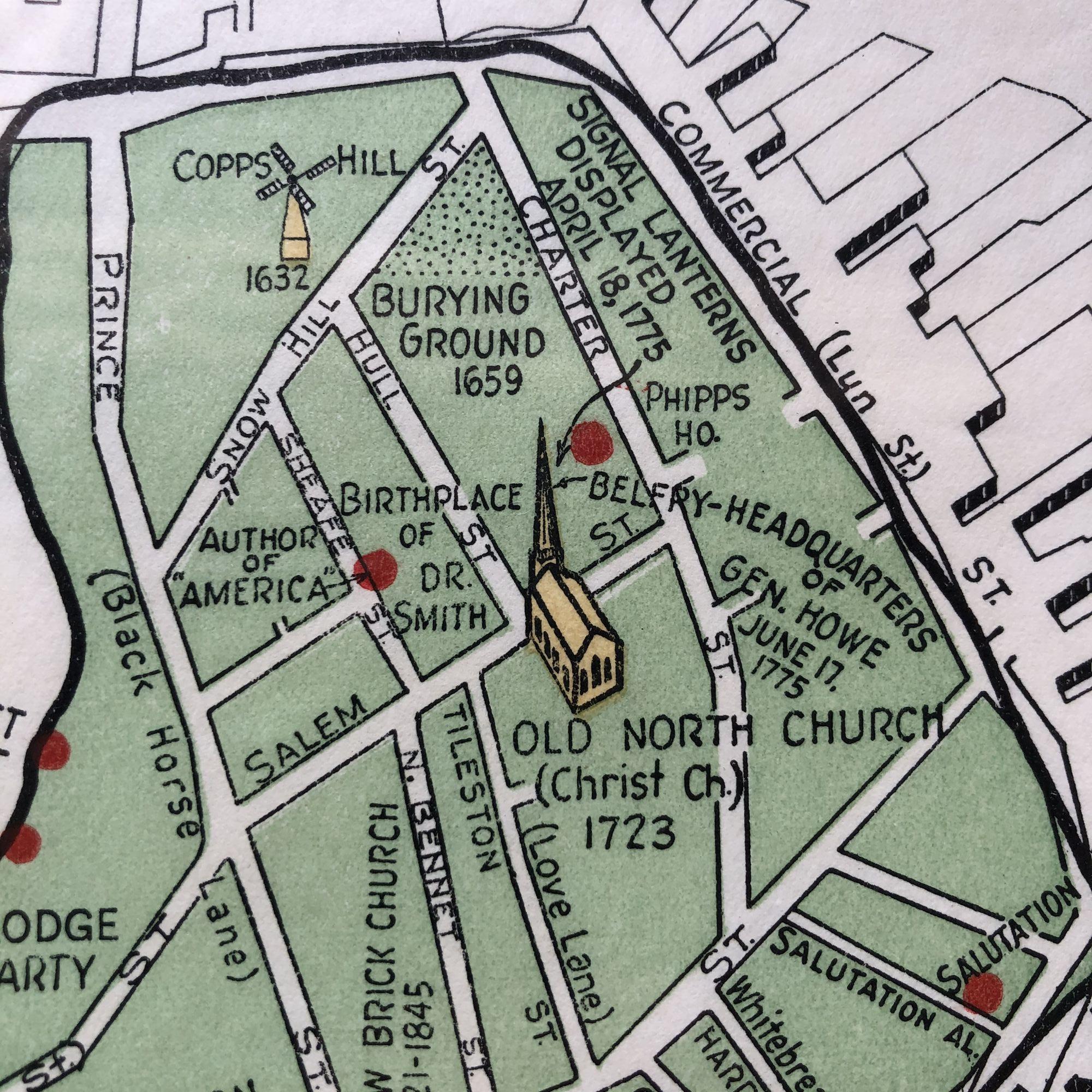
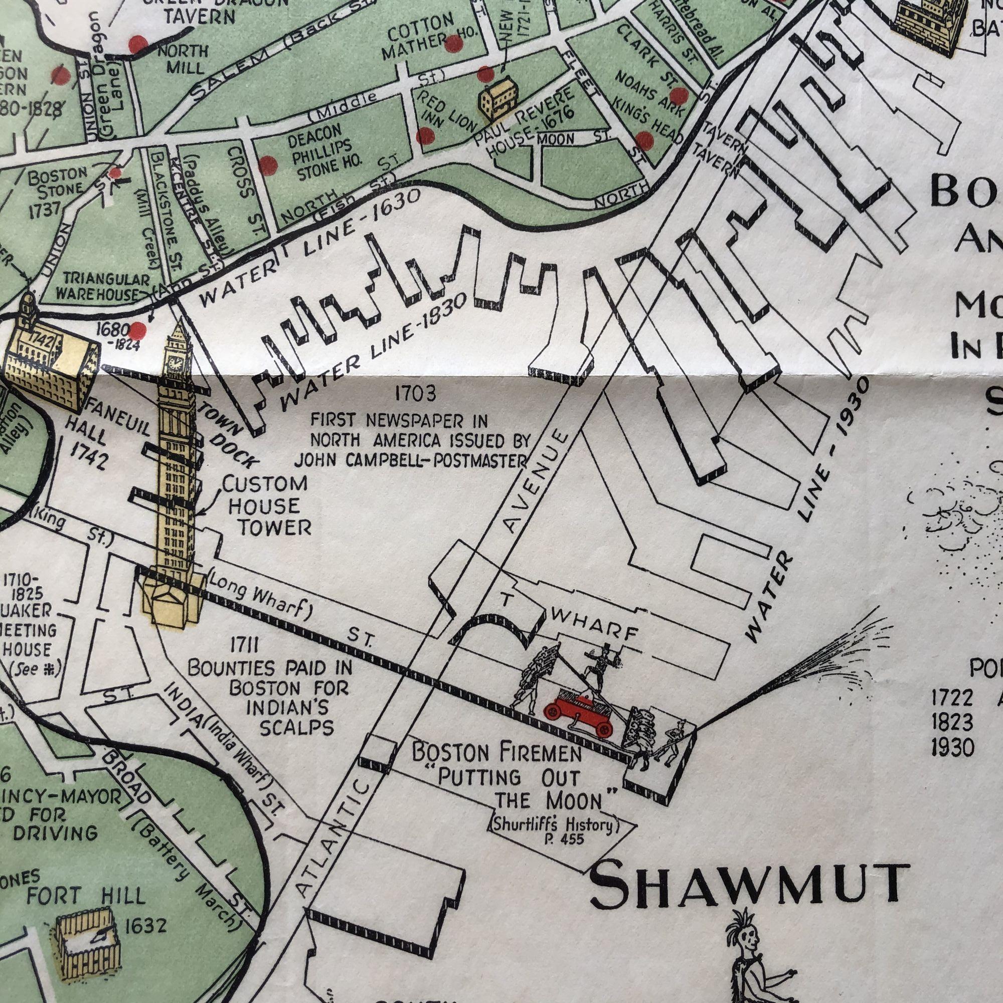
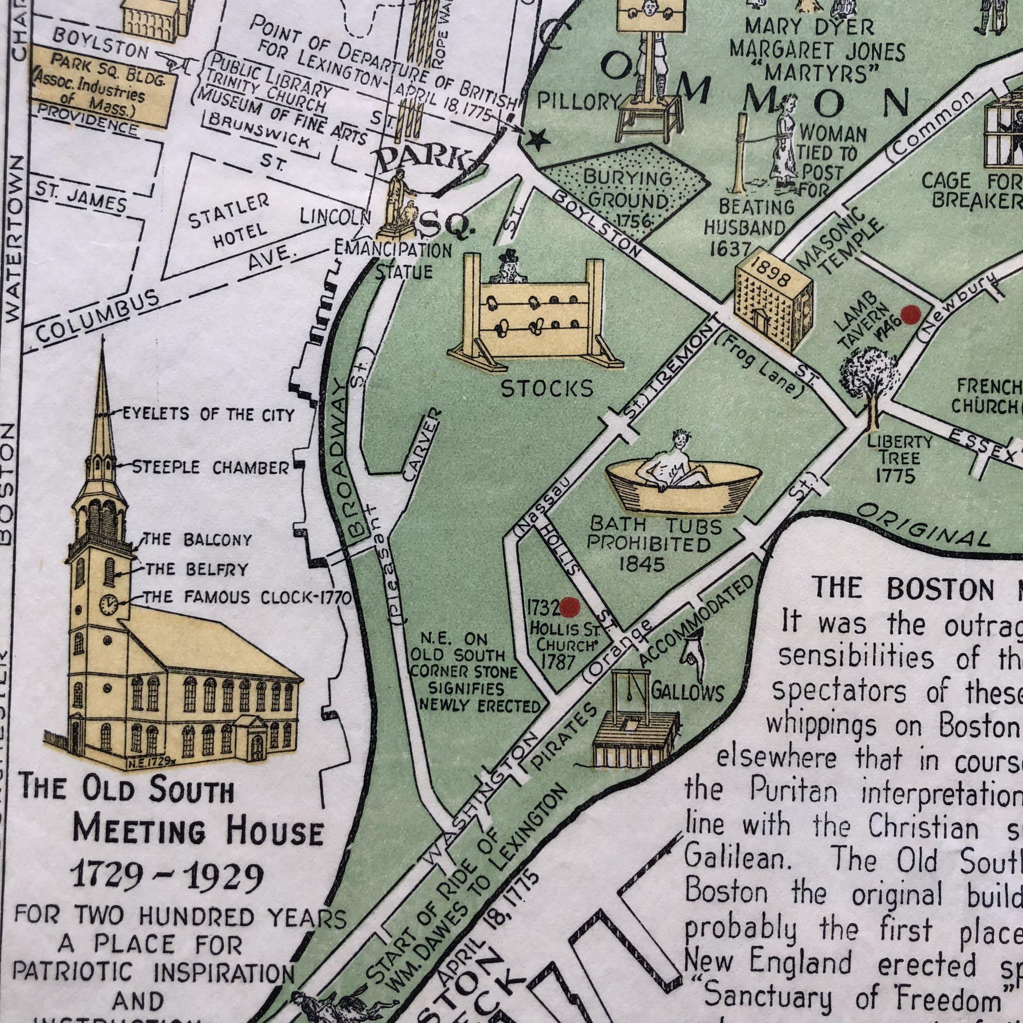
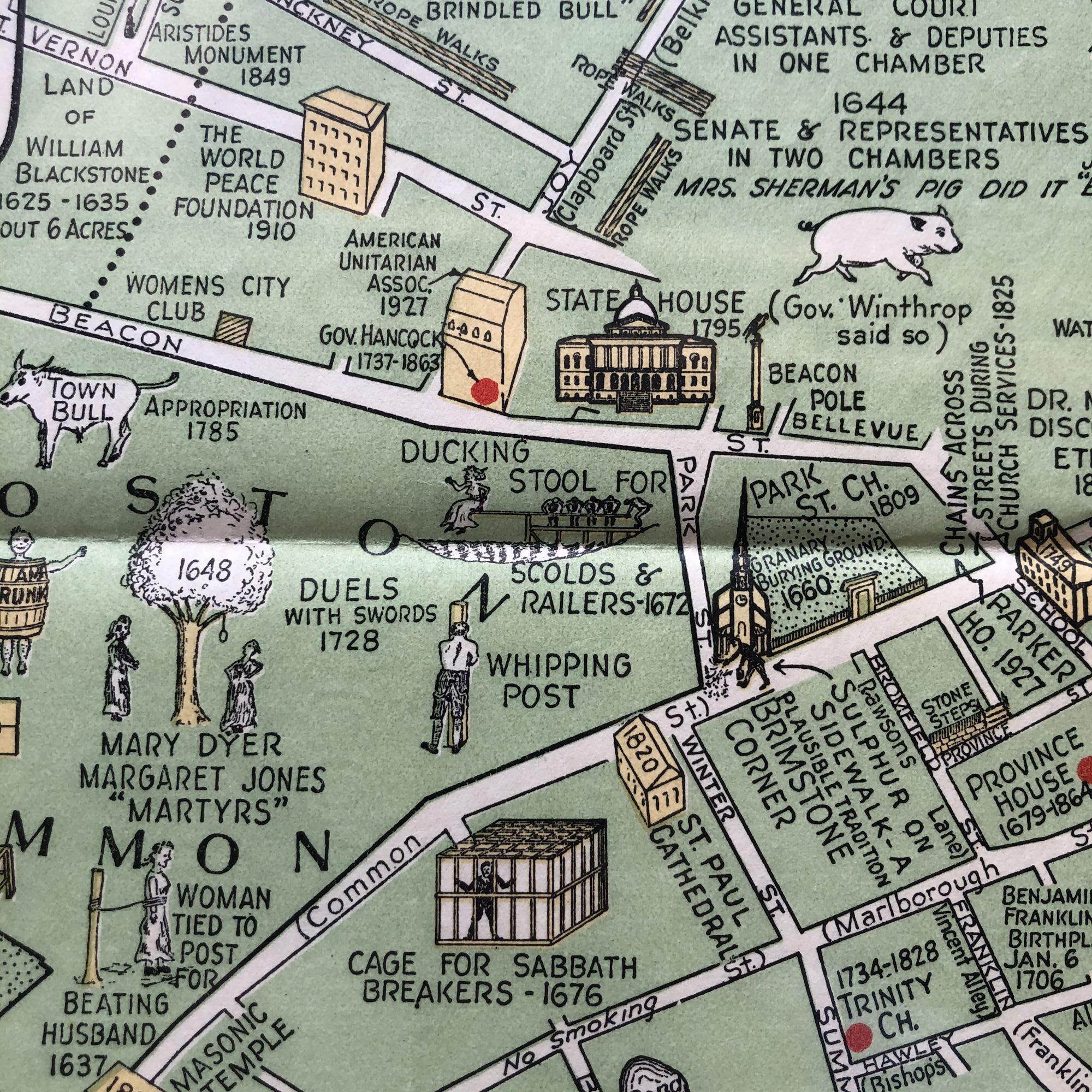
Gorgeous original 1928 Illustrated PICTORIAL MAP of BOSTON, Massachusetts by I.A. Chisolm and James O. FAGAN, published for the Boston Tricentennial in 1930.
This map features iconic landmarks such as Faneuil Hall, the Old South Meeting House, the Old North Church and many, many more.
The colored portion of the map, representing the Boston Neck of colonial days, is overlayed on the city's shoreline as it was in 1928, a drastic change from the 18th century.
This map measures 22" X 17" and is perfect for framing and display!
Price: $275.00
See all items by Shawmut: Boston, Three Hundred Years of Progess