1927 Hand-Embellished Illustrated Pictorial Map of the Finger Lakes of New York
Geneva, New York: Handiwrap Cardmakers of Geneva, 1927. Brew, Laura Aurora Hosmer. 1st Edition. Very Good. Item #900134
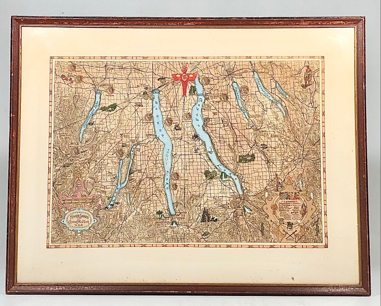
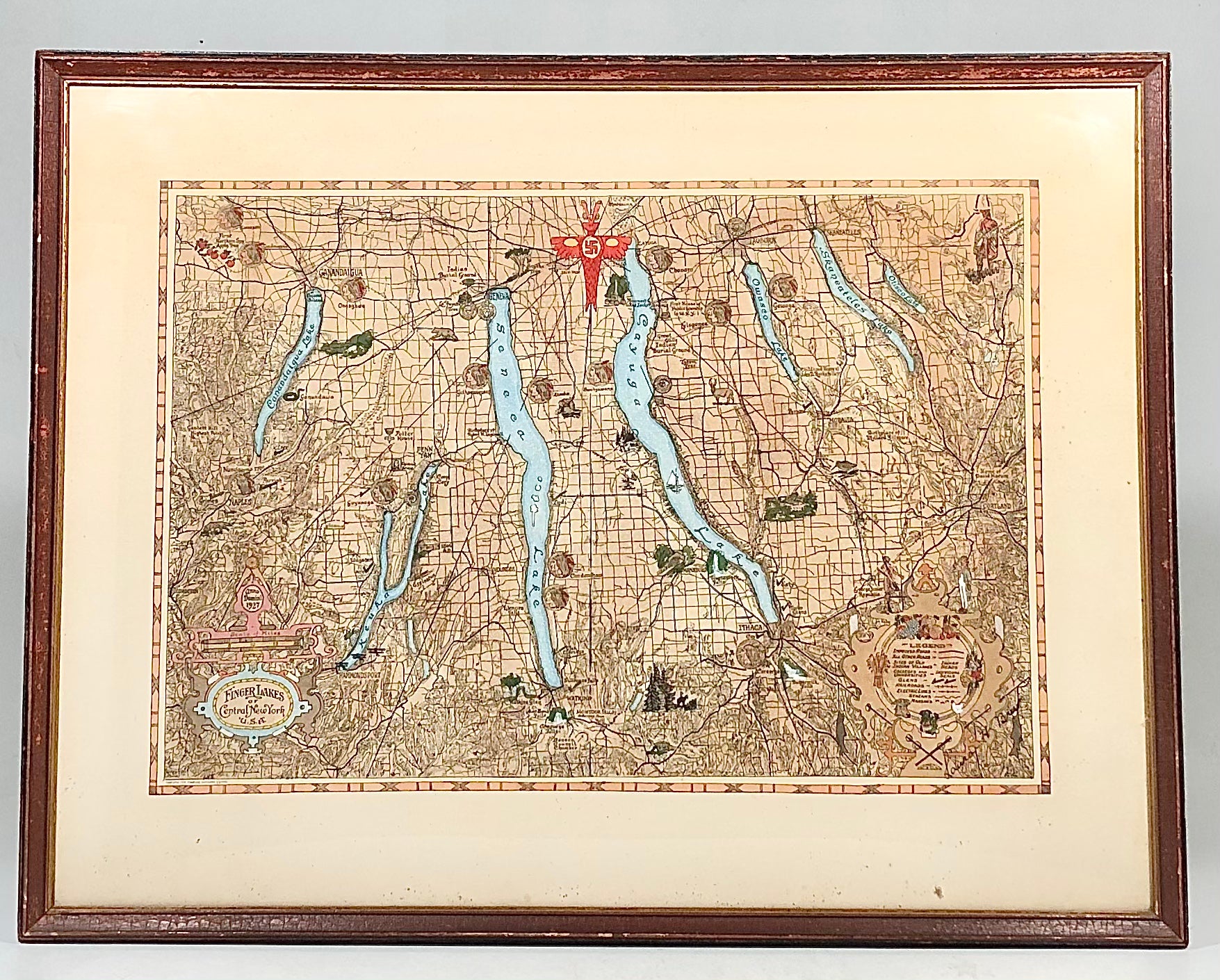
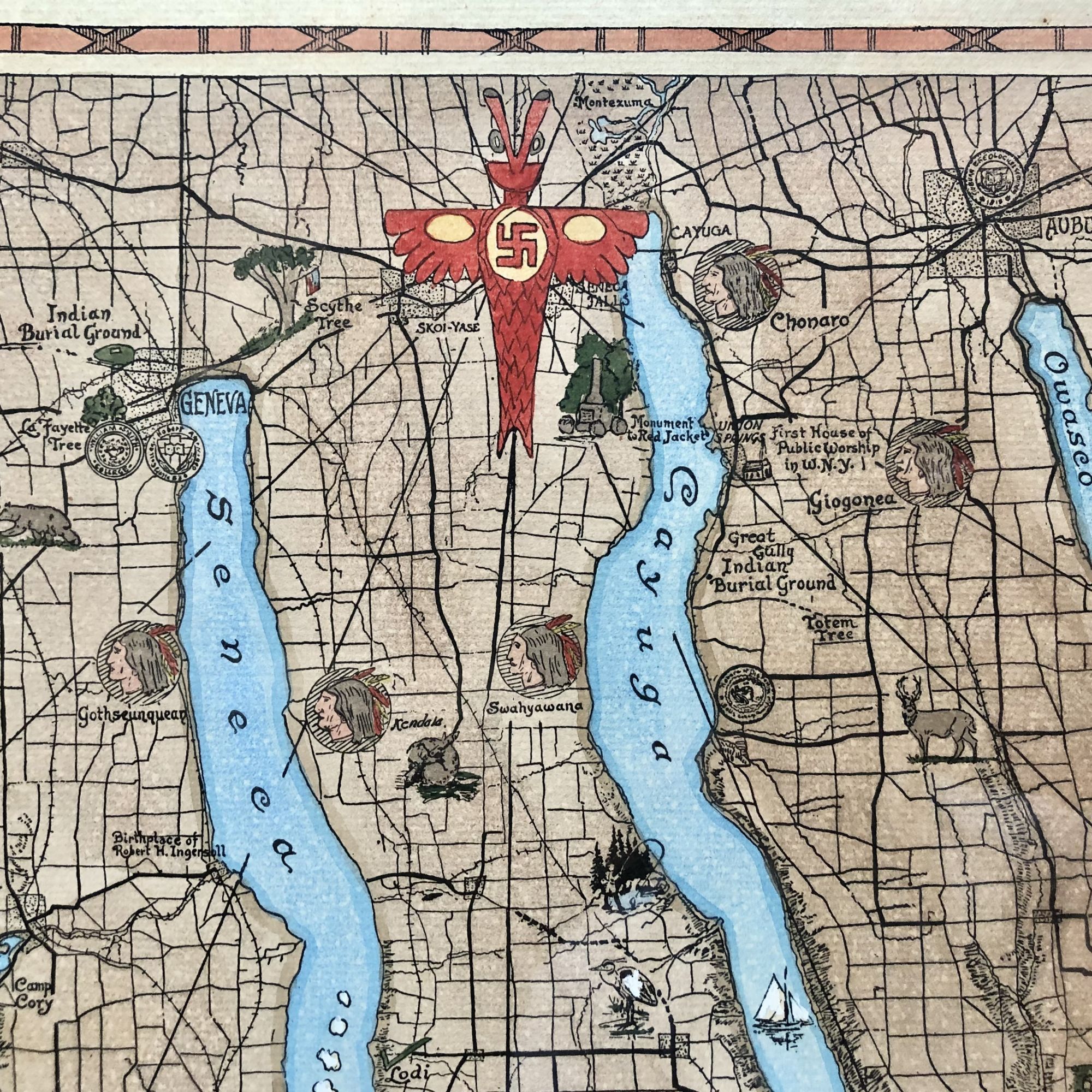
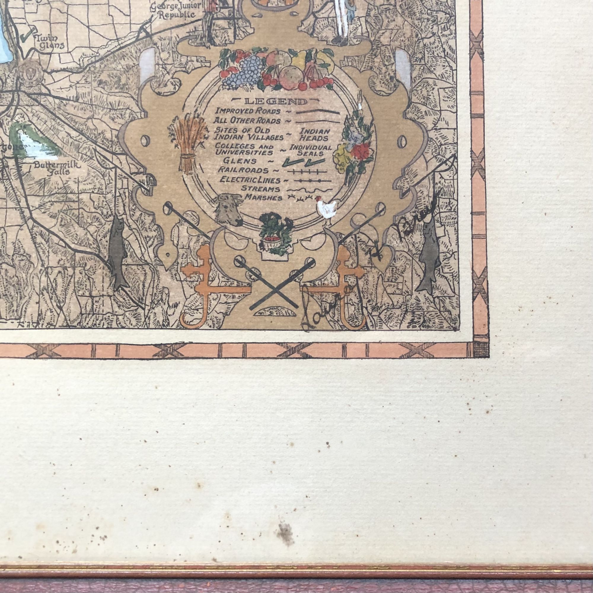
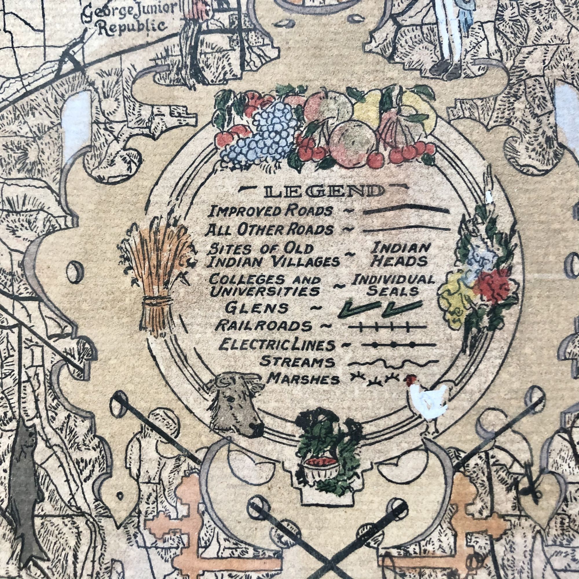
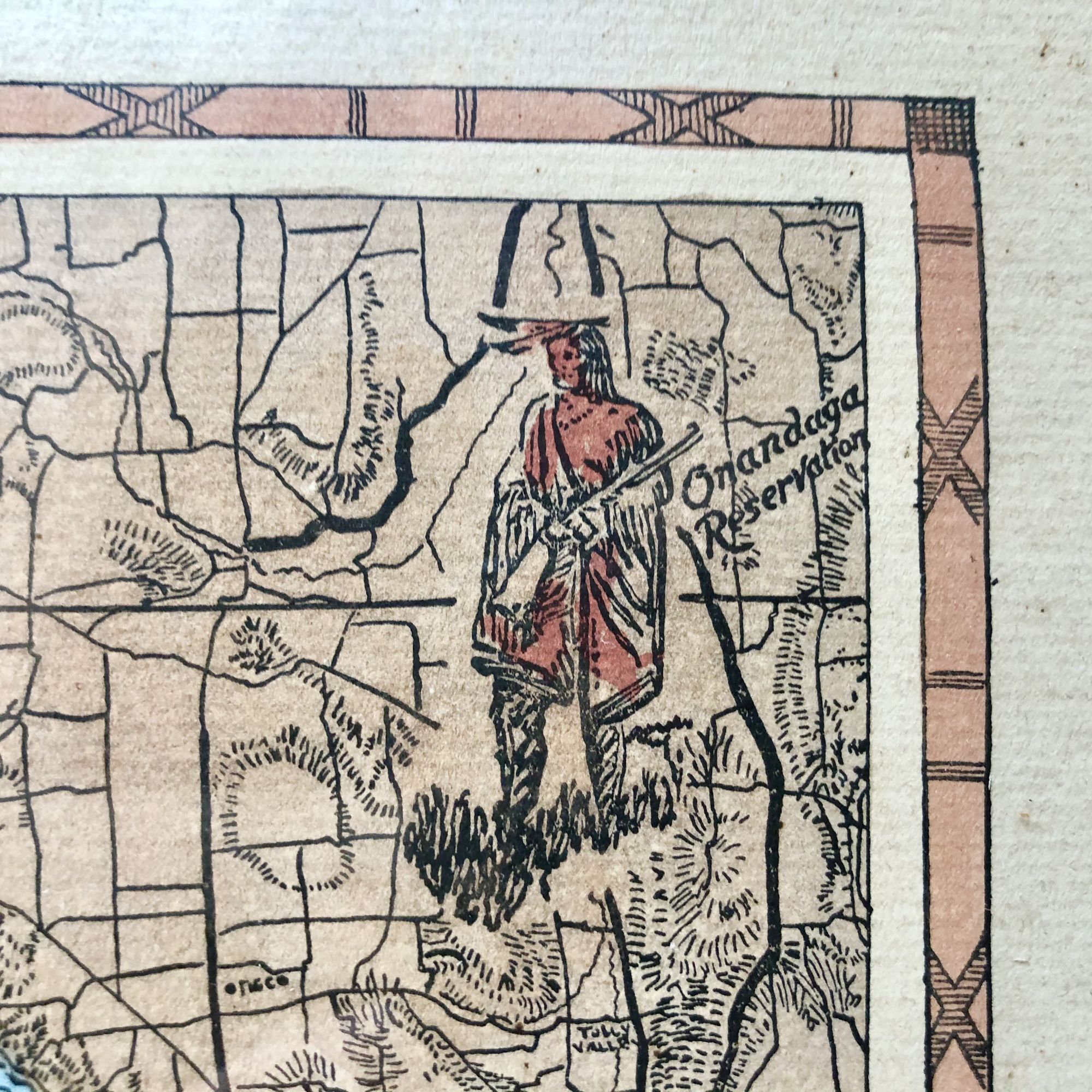
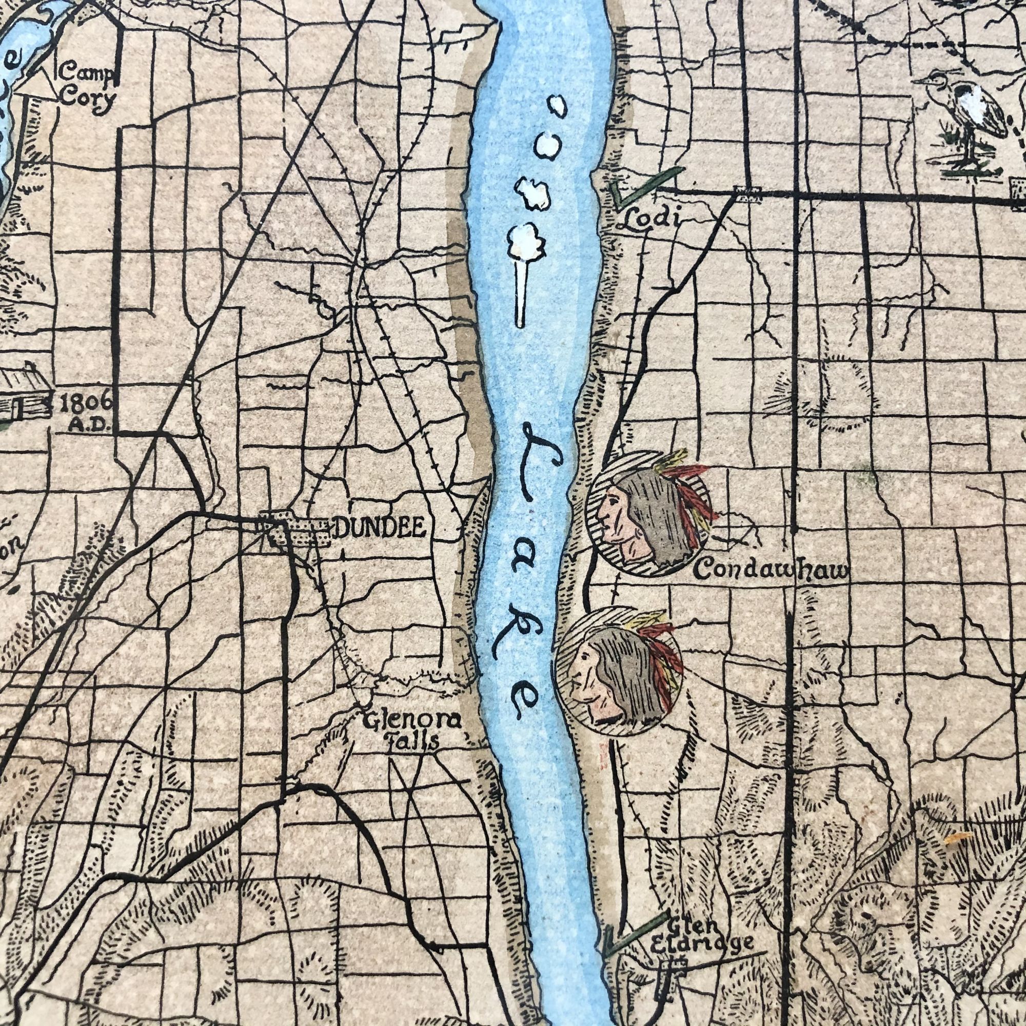
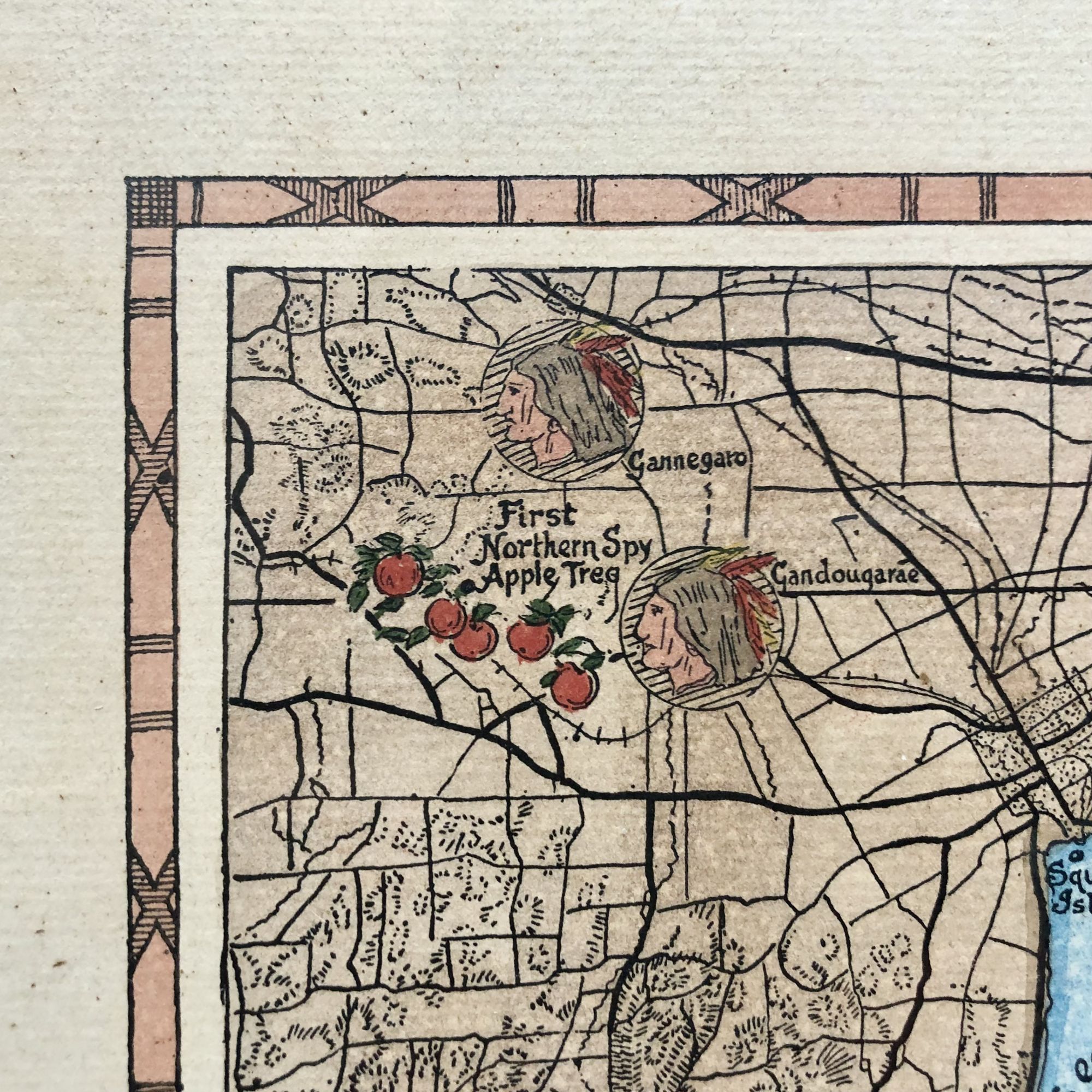
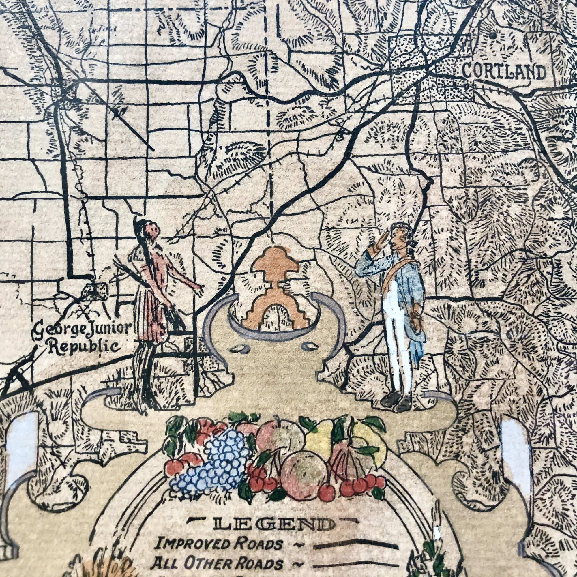
A spectacular and exceedingly rare 1927 pictorial map of the Finger Lakes region of New York State, depicting the ancient tribes and towns of the Iroquois Confederacy, the most powerful Indian nation on the North American Continent for hundreds of years until its ultimate eviction to Canada and the west after the Revolutionary War.
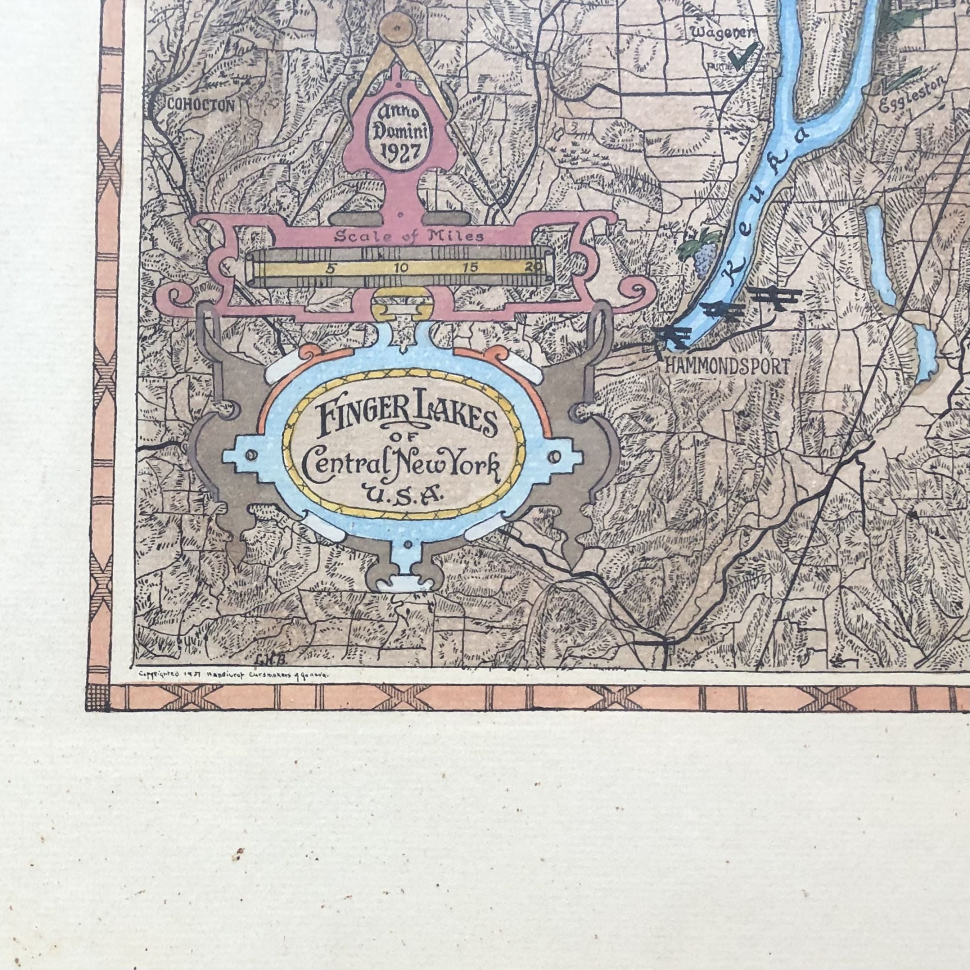
With original hand-embellished coloring by, and signature of, artist and cartographer Laura Aurora Hosmer Brew (1886-1976).
This map features natural landmarks, such as the lakes themselves as well as places like Sullivans Falls, Twin Glens, Gannett Hill, Montour Falls, Ancient Indian burial grounds.
Towns such as Ithaca, Watkins Glen, Hammondsport, Skaneateles, Naples and more are also featured.
Iroquois towns such as Gewaga, Giogonea, Guyanoga, Onnaghee and others are also depicted.
We could find no extant records of the existence of this map. OCLC, LOC and RBH locate no copies. Nor could we find any documented auction records.
The map is signed in the lower right corner by Brew.
Sporadic spotting around the white border of the map.
Framed, this map measures 26" X 20"
Sold