1879 Hand-Colored Map of Brockton Massachusetts w PROPERTY OWNER NAMES & Building Footprints
Boston, Ma: George H. Walker & Co., 1879. Very Good. Item #900250
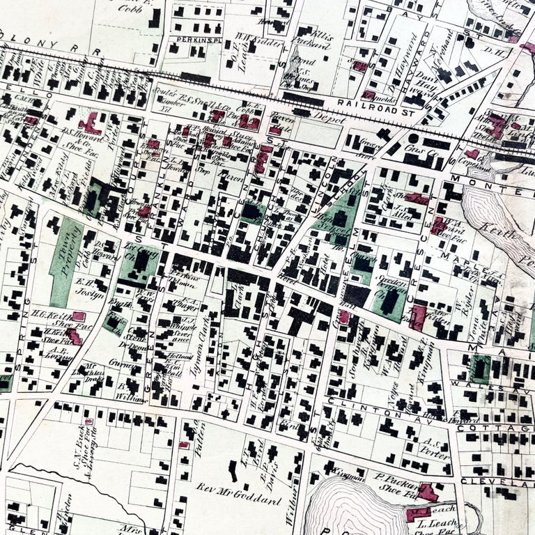
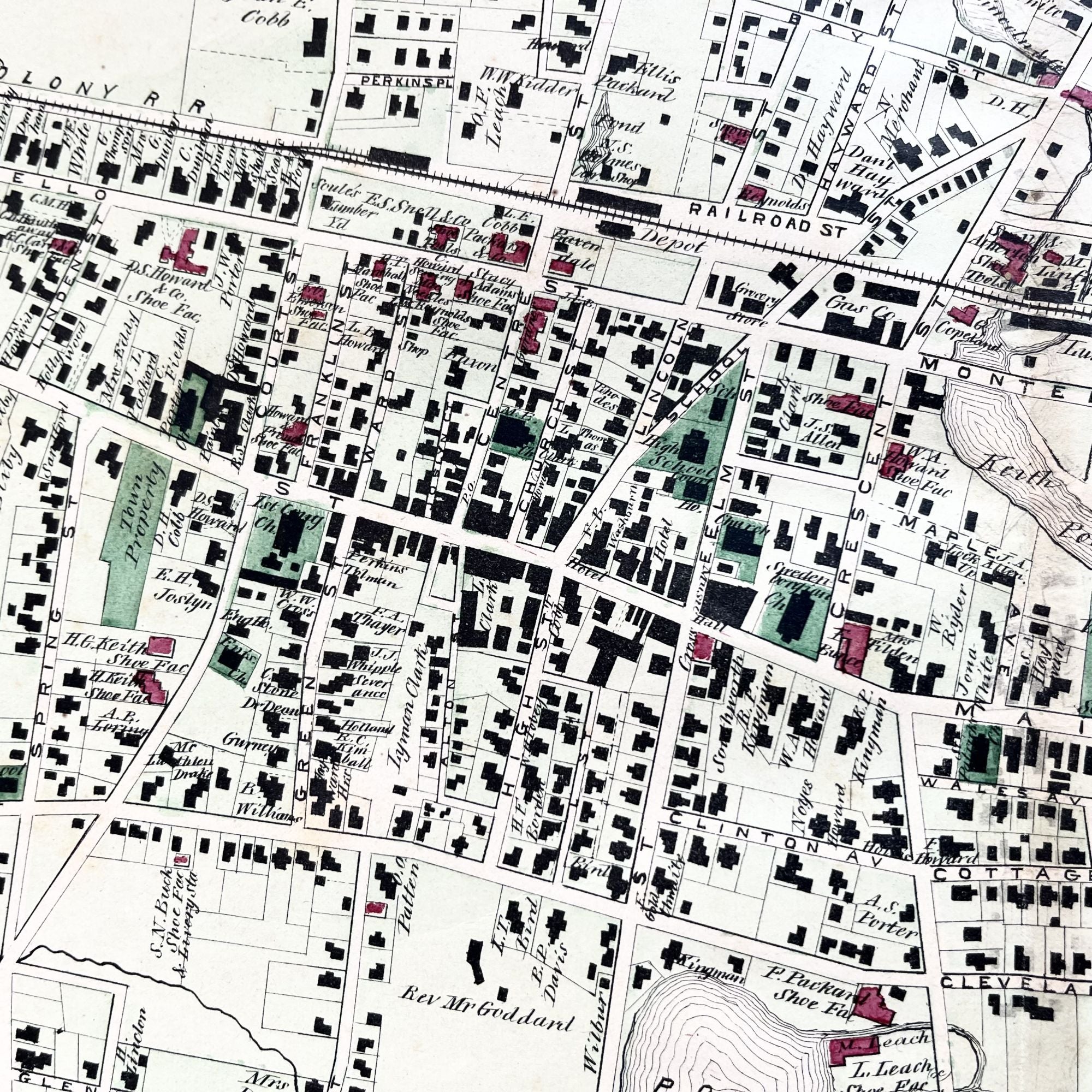
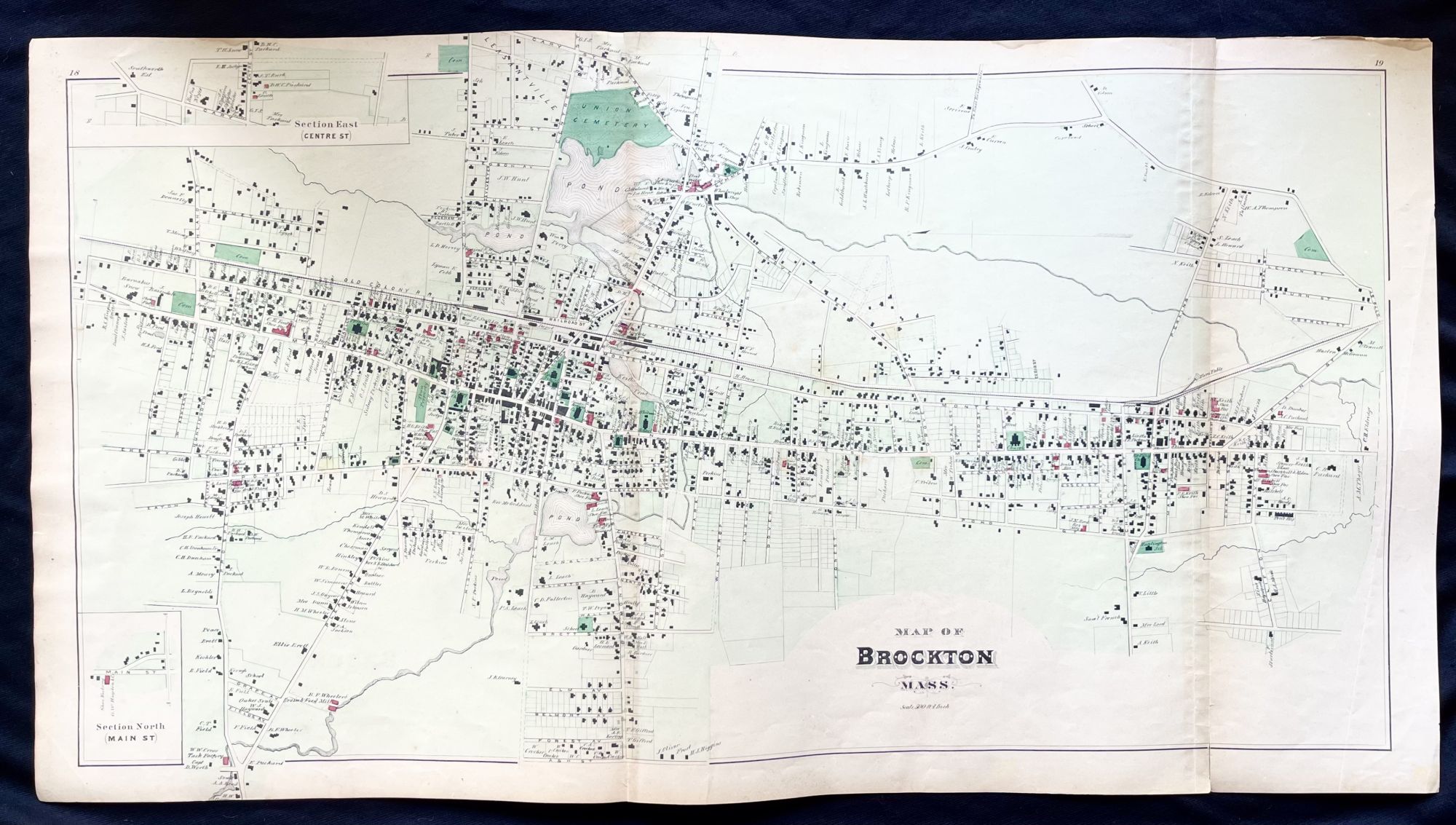
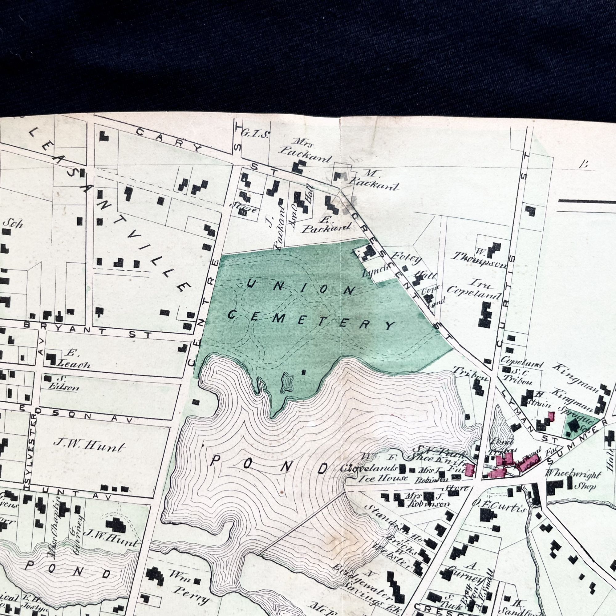
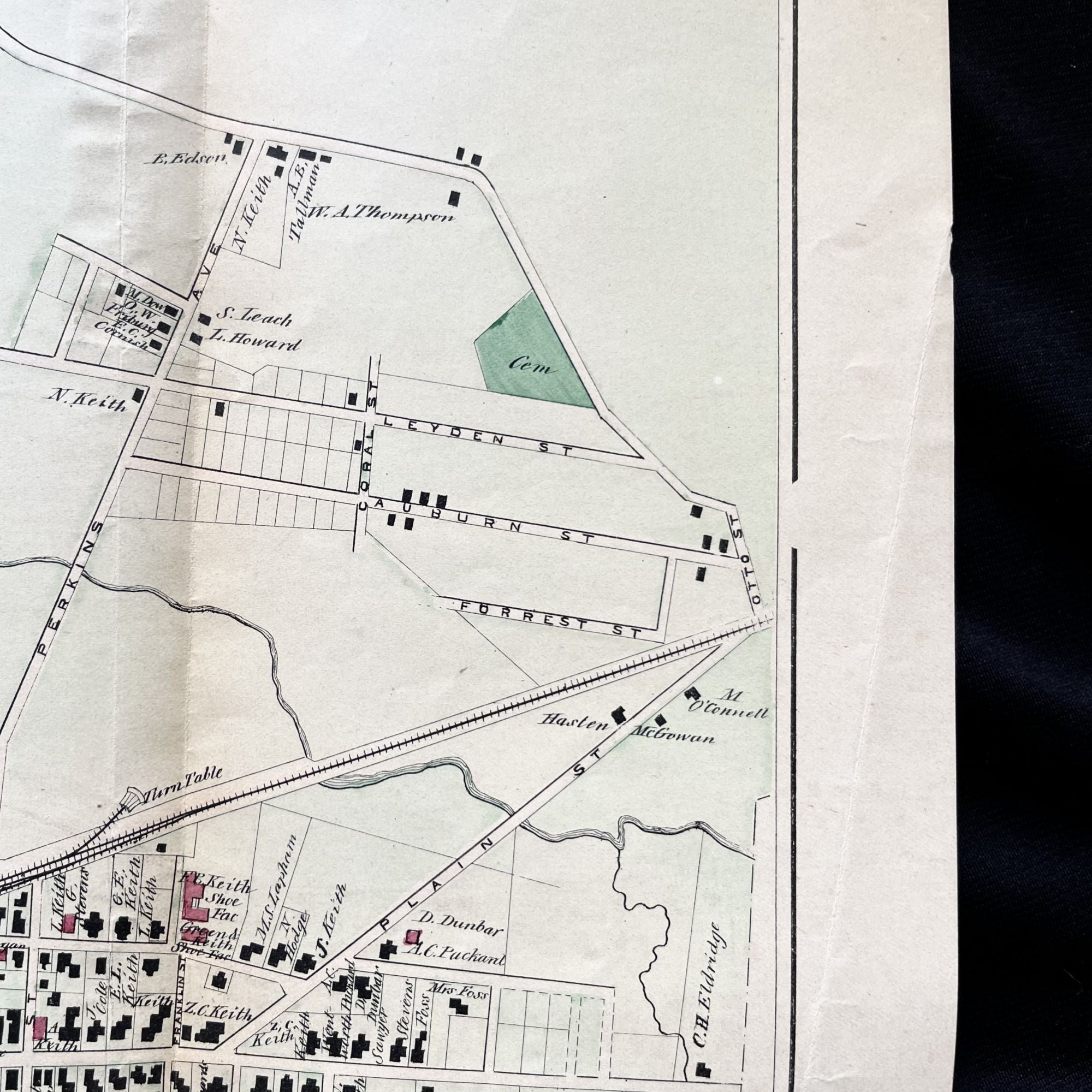
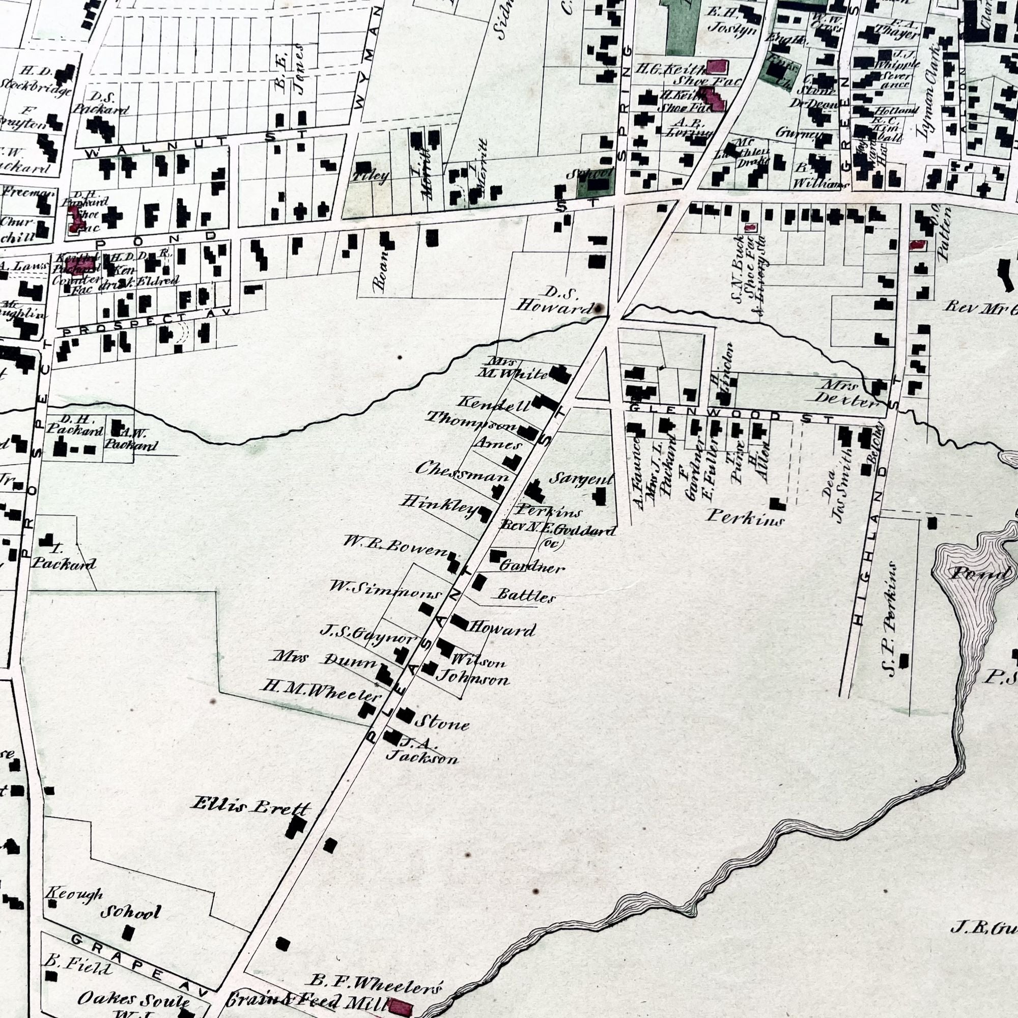
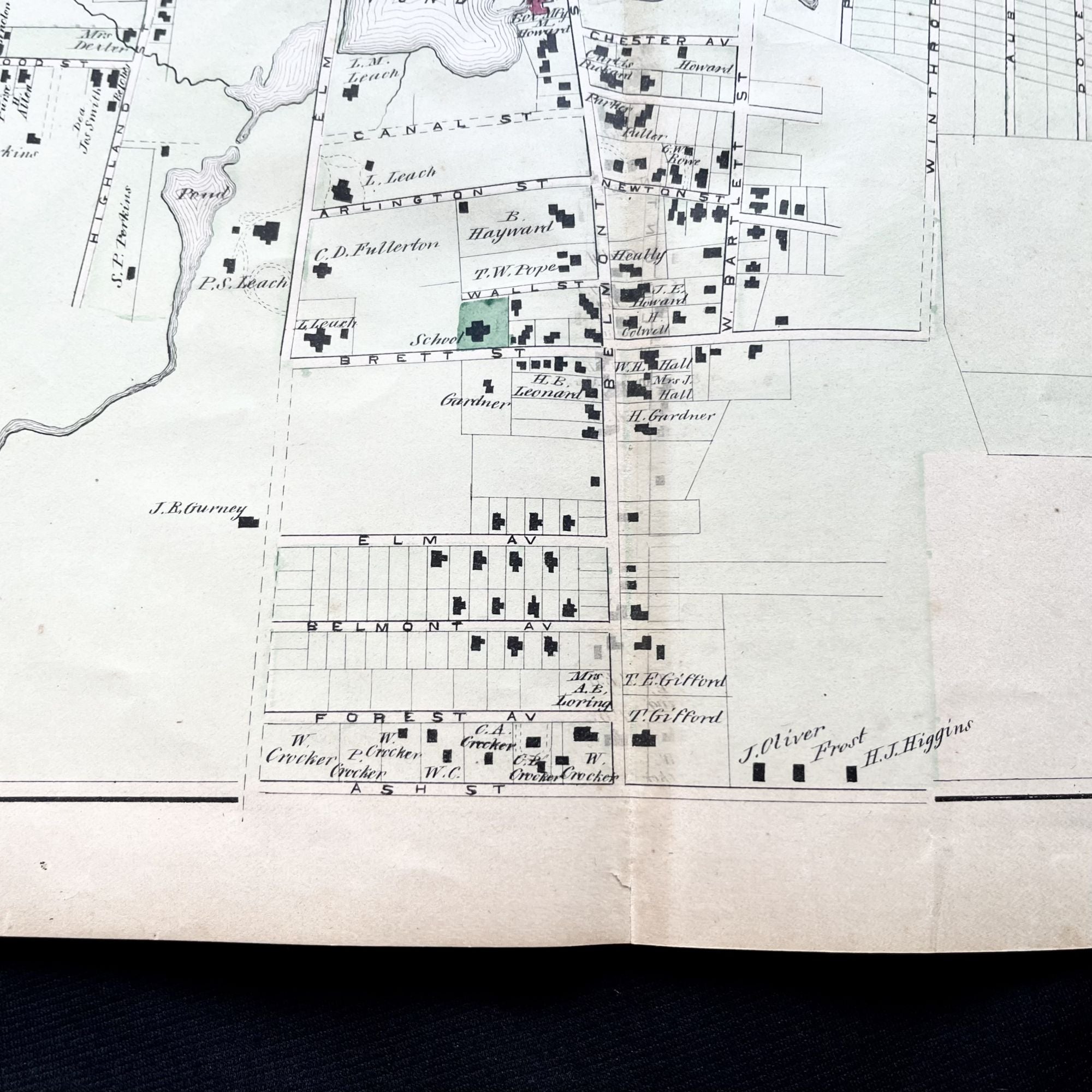
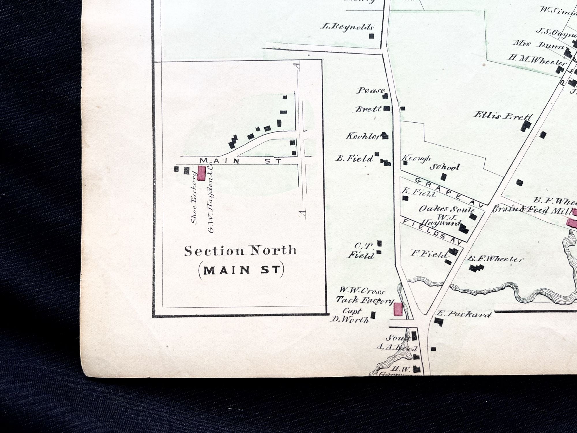
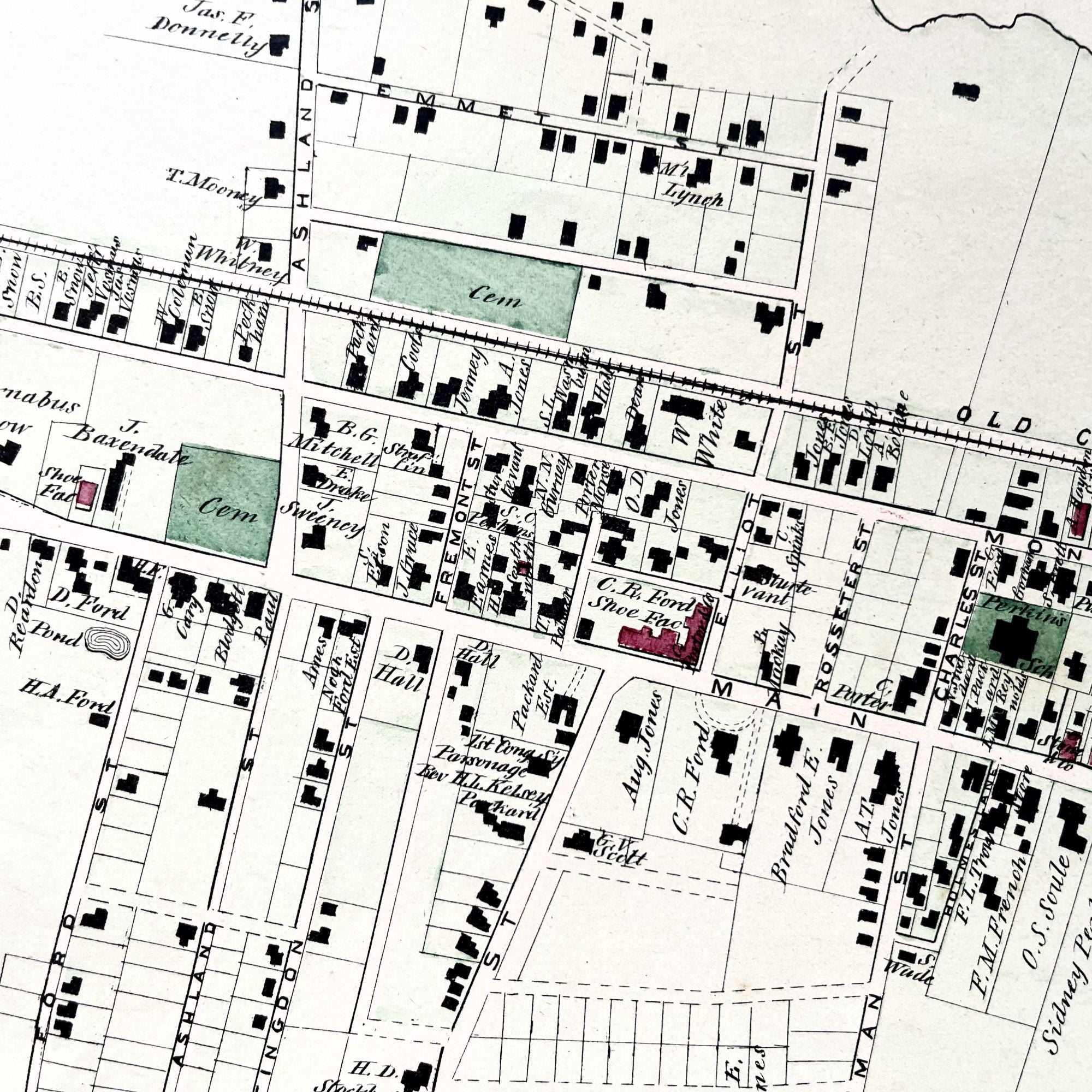
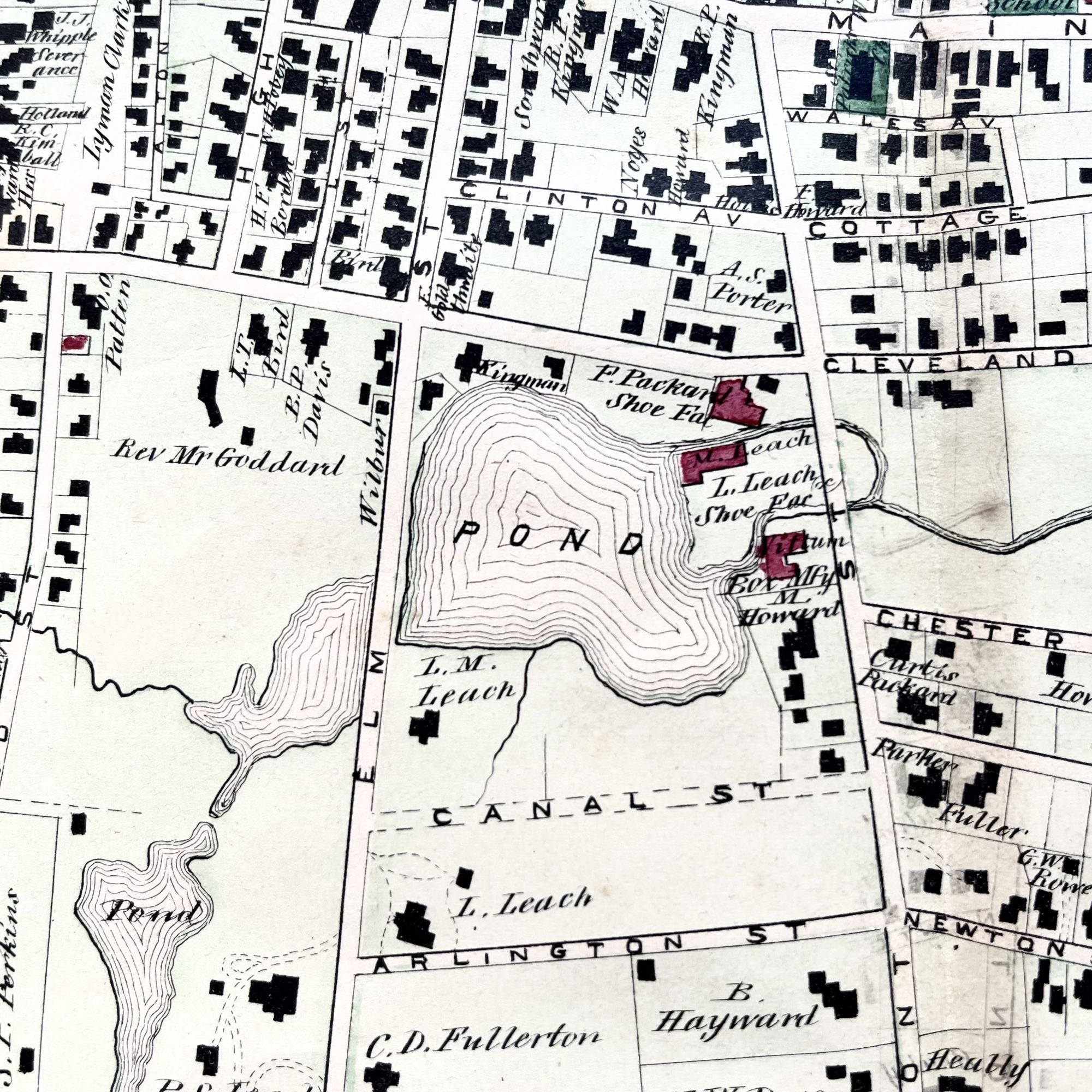
A Beautiful large folding original 1879 hand-colored map of Brockton, Massachusetts, in Plymouth County, showing property owner names at the time as well as 19th-century building footprints. This map features two sections of the town in vignette along the left side and also depicts the railroad line running the length of town.
Depicted are individual homes, schools, churches and local businesses, as well as local cemeteries and water sources. This historic map has two folds, making three complete sections.
In very good condition, there are small closed separations along the edges of the right fold, and mild age toning.
Measuring approximately 33" X 17 3/4", this map is PERFECT for framing and display!
#MB-172.
Price: $225.00