1879 Hand-Colored Street Map of Nantasket Beach Massachusetts w PROPERTY OWNER NAMES & Building Footprints
Boston, Ma: George H. Walker & Co., 1879. Very Good. Item #900256
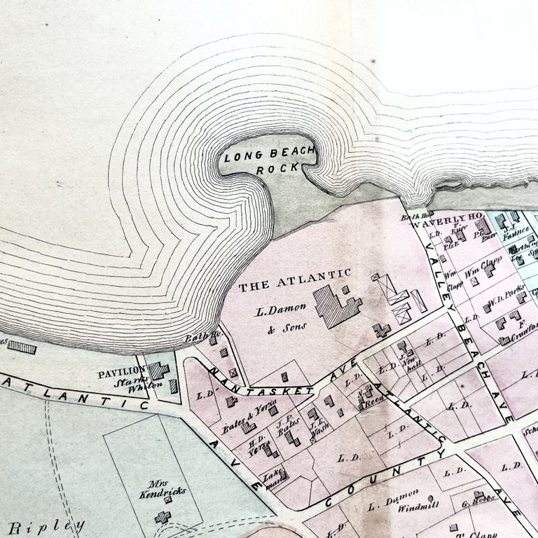
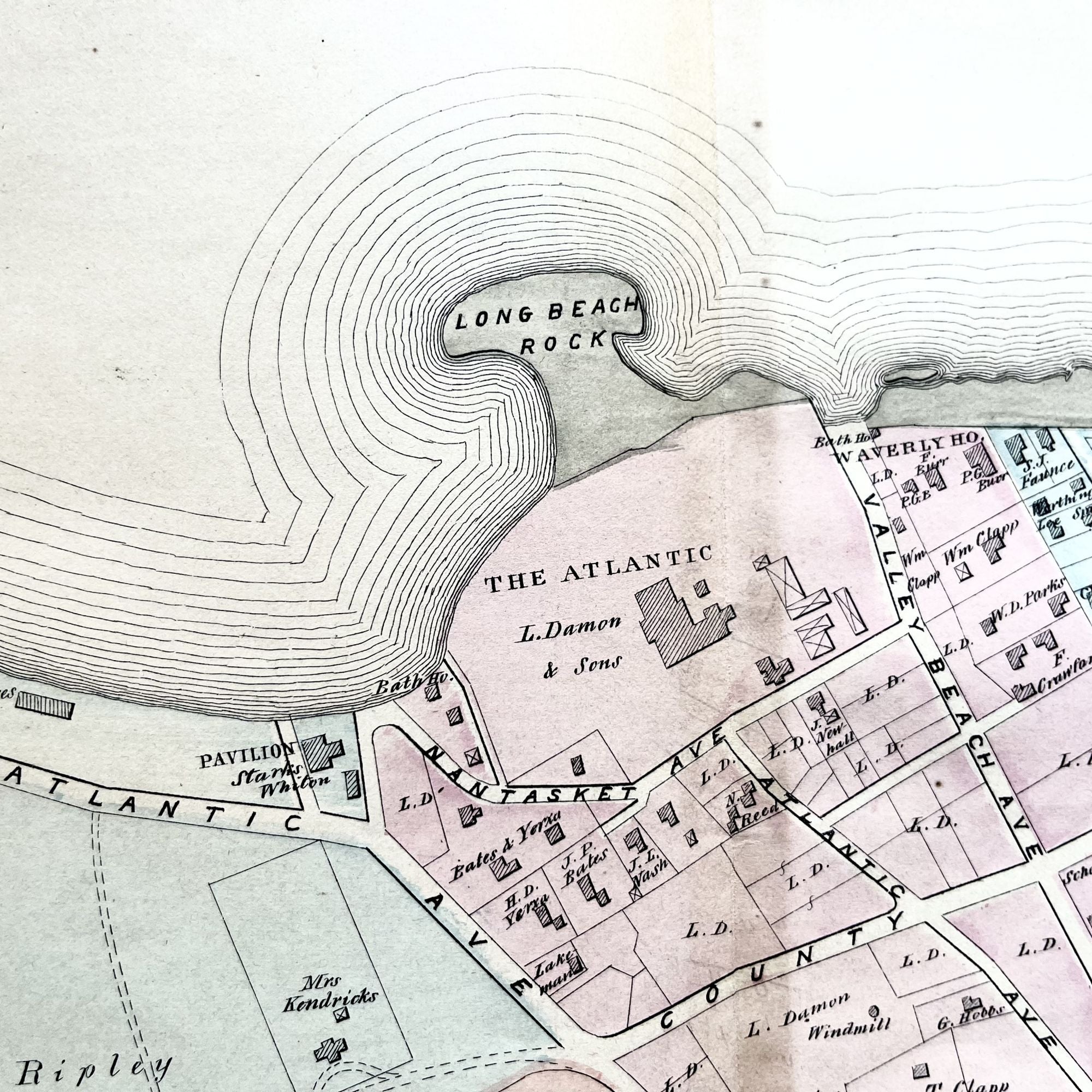
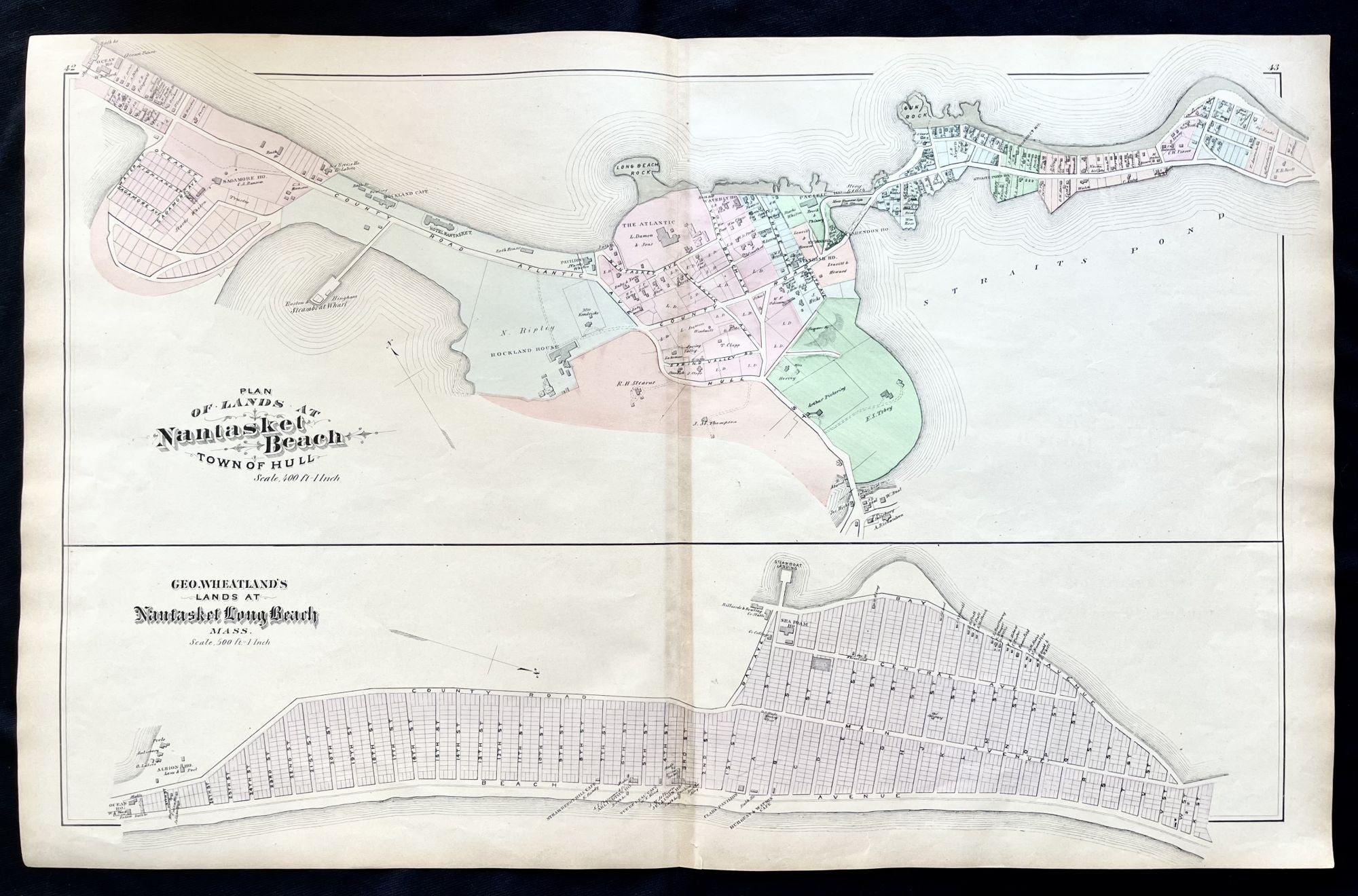
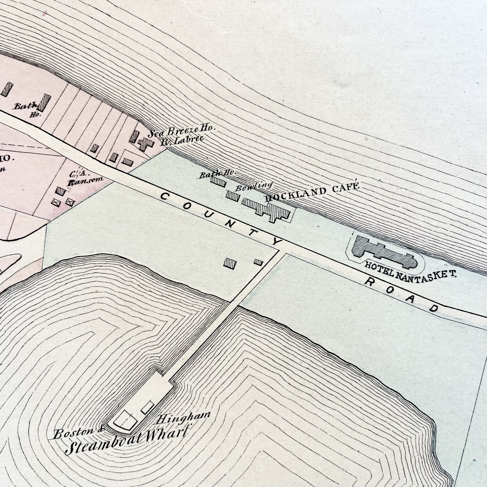
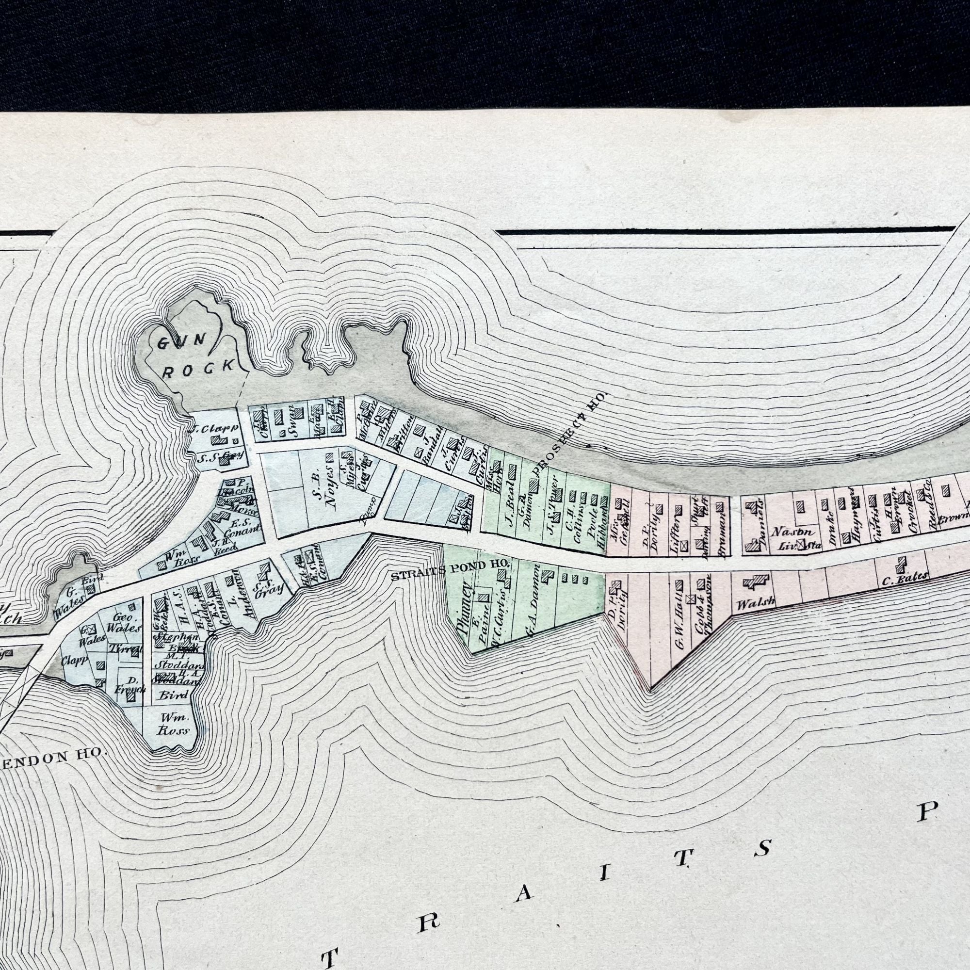
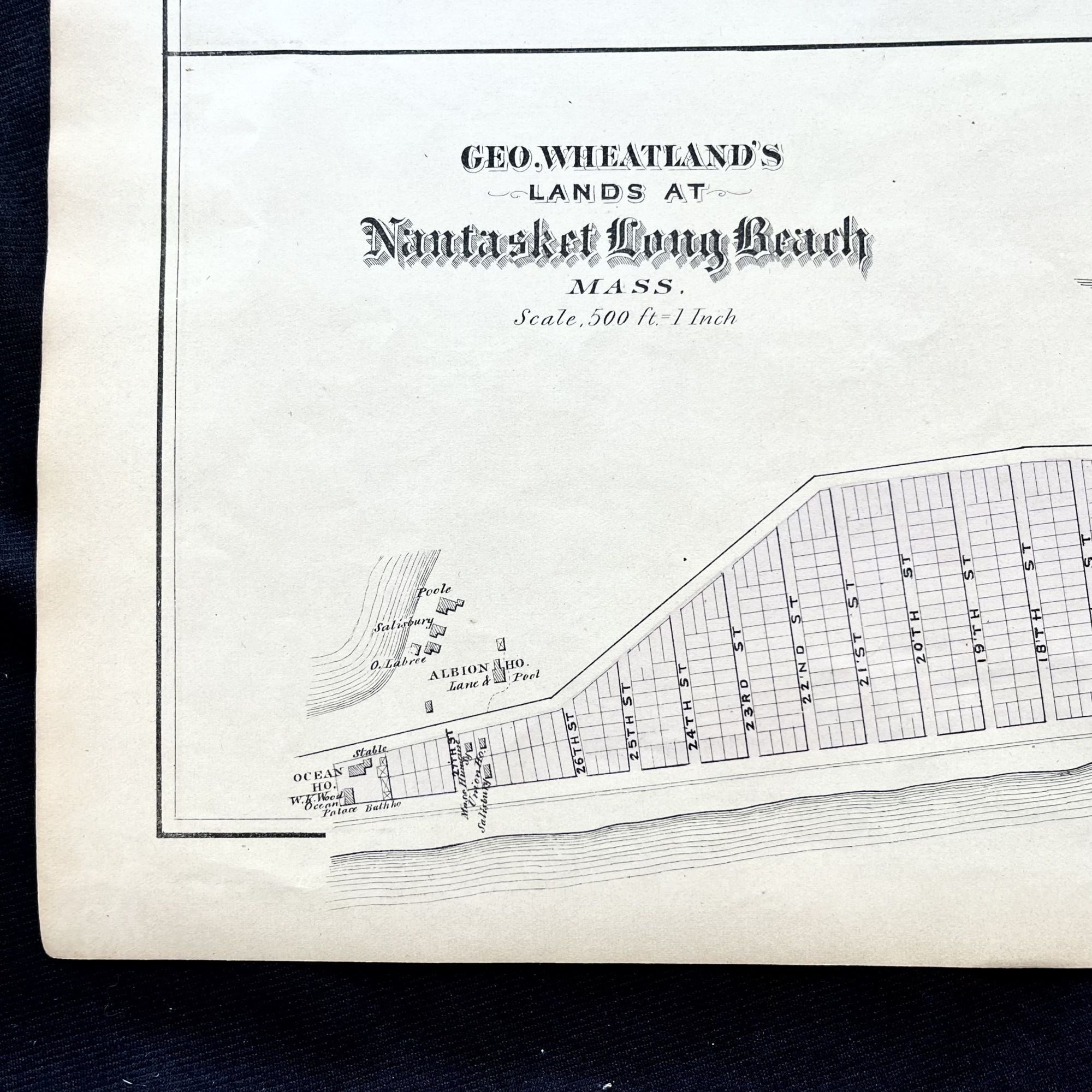
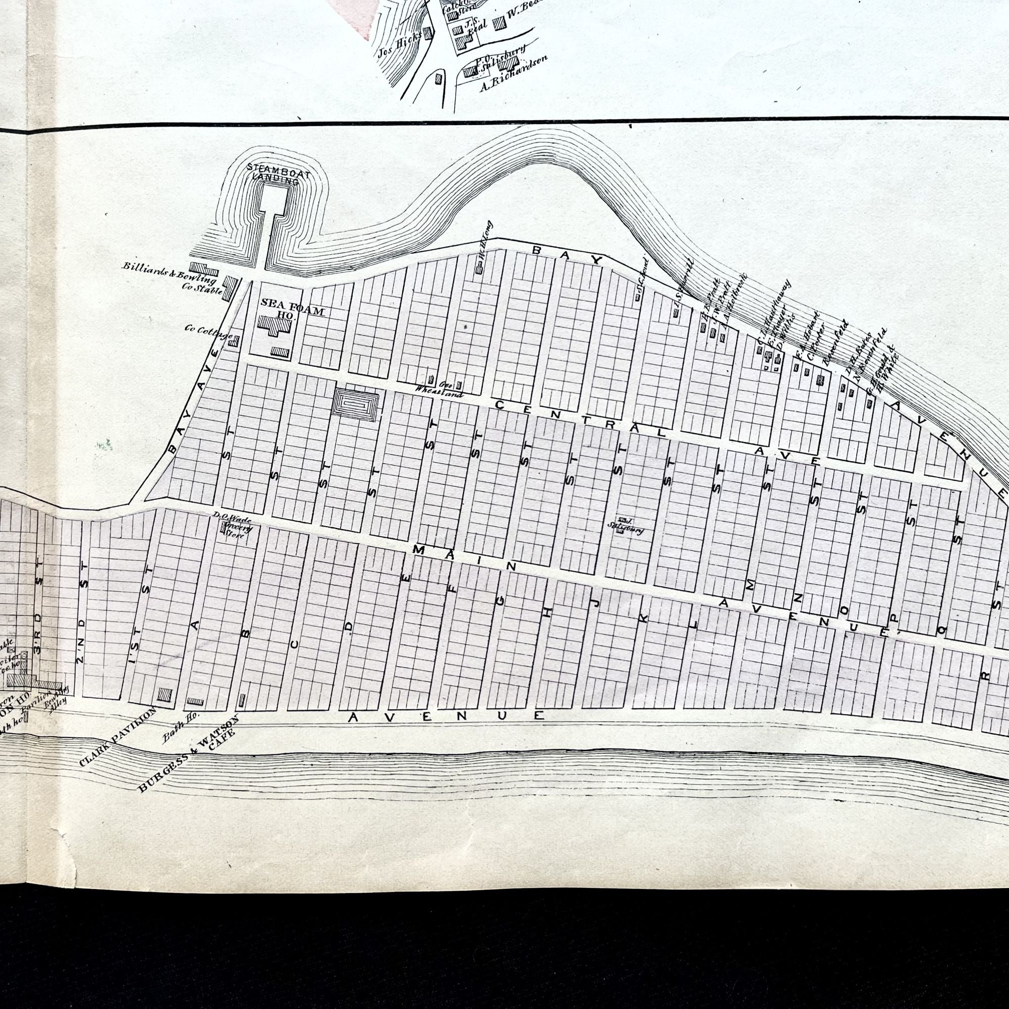
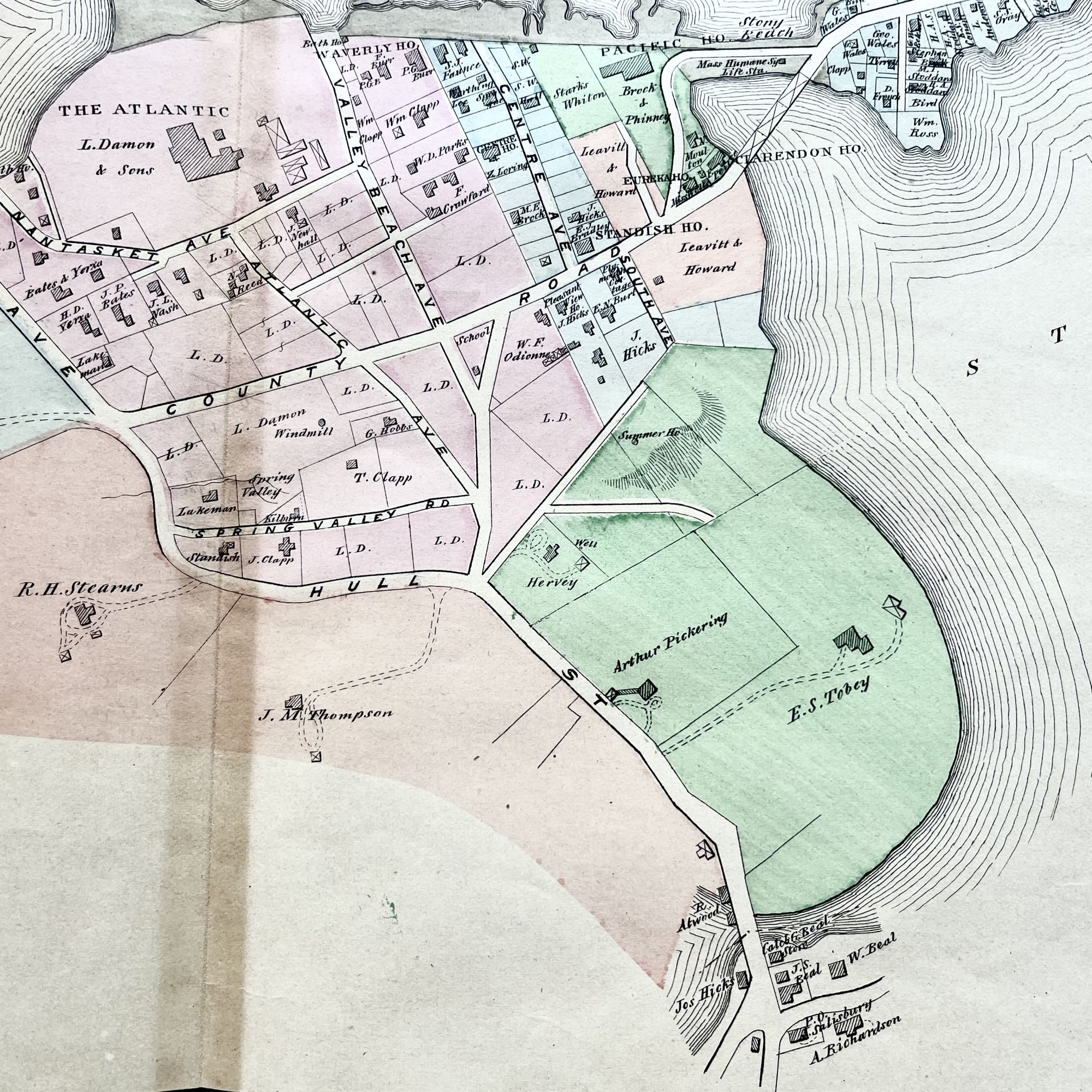
A Beautiful large folding original 1879 hand-colored street map of Nantasket Beach, Massachusetts, in Plymouth County, showing property owner names at the time as well as 19th-century building footprints and street names.
Featured on this gorgeous map are the Atlantic House Hotel, newly opened, as well as the Rockland Café and the Hotel Nantasket. Long Beach Rock is much different than today.
Depicted are individual homes, schools, churches and local businesses, as well as local cemeteries and water sources. Also featured is the Boston & Hingham Steamboat Co. Wharf.
In very good condition, this historic piece shows little wear, save for some mild age toning, more so along the centerfold.
Measuring approximately 28" X 17 3/4", this map is PERFECT for framing and display!
#MB-178.
Price: $325.00