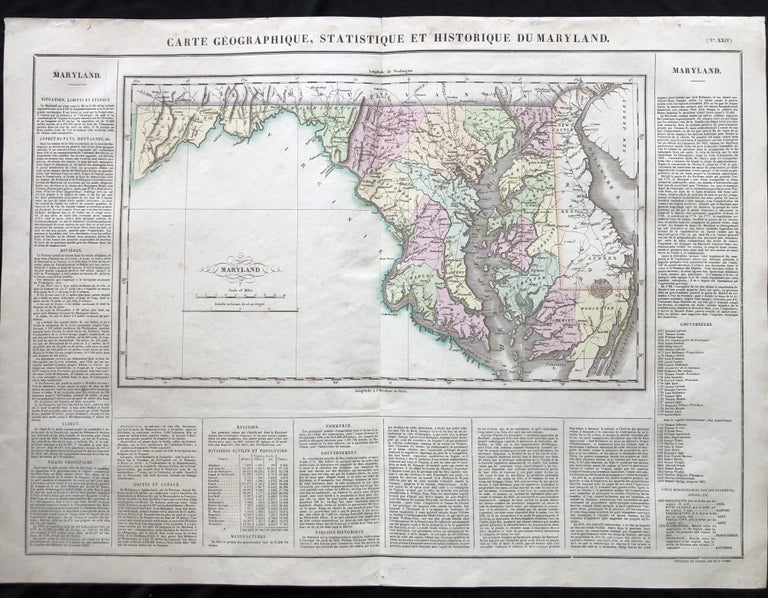
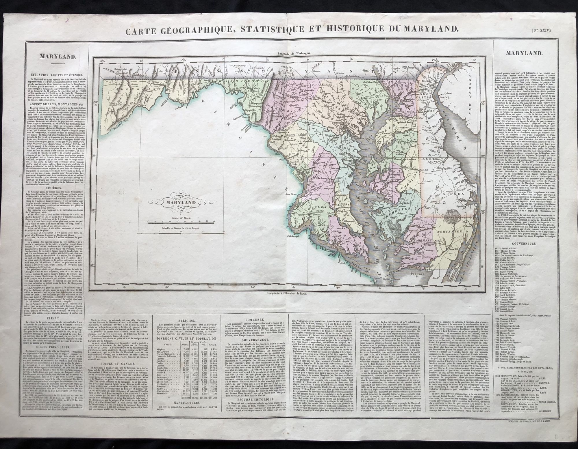
BEAUTIFUL Hand-Colored 1825 French Map of Maryland, with a List of Prominent Chesapeake Bay Rivers, Descriptions of Maryland's Mountains, Climate and Government and a list of Colonial and post-American Revolution Governors
J. Carez, 1825. Very Good. Item #IS-0421081
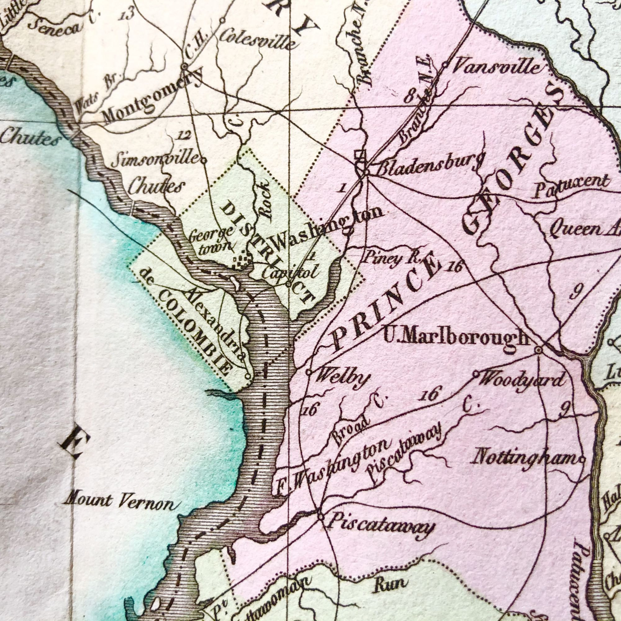
A SPECTACULAR 1825 French hand-colored map of Maryland from Lucas' 1822 map, which breaks down county populations by Whites, Free Blacks and Slaves. At the time of this printing a young Frederick Douglass is counted in the Slave Census of Talbot County on Maryland's Eastern Shore.
Originally published in 1822 by Carey and Lea and then revised and republished in 1825 by J. A. C. Buchon (1791-1846 ) in a French edition entitled Atlas Geographique des Deux Ameriques, printed by J. Carez.
Fielding Lucas, Jr. (1781-1854), a Baltimore mapmaker and publisher, drew the map.
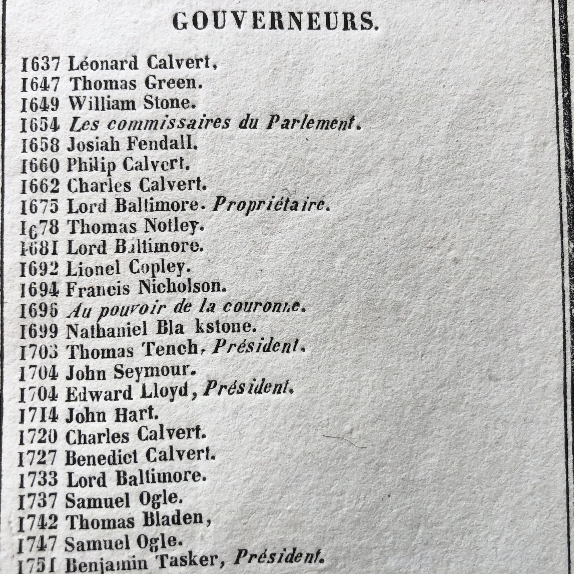
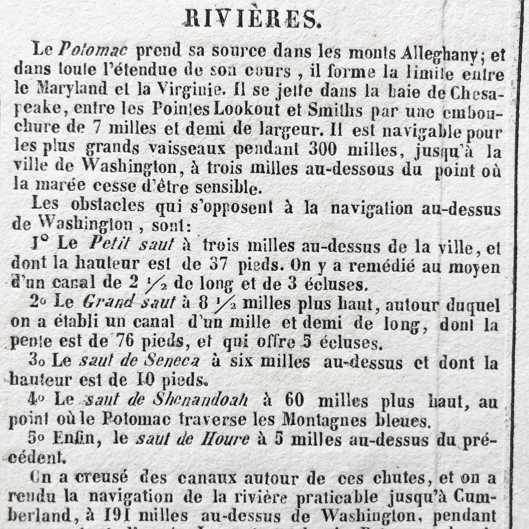
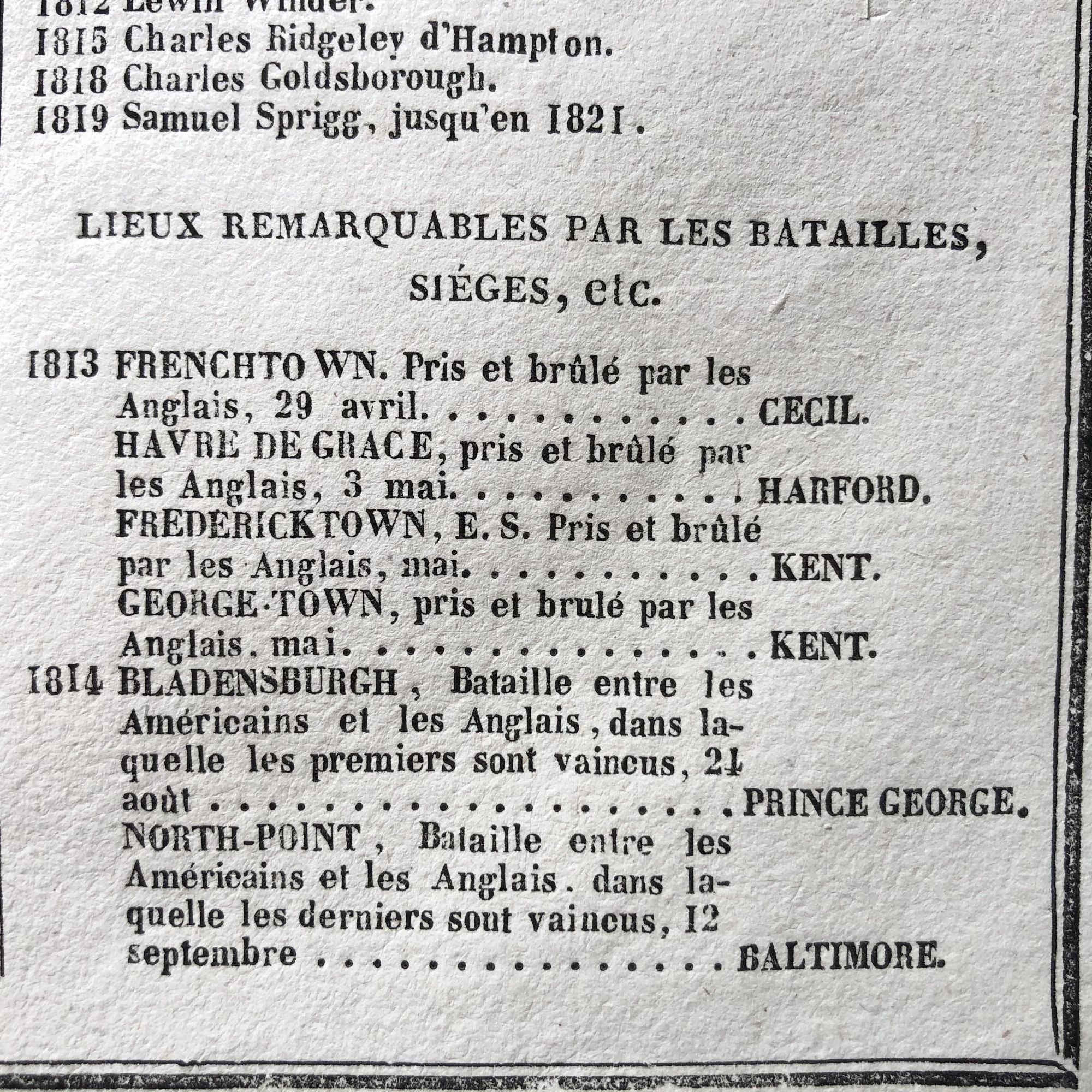
Also shown on the map are the District of Columbia, Delaware, and parts of Pennsylvania and New Jersey. Printed on the same page as the map is geographical, statistical, and historical information about Maryland, such as descriptions of the state's important rivers, a list of Governors since its founding as well as important War of 1812 Battles, such as the Battles of Baltimore and Bladensburg.
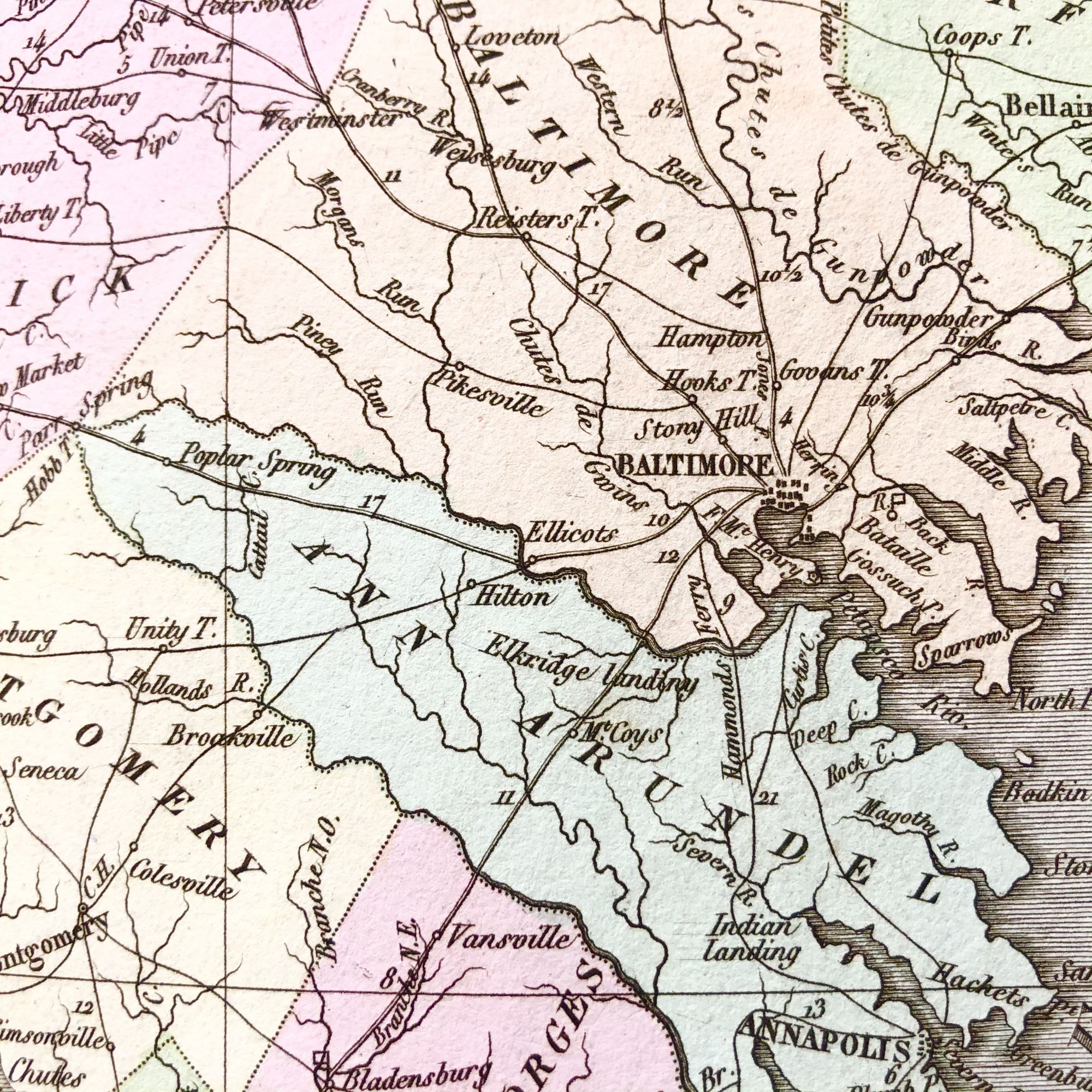
Most noticeable on the map for today's collector are the counties which had not yet come into existence and therefore are not represented on the map - Garrett, Carroll, Howard and Wicomico.
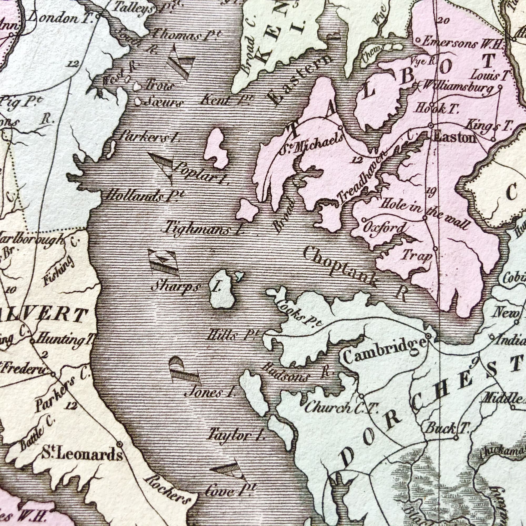
Also noticeable are the depictions of several islands of the Chesapeake which have either since disappeared or are markedly different today due to erosion, such as Sharp's Island, at the mouth of the Choptank River,once home to thriving civilization the island was swallowed up permanently by the Bay in 1963.
This map measures 26.5" X 19 3/4 and is PERFECT for framing and display!
#IS-0408211.
Sold