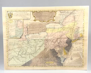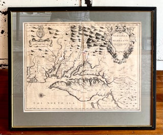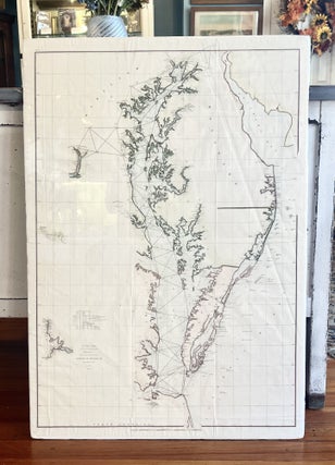
1853 U.S. Coastal Survey Map of the Eastern Shore of Maryland, Delaware and Chesapeake Bay
Washington, DC: U.S. Coast Survey, 1853. A GORGEOUS multi-color mid 19th-century nautical map of Chesapeake bay and the Eastern Shore of Maryland. This large map triangulates between various points on both sides of the Bay as well as Washington, DC, and includes historic towns such as Oxford, Easton, Cambridge..... More


![Item #13425 Afbeeldinge der Oude Waereld [Hand-colored Decorative Map of Old World]. Willem...](https://vintagebooksmd.cdn.bibliopolis.com/pictures/13425.jpeg?width=320&height=427&fit=bounds&auto=webp&v=1641569844)